
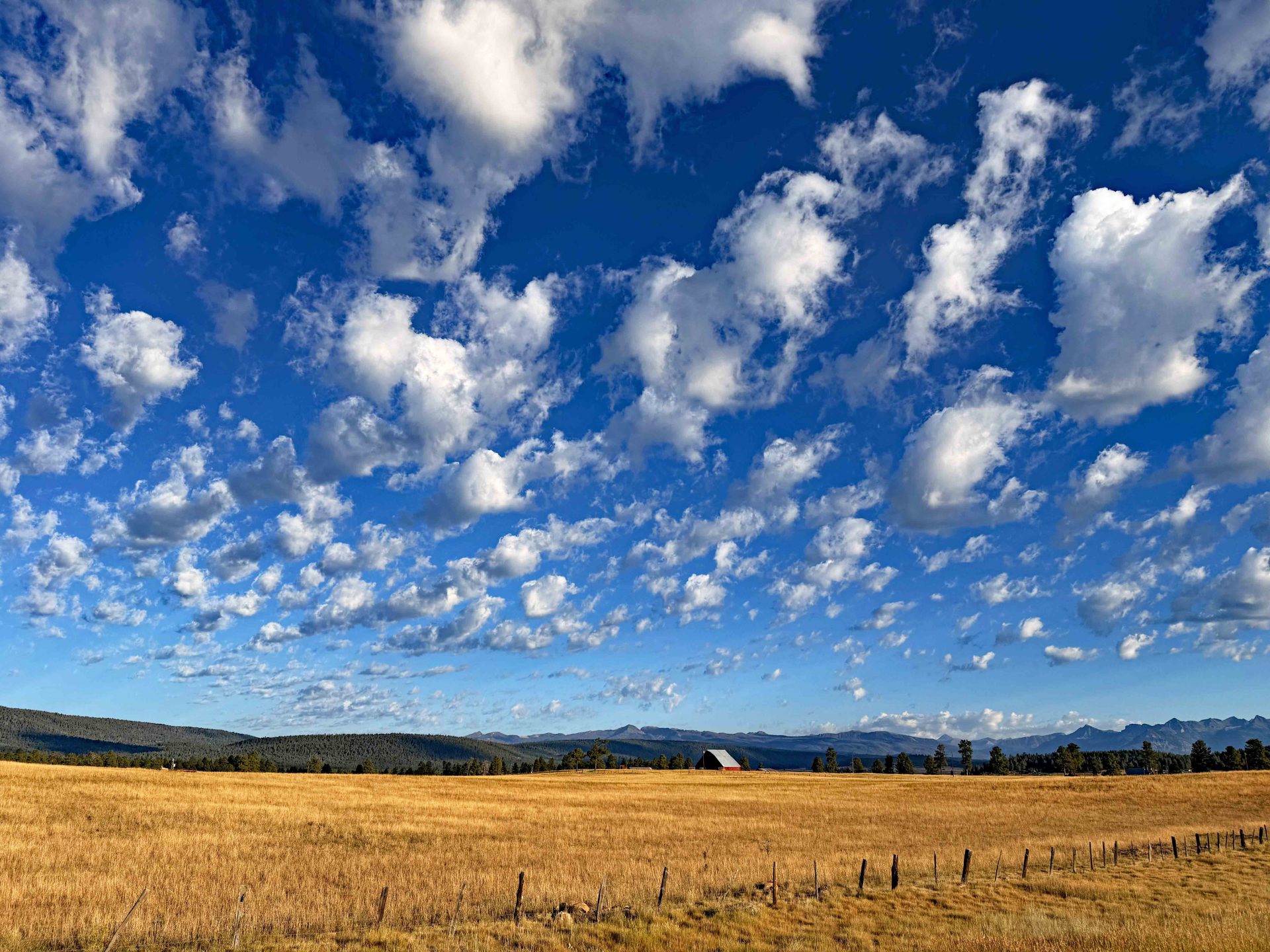
Yesterday morning was so pretty. Clear blue skies, free of smoke and only picture perfect little cumulus. – Pic taken 8/3/2025
Monday – 4 Aug 2025 – 3:30am
The past…
At Stevens Field the high temperature on Saturday was 84, and on Sunday it was 86. So far today (Monday) the high has been 82. The low this morning was 42. On Sunday morning it was 44. But the cold spots were in the low 30s!!!
The minimum relative humidity Saturday afternoon was 13% and Sunday afternoon it was 8%. Today has been 6%. The dry air is responsible for the chilly morning temps. Yesterday we had a temperature swing of 44 degrees!
The peak wind at Stevens Field on Saturday was 31mph and on Sunday it was 26mph. Today (Monday) has been 31mph.
| Average High | Record High / Year | Average Low | Record Low / Year |
| 82 | 95 / 1940 | 46 | 29 / 1950 |
Precipitation summary… There were not any reports of precipitation on Saturday or Sunday afternoon or overnight.
Fire and smoke…
As of Monday morning, the Elkhorn Fire north of Durango is 297 acres and is 62% contained.
The Middle Mesa Fire burning east of Navajo Lake just south of the CO/NM border is 1,115 acres and 0% contained.
There is a quite a bit more smoke in our area and air quality is now moderate across Archuleta County.
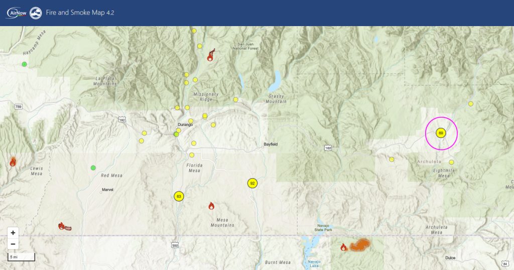
*** Between the Middle Mesa Fire east of Navajo Lake and the large Dragon Bravo Fire near the North Rim of the Grand Canyon, more smoke has moved into our area. We have a subsidence inversion in our upper levels which suppresses the smoke. It will be worse overnight and in the mornings. ***
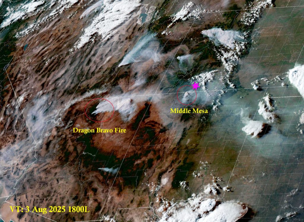
Fire and smoke map on Sunday evening – If the Middle Mesa Fire is active and spreads today, smoke may move into Archuleta County. I also outlined the large plume from the Dragon Bravo in northern AZ. More smoke is possible from that fire too.
Forecast discussion…
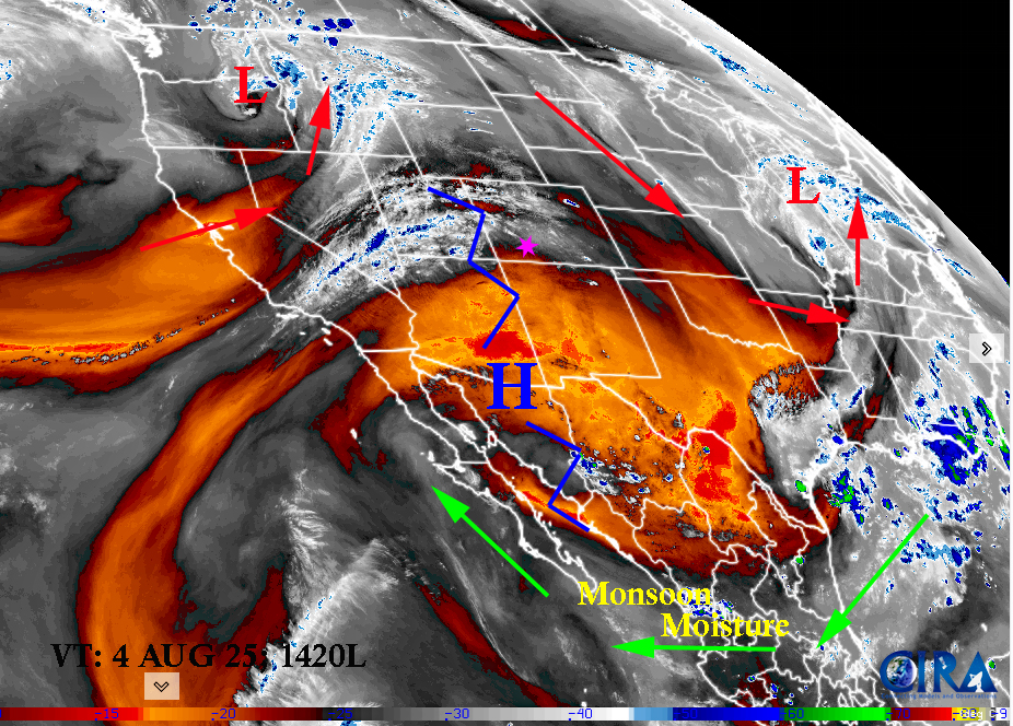
Satellite
The polar front jet is still active to our north currently streaming from northern California up into the Dakotas and down into the southern plains. It normally is much farther north. It’s current migration is weakening the subtropical ridge and it has moved off to the southwest. Current monsoon moisture is being shunted off to the Baja area. We have a weak jet finger over our head which is advecting in only some mid and upper level clouds. And… it is enhancing our afternoon winds which is drying us out more.
Radar on Monday; There are not any showers in the entire southwestern area.
Forecast highlights…
*** Stage 1 Fire Restrictions are in effect for the entire San Juan National Forest. ***
***AND Stage 1 Fire Restrictions in Archuleta County effective, Tuesday Aug 5th, 2025.***
*** Concerned about fire danger through the week with lots of sun, warm, dry, and gusty afternoon winds. ***
*** If you spot smoke, call Archuleta County dispatch at 970-731-2160. ***
Monday and Tuesday… High pressure dominates. The monsoon plume is cut off and well to the south of us.
Temps… Highs will be in the mid-80s to upper-80s and lows will be in the upper 30s to low-40s. Note cold spots may see low 30s Tuesday morning.
Winds… afternoon gusts will be around 25mph.
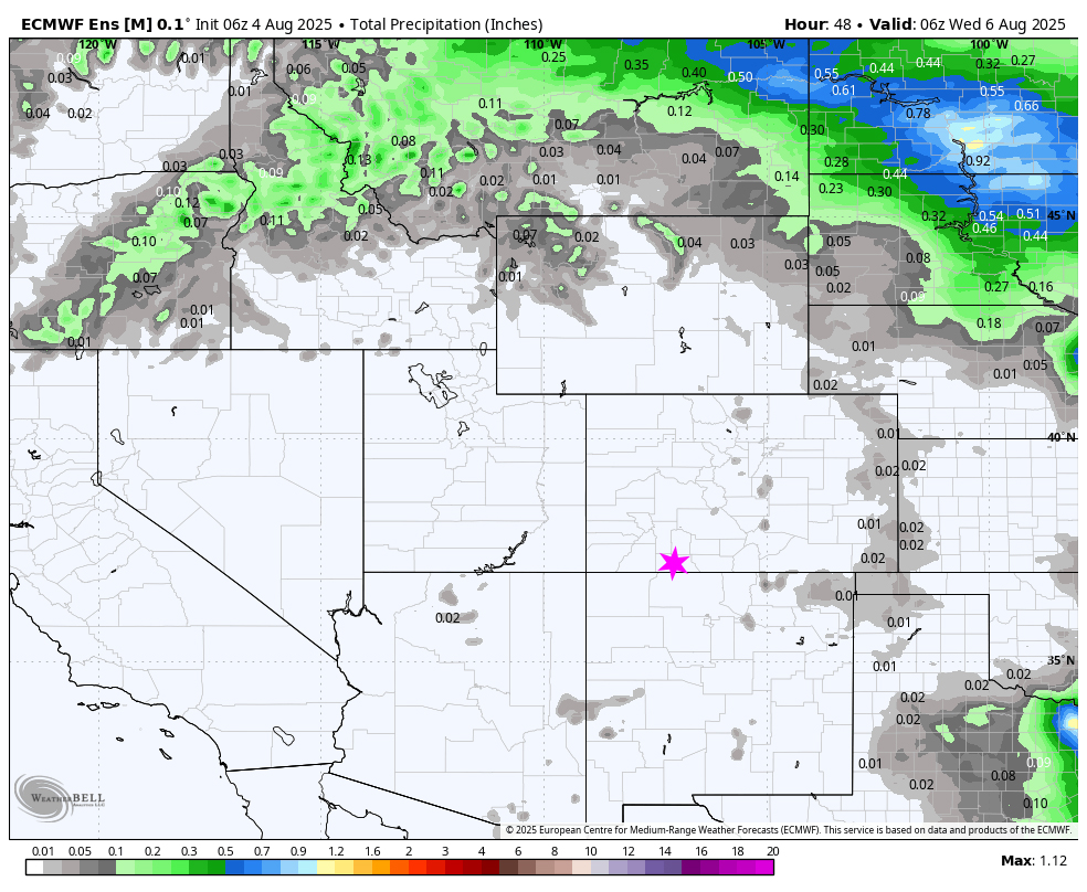
Wednesday through Sunday
The ridge will try to rebuild. There is a slight chance on for an isolated shower or thunderstorm every day. Consider yourself lucky if you get enough rain to wet the ground. Unfortunately, it means lightning without higher relative humidities and rain. So the chances of wildfire outbreaks increases.
Temps: Highs will be in the mid-80s to low-90s. Lows will be mid-40s to low-50s.
Winds: Wednesday through Sunday afternoon gusts will be around 20mph. Thursday and Saturday could see 25mph. As always, stronger isolated gusts are likely near a shower or thunderstorm.
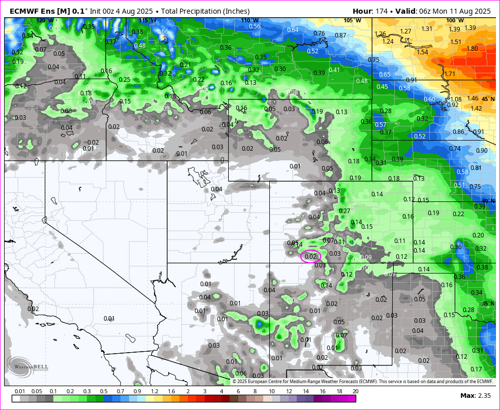
The 8-14 day period… A weak monsoon pattern with weak moisture and weak instability will persist. Expect isolated showers and thunderstorms most afternoons. Precip amounts will vary considerably.
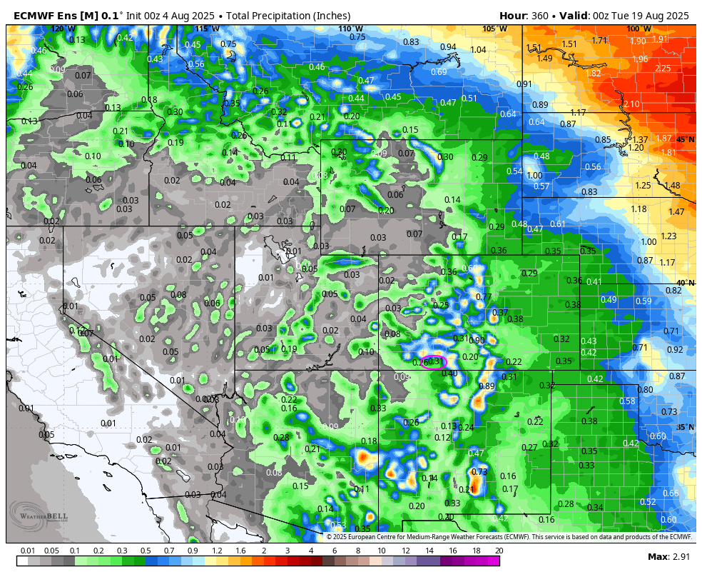
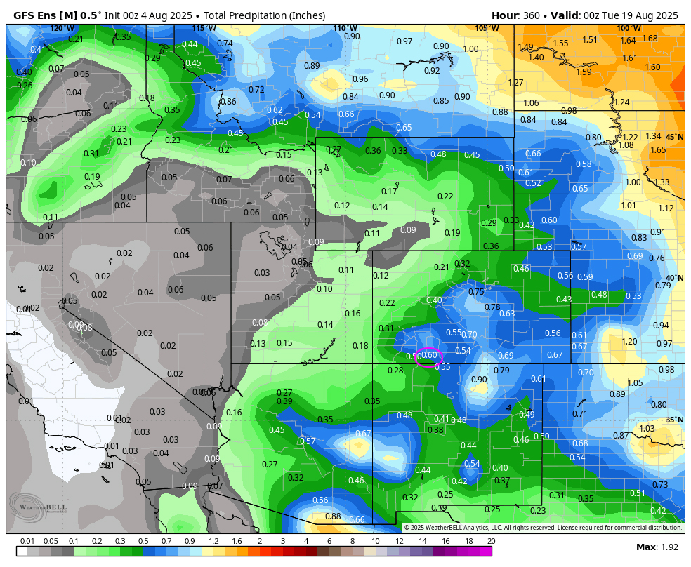
We need a good, deep tropical moisture storm to give the southwest and the firefighters some relief.
Unless something interesting pops up, the next post will be on Wednesday.
– Arleen


