

Clouds brewing over the mountains earlier today – pic taken 6/4/2025
Wednesday – 4 Jun 2025 – 5:00pm
We are back from a fun camping trip with our family. And it was nice to get a break from our “responsibilities”! Thanks for your patience and understanding.
The past…
At Stevens Field the high temperature on Monday was 63, and on Tuesday it was 66. The low this morning was 45.
The peak wind at Stevens Field on Monday was 24mph and on Tuesday it was 22mph.
| Average High | Record High / Year | Average Low | Record Low / Year |
| 73 | 90 / 1946 | 34 | 18 / 1951 |
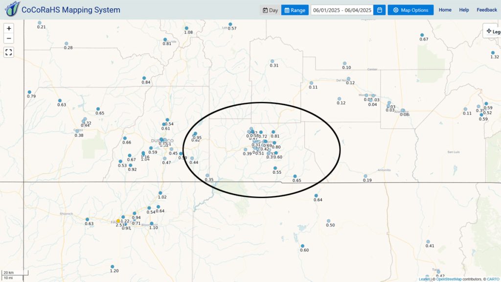
Precipitation summary… Precip amounts have been mostly lower than I expected, but a few lucky spots got over ¾ of an inch.
Forecast discussion…

Forecast highlights…
*** Still active through Thursday afternoon. ***
*** Less active Friday through Sunday. ***
*** A little more active Monday through next Thursday. ***
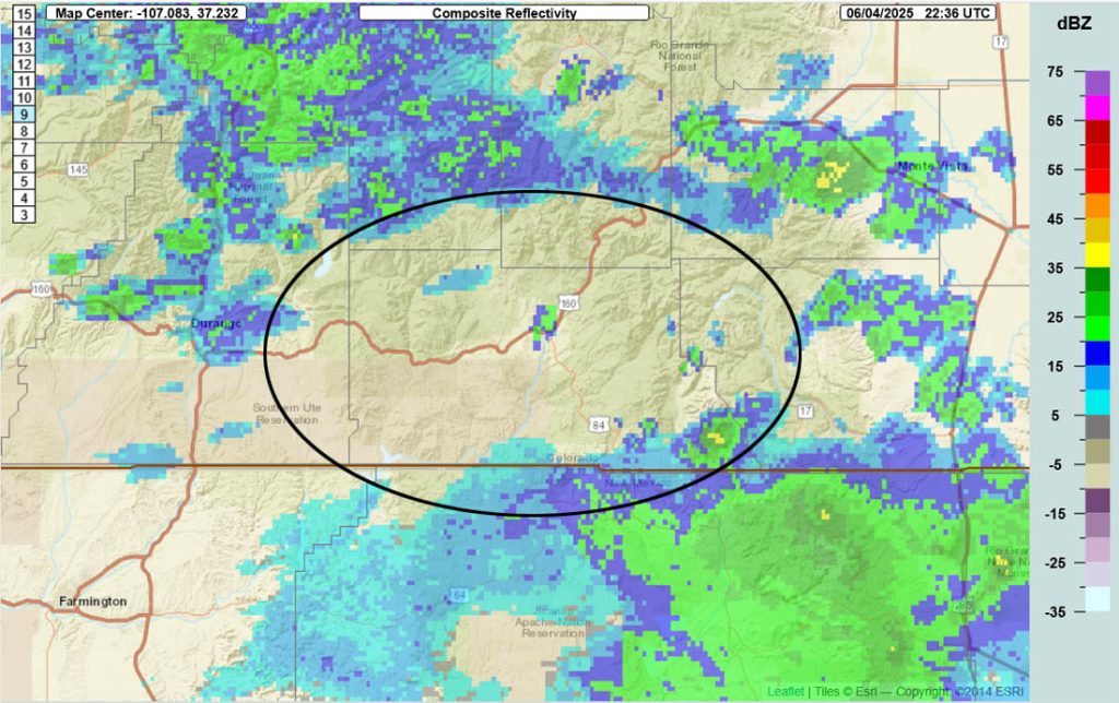
Rest of Wednesday through Thursday… Precipitable water is still around 200% of average. Afternoon Capes, a measure of instability, are around 400, which is quite high. Mix the above average moisture with unstable atmosphere and we get scattered showers and thunderstorms.
Showers and thunderstorms will become more hit and miss Wednesday night and then ramp up again Thursday afternoon.
Temps… Lows Wednesday night will be in the low to high 40s. Thursday highs will be in the mid-60s to low 70s and lows will be in the mid-30s to low 40s. The cold spots could dip below freezing.
Winds… Afternoon gusts will mostly be 15-20mph but stronger gusts are possible near showers and thunderstorms.

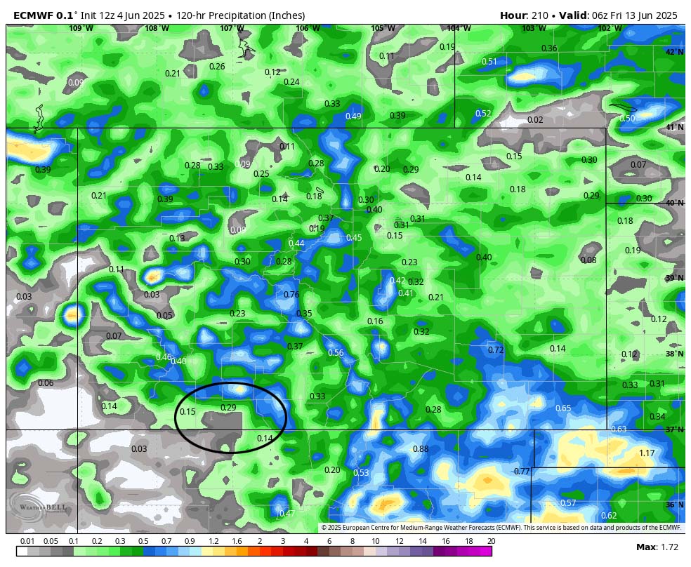
Friday through next Thursday…. Friday, Saturday, and Sunday moisture will decrease but we’ll remain unstable. Expect just a few spotty afternoon showers and thunderstorms mostly over the mountains.
Monday, Tuesday, Wednesday, and Thursday there will be a slight increase in moisture and instability leading to a better chance for scattered afternoon showers and thunderstorms.
Each day precip will be spotty with amounts ranging from zero to 0.10”.
Temps… Friday highs will be near 70 to the high 70s and lows will be in the mid-30s to mid-40s. For the rest of this period highs will be in the mid-70s to low 80s and lows will be in the high 30s to high 40s.
Winds… Afternoon gusts will be around 20mph, but isolated stronger gusts are possible near showers and thunderstorms.
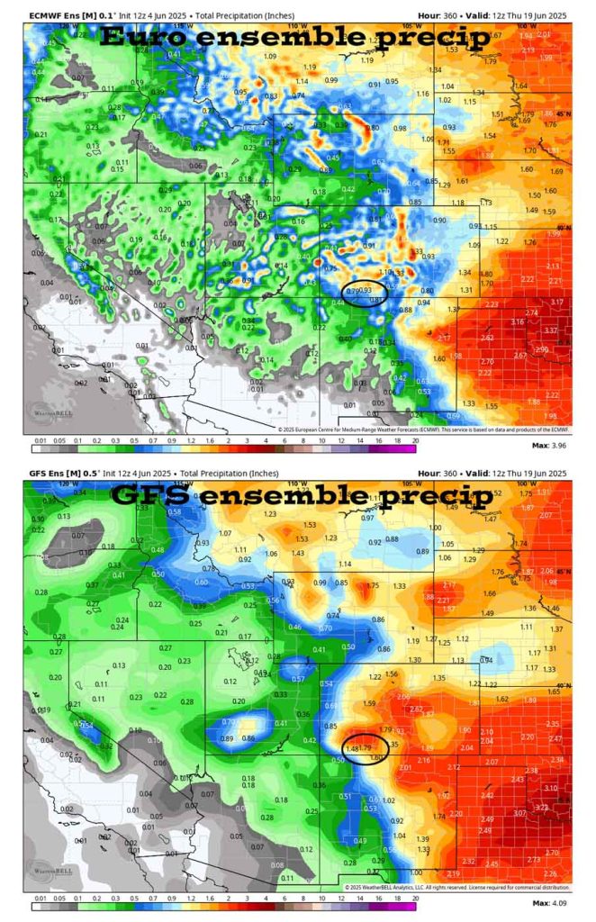
The 8-14 day period… More typical for this time of year, fairly stable and drier southwest flow will set up. There’s still a slight chance for a spotty afternoon shower or thunderstorm each day. Precip amounts will vary considerably.
The next forecast post will be on Friday. Plus Arleen is working on the monthly newsletter and I hope to get the May Summary done tomorrow.
– Shawn


