

Colorful little brook trout from a beaver pond – pic taken 5/25/2025
Tuesday – 27 May 2025 – 3:30pm
The past…
At Stevens Field the high temperature on Sunday was 72, and on Monday it was 66. The low this morning was 32 and the cold spots were in the mid-20s.
The peak wind at Stevens Field on Sunday was 26mph and on Monday it was 31mph.
| Average High | Record High / Year | Average Low | Record Low / Year |
| 71 | 87 / 1951 | 32 | 16 / 1911 |
Precipitation summary… Monday afternoon a few weak showers developed over the mountains. There was no measurable precip reported in the Pagosa area.
Forecast discussion…


Forecast highlights…
*** Spotty showers each afternoon the rest of the week. ***
*** Potential for a decent soaking Sunday afternoon into Monday evening. ***
Rest of Tuesday through Saturday… Weak high pressure with a little moisture and unstable air will continue to kick up a few spotty afternoon showers and a thunderstorm or two. Precip amounts will be light in the Pagosa area.
Temps…
Tuesday night lows will be in the low to high 30s.
Wednesday highs will be in the low to high 70s and lows will be in the low to high 30s.
Thursday highs will be in the mid-70s to low 80s and lows will be in the mid-30s to mid-40s.
Friday and Saturday highs will be in the high 70s to mid-80s. The warm spots will flirt with 90. Lows will be in the high 30s to mid-40s.
Winds… Afternoon gusts will mostly be 15-20mph but stronger gusts are possible near showers and thunderstorms.

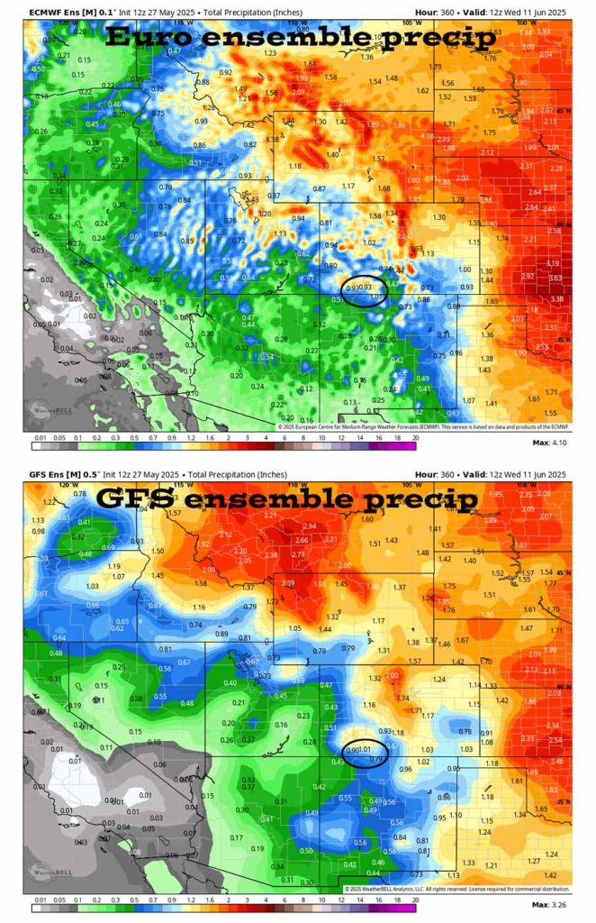
Sunday and Monday… A cut-off low off the Baja coast could tap a bit of moisture from “Alvin”, the first Pacific tropical storm of the season, and push that moisture into the Four Corners area. There is still uncertainty how the moisture will track, but right now it looks like we could decent rain, especially on Monday.
Timing… Sunday afternoon we’ll see hit and miss showers and thunderstorms with isolated areas getting brief bursts of heavy rain. Hit and miss showers and thunderstorms will persist Sunday night and then ramp up during the day on Monday.
Temps… Sunday highs will be in the high 70s to mid-80s. The warm spots will flirt with 90. Lows Sunday night will be in the mid-40s to low 50s. Monday will be cooler with highs in the mid-60s to low 70s and lows will be in the high 30s to mid-40s.
Winds… Afternoon gusts will mostly be 15-20mph but stronger gusts are likely near showers and thunderstorms.

The 8-14 day period… More typical for this time of year, fairly stable and dry southwest flow will set up. There’s a slight chance for a spotty afternoon shower or thunderstorm, but most of us will stay dry.
Unless there’s a big change to my forecast, the next post will be on Thursday.
– Shawn


