

Wild irises are blooming in some places – pic taken 5/22/2025
Thursday – 22 May 2025 – 6:00pm
The past…
At Stevens Field the high temperature on Wednesday was 72, and on Thursday it was 75. The low this morning was 34 and the cold spots were in the high 20s.
The peak wind at Stevens Field on Wednesday was 30mph and on Thursday it was 30mph.
| Average High | Record High / Year | Average Low | Record Low / Year |
| 69 | 80 / 1984 | 32 | 20 / 1974 |
Precipitation summary… There was no precip in the last 24 hours.
Forecast discussion…
There is nothing on radar Thursday evening.
Forecast highlights…
*** Fantastic weather through the weekend! ***
*** Slight chance for a few spotty showers each afternoon next week. ***
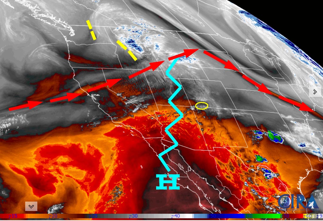
Rest of Thursday through Sunday… Upper-level flow out of the west is bringing us dry, stable air. We’ll have lots of sun, warmer temps, breezy afternoons, and dry weather.
Temps… Thursday and Friday highs will be in the mid-70s to low 80s and lows will be in the low to high 30s. Saturday and Sunday highs will be near 70 to the high 70s and lows will be near 30 to the high 30s.
Winds… Afternoon gusts will be around 25mph.
Monday through Friday… Less stable air with a little more moisture will give us a slight chance for a few spotty afternoon showers, mostly over the mountains. Consider yourself lucky if you get enough rain to wet the ground.
Temps… Monday, Tuesday, and Wednesday highs will be near 70 to the high 70s and lows will be near 30 to the high 30s. Thursday and Friday highs will be in the low to high 70s and lows will be in the low to high 30s.
Winds… Afternoon gusts will be around 20mph.

The 8-14 day period… The jet stream and storm track are pushing well to our north, as they should this time of year. Marginally unstable air and a little bit of moisture will give us a slight chance for spotty afternoon showers and a thunderstorm or two. We’ll be playing the rain lottery.

There isn’t much going on, so we are taking a break until late Monday or Tuesday. Enjoy your Memorial Day weekend!
– Shawn


