

It’s been a few days since we’ve had clouds for a pretty sunset – pic taken 2/21/2025
Friday – 28 Feb 2025 – 4:00pm
The past…
At Stevens Field the high temperature on Wednesday was 48 and on Thursday it was 52. The low this morning was 19.
The peak wind at Stevens Field Wednesday afternoon was 36mph and on Thursday afternoon it was 10mph.
| Average High | Record High / Year | Average Low | Record Low / Year |
| 44 | 62 / 1986 | 11 | -23 / 1962 |
Precipitation summary… There has been no recent measurable precip.
Forecast discussion…
There is nothing on radar in our area Friday afternoon.
Forecast highlights…
*** Dry and warm through Saturday. ***
*** A few snowflakes Saturday night through Sunday morning, a few more Monday afternoon to Tuesday afternoon, and then our best chance for snow is Wednesday night into Friday morning. ***
Rest of Friday through Saturday evening… Friday the ridge will be in control. We’ll see lots of blue sky and temps warming up. Friday temps will be 10 degrees above average.
Saturday there will be more clouds as the ridge moves to our east. Temps will remain 10 degrees above average.
Temps… Friday and Saturday highs will be in the mid-50s to low 60s and lows will be in the high teens to mid-20s.
Winds… Friday and Saturday afternoons peaks will be 10-15mph.
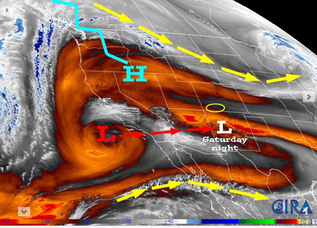
Saturday night through Tuesday afternoon … Two weak low-pressure systems will bring us a few snowflakes.
Saturday night into early Sunday afternoon a weak low will skirt to our south. There will be scattered snow showers, mostly over the mountains. Snow levels will start around 8,500ft Saturday night, drop to around 7,000ft by sunrise Sunday, and then pop up to 8,000ft by Sunday afternoon. Lucky spots near Pagosa could get a dusting. Wolf Creek could get up to 1”.
Sunday afternoon through Monday morning a transient ridge will keep us dry. There will continue to be quite a few clouds and winds will be a bit gusty Sunday afternoon.
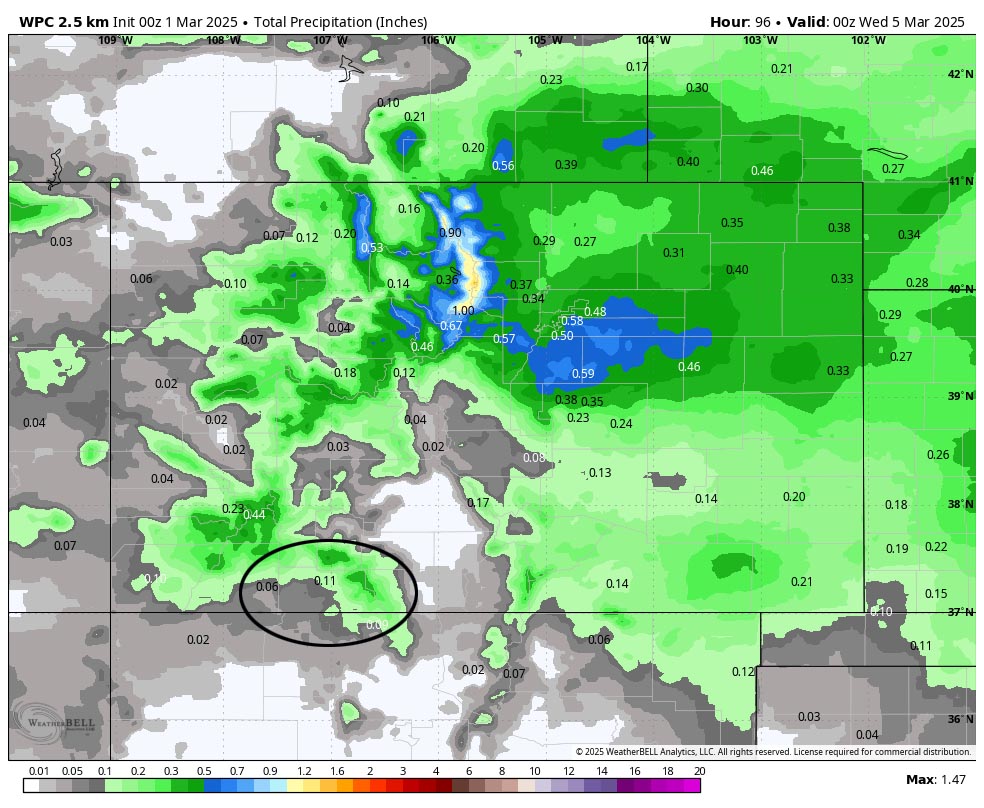
Monday afternoon through Tuesday afternoon a trough with a little more moisture and storm energy will move through. Snow levels will be 7,000-7,500ft each afternoon and temps will be 40 degrees or higher so snow will struggle to accumulate.
Snow amounts Monday afternoon through Tuesday afternoon…
Mountains: 2-4”
Pagosa area: up to 1”
Temps… Saturday night lows will be in the high teens to mid-20s. Sunday highs will be near 50 the mid-50s and lows will be near 20 to near 30. Monday highs will be in the low to high 40s and lows will be in near 20 to the high 20s. Tuesday highs will be near 40 to the mid-40s and lows will be in the mid-teens to mid-20s.
Winds… Saturday afternoon gusts will be 10-15mph. Sunday afternoon gusts will be around 20mph. Monday and Tuesday afternoons gusts near Pagosa will be 20-30mph and in the mountains gusts will be 35-45mph.
Tuesday evening to Wednesday evening… A transient ridge will give us a brief break. Clouds will clear Tuesday night and temps will cool.
Temps… Tuesday night lows will be in the high single digits to high teens. Wednesday highs will be in the mid-40s to low 50s.
Winds… Wednesday afternoon gusts will be 15-20mph.
Wednesday night into Friday morning… Another low-pressure system will move through. It will have a little more moisture and storm energy, so I expect a little more snow.
Snow amounts…
Wolf Creek area: 4-8”
Pagosa area: 1-3”
I’ll adjust the timing and snow amounts as the data gets better.
Temps… Wednesday night low will be in the high teens to high 20s. Thursday highs will be in the high 30s to low 40s and lows will be in the high teens to mid-20s.
Winds… Thursday afternoon gusts will be around 25mph.

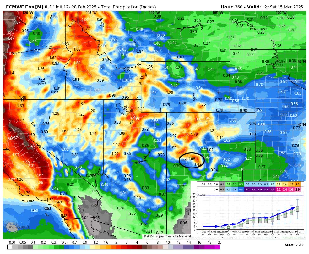
The 8-14 day period… It will be dry 8-10 Mar and then more active 11-15 Mar.

The next post will be on Sunday.
– Shawn


