

Making the most of the 4” from the last storm – pic taken 30 Jan 2025
Tuesday – 4 Feb 2025 – 4:50pm
The past…
At Stevens Field the high temperature on Sunday was *55*, Monday was *57* and Tuesday was 55. The low this morning was 27.
* New record highs! Previous records highs were 53 on Sunday in 1935 and 54 on Monday in 1991. Tuesday’s record high is 57 in 1941
The peak wind at Stevens Field Sunday afternoon was 18mph, Monday was 9mph, and Tuesday it was 9mph.
| Average High | Record High / Year | Average Low | Record Low / Year |
| 40 | 57 / 1941 | 2 | -29 / 1915 |
Precipitation summary… There has been no recent measurable precip.
Forecast discussion…

There is nothing on radar in our area.
Forecast highlights…
*** Dry with gusty winds through Friday afternoon. ***
*** A few spotty snowflakes Friday night through Saturday morning. ***
*** Unsettled next week with chances for snow. ***
Wednesday through Friday afternoon… The ridge will continue to push storm energy and moisture to our north. Patches of mid and high clouds will move through, and winds will remain gusty, especially in the mountains.
Temps… Highs will be in the high 40s to mid-50s and lows will be in the low to high 20s.
Winds… Wednesday and Friday afternoons gusts will be 20-30mph. In the mountains, gusts will be 35-45mph. Thursday afternoon gusts will be around 20mph.
Friday evening through Saturday morning… We’ll catch the southern edge of a trough moving through northern Colorado. Bands of scattered showers will move through our area, mostly over the mountains.
Snow amounts…
Mountains: 1-3”
Pagosa area: up to a half inch in the lucky spots
Temps… Friday night lows will be in the high teens to high 20s.
Winds… Winds will be erratic with occasional gusts 15-20mph.
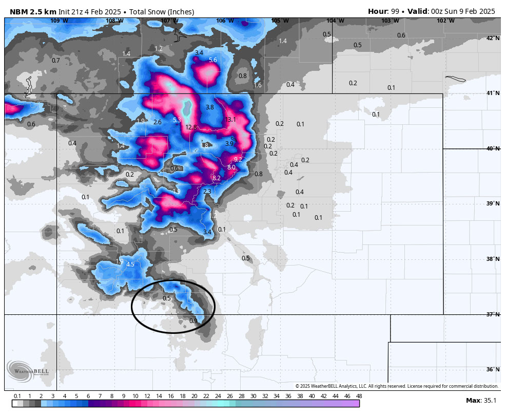
Saturday afternoon through Monday… It’s going to stay unsettled as weak troughs with little moisture move quickly through the region. We’ll see periods of mostly cloudy skies and a spotty shower or two.
I don’t expect snow to accumulate in the Pagosa area. Lucky spots in the mountains could get up to 1” of snow.
Temps… Saturday highs will be in the low to high 40s and lows will be in the low teens to low 20s. Sunday and Monday highs will be in the high 30s to mid-40s and lows will be in the low teens to low 20s.
Winds… Saturday afternoon gusts will be 20-30mph. Sunday and Monday afternoons gusts will be around 20mph.
The 8-14 day period… The jetstream will dip a little farther south. If we’re lucky, more moisture will move into our area, and we’ll get some precip. The models are hinting at a decent storm roughly 13-15 Feb. Keep your fingers crossed!

The inset shows the timing from left to right. It’s dry through the week and then gets more active next week. This model expects a total of 10” of snow with most of it falling 13-15 Feb.
The next forecast post will be on Thursday.
– Shawn


