

Snowpack has fallen below average across southwest Colorado
Thursday – 2 Jan 2025 – 8:00am
December Summary…
The average high for December is 39 and the average low is 5. The record high of 70 occurred on 3 December 1906. The record low of -35 occurred on 19 December 1909. December precip averages 1.89″ and average snowfall is 21.2″. Wolf Creek Pass averages 4.42″ of precip and 78.7″ snow.
How did we do?


Snowpack and Drought…

The Upper San Juan snotel is at 58% of the seasonal median and the Wolf Creek Summit snotel is at 72%
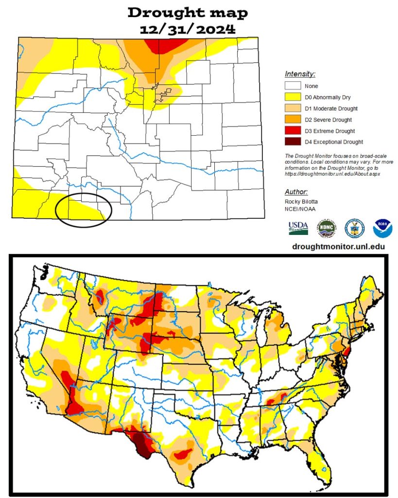
The US drought map on the bottom shows that much of the country is experiencing drought conditions.
January Outlook…
The average high for January is 37 and the average low is 2. The record high of 59 occurred on 1 January 1981. The record low of -42 occurred on 13 January 1963. January precip averages 2.08″ and average snowfall is 26.4″. Wolf Creek Pass averages 3.67″ of precip and 76.1″ snow.
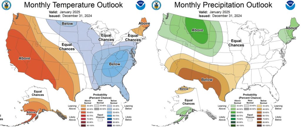
The precip outlook on the right has us on the border of equal chances for average precip and a 33-40% chance for below average precip.

And what do we expect?
Arleen is the expert, and this is what she says…
It’s been dry because there has been a persistent trough/low pressure system over the Bering Sea and a ridge near the west coast. The storm track has stayed to our north putting us under predominately northwest flow. This pattern favors Colorado’s central and northern mountains, while we just get scraps. At some point the blocking ridge will move. When it does , we’ll be under the storm track again.

The ENSO is finally cooling to La Nina conditions in the last half of December. But we’ve been stuck in “La Nada” conditions. The QBO is now a strong westerly flow. So what does this mean?
First, have we ever recovered from such an abysmal December? We’ll look at Wolf Creek data. They only had 10” this month. Here are a few previous comparable Decembers:
December 1989: 5.5″ – rest of the season was 338”
December 1999: 8″ – rest of season 232”
December 2017: 9″ – rest of the season was 165”
Next, how have we done in previous winters where we were La Nada ENSO conditions with Westerly QBO?
Those winters were 80/81, 85/86, 90/91, 13/14. In 80/81 Wolf Creek had 256”, well below average. In 85/86 Wolf Creek had 451”, well above average. In 90/91 Wolf Creek had 363”, right at average. In 13/14 Wolf Creek had 286”, well below average. There isn’t any correlation that can be drawn from these numbers, but all years are above the 104” that Wolf Creek has to date.
January will be below average again. The first two weeks will be dry with only occasional scraps from northwest/northerly systems. The third week into the fourth week the long range models hint at the possibility of some change. But it will be too late to make up the difference.
A HUGE thanks for your precip reports and pictures! Reports help verify our forecasts and make us better forecasters.
Another HUGE thanks to our donors and sponsors! You help cover the cost of this web page and our weather subscriptions, necessary to provide you accurate weather reports!
- Shawn


2 Responses
Thanks again for the incredible forecasting and in depth analysis of our local weather.
Happy New Year and God Bless You Both
Guiseppe
Thank you for your kind words! We wish you a Happy and Healthy New Year! God Bless you, as well! – Arleen & Shawn