

Pagosa Weather pup Tommy in the falling snow yesterday – Pic taken 11/3/2024
Monday – 4 Nov 2024 – 11:15am
The past…
At Stevens Field the high temperature on Sunday was 41. The low Saturday night was 28 shortly before midnight. The cold spots dipped into the low 20s around midnight.
The peak wind at Stevens Field on Sunday was 8mph.
| Average High | Record High / Year | Average Low | Record Low / Year |
| 55 | 72 / 1915 | 19 | -6 / 1991 |
Precipitation summary… Wolf Creek reported 4” of new snow this morning bringing the storm total to 5”.
Scattered snowshowers moved through the area all day yesterday. Most of the showers were light, but a couple of showers dropped a quick inch of snow in a few spots.


Forecast discussion…

Forecast highlights…
*** Roads could be slick in the mountains into Monday evening. ***
*** Tuesday night into Friday afternoon the first good snow of the season is possible in the valley. ***
*** The heaviest snow will fall Wednesday morning through Thursday morning. Expect poor driving conditions Wednesday night and Thursday morning. ***

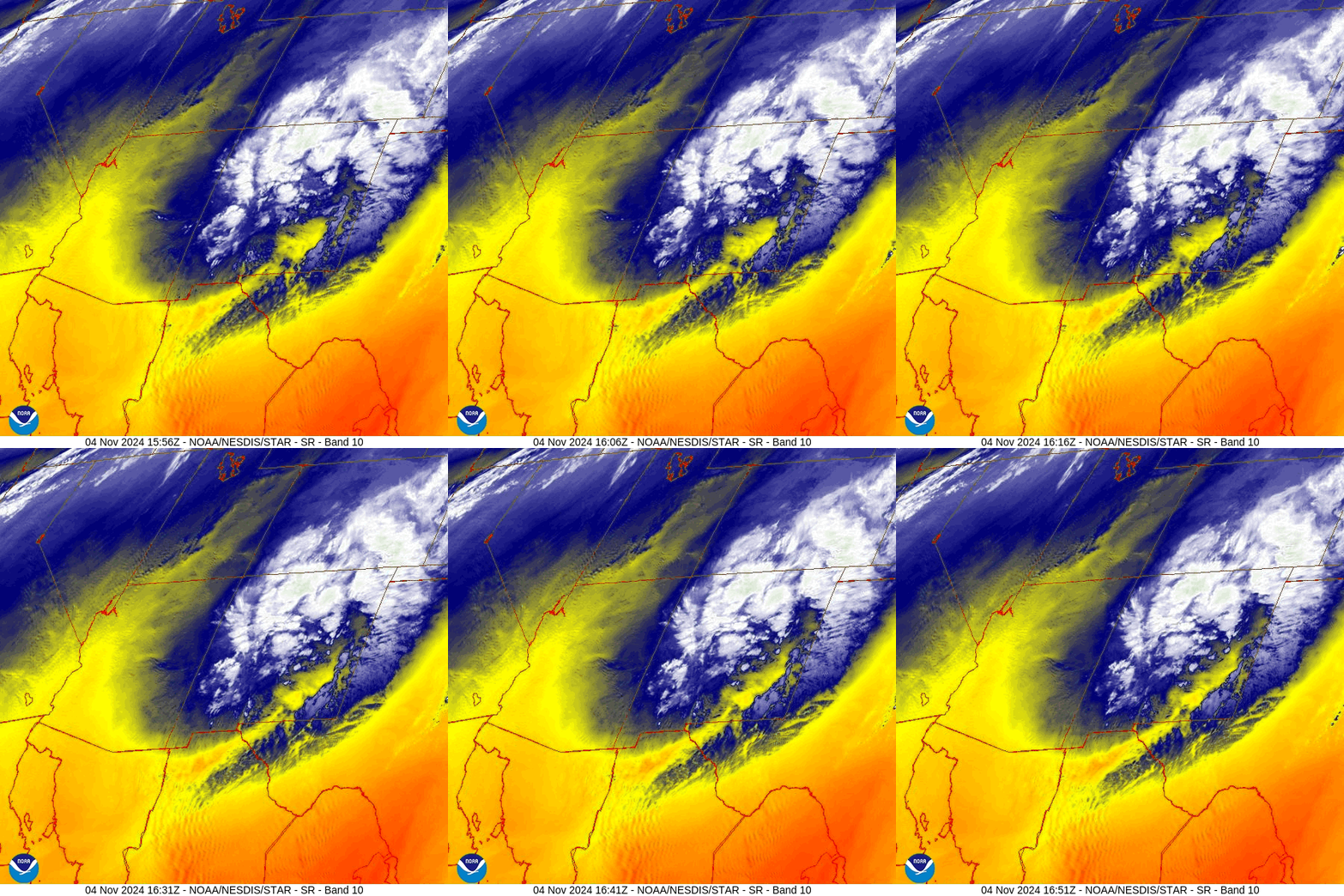
Monday afternoon and evening… A low is moving west to east across central NM. In our area east to west upper-level flow will result in just a few spotty snowflakes over the valley and scattered snowshowers mostly along the eastern side of The Divide. Expect periods of poor driving conditions in the mountains.
Snow levels will be up to 7,600ft during the day.
Snow amounts for this period:
Mountains above 9,000ft: 1-2”
Valley: a dusting
Winds… Monday afternoon gusts will be 15-20mph.
Temps… Monday highs will be in the low to high 40s and lows Monday night will be in the high teens to mid-20s.
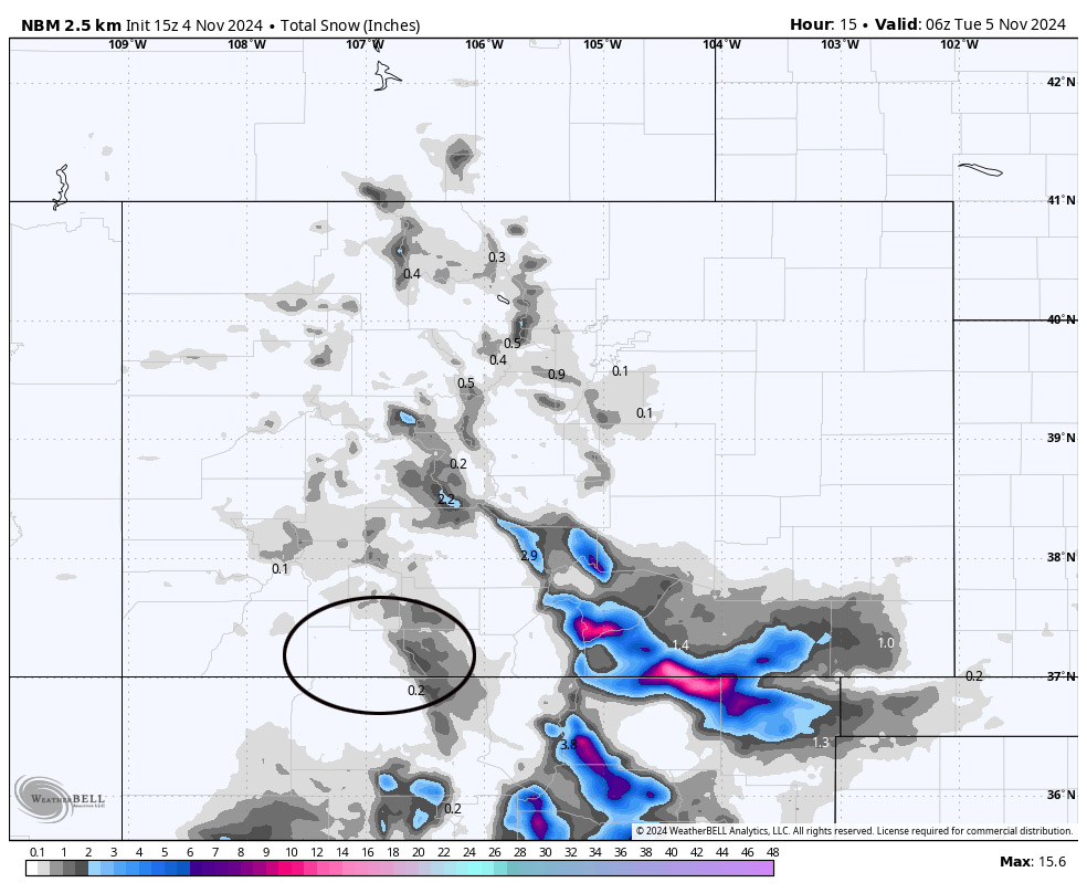
Monday evening to early Tuesday evening… Transient ridging will give us a brief break. Patches of clouds will continue to move through. Spotty snowshowers will develop over the mountains Tuesday evening.
Winds… Tuesday afternoon gusts will be 15-20mph.
Temps… Highs will be in the low to high 40s and lows will be in the high teens to mid-20s.
Late Tuesday evening into Friday evening… The next low-pressure system will move through. Upper-level flow, storm energy, and moisture line up best Wednesday morning through Thursday morning. The low will move to our east by Friday afternoon.
Timing… The first scattered snowshowers will start over the mountains Tuesday evening and then over the valley around midnight. The heaviest precip will fall early Wednesday morning through Thursday morning. Precip Thursday afternoon through Friday afternoon will be hit and miss showers and won’t add up to much.
Snow levels…
Tuesday night: around 6,000ft
Wednesday: around 6,000ft
Thursday: 6,000- 6,500ft
Friday: 6,500-7,000ft
Snow amounts for this period…
Mountains above 9,000ft: 12-20”
Valley above 7,600ft: 4-8”
Valley below 7,600ft: 2-4”
*** Most of this will fall Wednesday morning through Thursday morning. ***
Winds… Gusts will be 10-20mph.
Temps… Highs will be in the mid-30s to low 40s and lows will be in the low to high 20s. Lows Friday night will be in the mid-teens to low 20s.

Saturday through Monday… Ridging will build over the region. We’ll see a lot of blue sky and temps will gradually warm closer to season averages.
Next Tuesday and Wednesday… The next system could move through 12-13 Nov. Right now it doesn’t look too impressive. There’s still plenty of time for it to take a more favorable track.
My next post will be on Tuesday.
– Shawn


