

Can you spot Batman? Our ephemeral creek was flowing yesterday, however was frozen in its track this morning & covered in 3″ of fresh snow!
Most of the area had 2-4″ of snow with Wolf Creek getting 8″! Plus winds blew from 30-62mph across the area!
If images fail to load in the email, just click the title of the post.
Saturday – 6 Apr 2024 – 12:30pm
The past…
At Stevens Field the high temperature yesterday afternoon was 60 and the low this morning was 21.
The peak wind at the airfield yesterday evening was 54mph! We only hit 31mph out in O’Neal Park, 7 mi NW of Pagosa Springs.
| Average High | Record High / Year | Average Low | Record Low / Year |
| 57 | 72/ 1991 | 23 | 4 / 1909 |
Precipitation summary… Most reports in the area are of two to four inches of new snow. Wolf Creek reported 8″ of new snow bringing their season total to 320″.
CoCorahs Precip

CoCoRaHS Snow

Forecast discussion…
Satellite…

Area of low pressure slipped right over us and to the east last night. That explains our winds. We are now in cold area behind the front and with lots of moisture advecting in from the northwest. However, the area of low pressure & occluded front our still in the general area & areas like Wolf Creek could see wrap around showers.
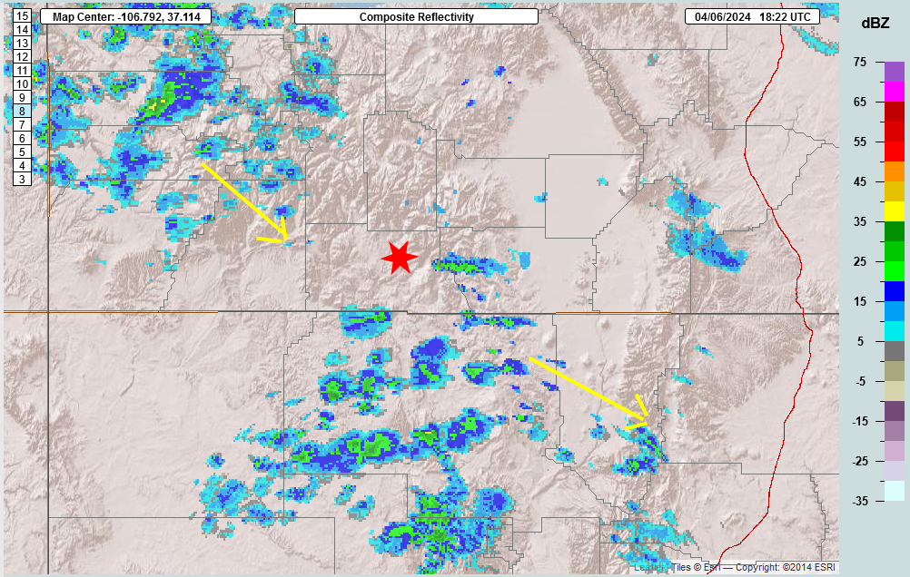
Radar…
Forecast highlights…
*** Windy Today through this evening; Wind Advisory***
*** A few more inches of snow especially over mountains; Winter Weather Advisory. ***
***Possible Thunderstorms this afternoon!***
Saturday – The Aftermath
The area of low pressure and its associated front have moved to the east leaving us in a chilly northwesterly flow. The cold air advection or thermal gradient is causing continued winds. It is also helping to enhance additional snowshowers. We have snow showers in the area as of 1100L. With the winds expect to see blowing snow as well.
Timing of Showers… Expect snowshowers to persist till around 5pm this afternoon, especially over the mountains. A stray thunderstorm is possible as well, especially over the mountains.
Snow levels… Snow level is at 4,600 feet with all the cold air moving in. All areas should see snow.
Snow amounts…
Valley: Trace to 1″
Mountains: 2-4”
URGENT - WINTER WEATHER MESSAGE
National Weather Service Pueblo CO
1207 PM MDT Fri Apr 5 2024
Including the cities of North Pass, Cumbres Pass, and Wolf Creek Pass
...WINTER WEATHER ADVISORY REMAINS IN EFFECT FROM 6 PM THIS
EVENING TO 6 PM MDT SATURDAY...
* WHAT...Snow expected. Total snow accumulations of 5 to 10
  inches with locally higher amounts across the eastern San Juan
  Mountains. Winds gusting as high as 60 mph.
* WHERE...La Garita Mountains Above 10000 Feet and Eastern San
  Juan Mountains Above 10000 Feet.
* WHEN...From 6 PM this evening to 6 PM MDT Saturday.
* IMPACTS...Travel could be very difficult. Widespread blowing
  snow could significantly reduce visibility. Strong winds could
  cause tree damage.
PRECAUTIONARY/PREPAREDNESS ACTIONS... Slow down and use caution while traveling.
The latest road conditions for the state you are calling from can
be obtained by calling 5 1 1.***

Winds…
Winds are gusty again as the cold air continues to ooze in. Expect peaks of 40mph out of the west/northwest after noon till sunset in the valley areas and up to 45mph in the mountains till early morning hours.
URGENT - WEATHER MESSAGE
National Weather Service Grand Junction CO
821 AM MDT Sat Apr 6 2024
Including the cities of Rangely, Dinosaur, De Beque, New Castle, Mesa, Parachute, Rifle, Silt, Eagle, Edwards, Glenwood Springs, Carbondale, Montrose, Hotchkiss, Delta, Gunnison, Cimarron, Cortez, Dove Creek, Mancos, Durango, Bayfield, Ignacio, Pagosa Springs, Vernal, and Ballard.
...WIND ADVISORY REMAINS IN EFFECT UNTIL 9 PM MDT THIS EVENING...
* WHAT...West winds 25 to 35 mph with gusts up to 50 mph expected.
* WHERE...Portions of northwest, southwest and west central Colorado and east central, northeast and southeast Utah.
* WHEN...From 11 AM this morning to 9 PM MDT this evening.
* IMPACTS...Gusty winds could blow around unsecured objects.
  Tree limbs could be blown down.
Temps… HIGHS on Saturday will only be mid-30s to hi-30s. Not very HIGH!!!
Sunday – A Nice Break
Sunday will start out COLD but be partly to mostly cloudy with some increasing clouds throughout the day.
Winds… Winds will switch back to the southwest and be breezy in the afternoon with gusts of 20-25mph in the valley areas and 35 to 40mph in the mountains in the afternoon.
Temps… Low temps on Sunday morning will be hi-single digits to mid-teens! Brrrr! Note: the record low for Sunday morning is 6 degrees Fahrenheit set back in 1979! Some areas could break that early Sunday morning!!!
Highs on Sunday will be lo-40s to hi-40s.
Monday & Tuesday – A Weak “Disturbance”
A weak disturbance approaches us from the northwest starting on Monday and sinks to our south and forms an area of low pressure. We’ll see some clouds, snowshowers over our mountains and some wind. Otherwise all of the storm energy will be well to our south. Most models agree with this solution.
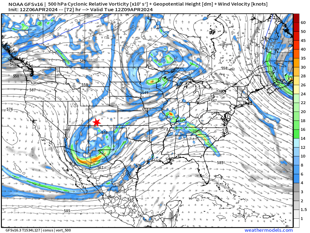
Snow Levels: Increase to 5,700′ early Monday and to 7,700′ by Tuesday evening. Our airmass will be modifying.
Precipitation and Snow amounts: The mountains could see a trace to 3″ of snow overnight Monday to Tuesday morning.
Winds… Occasional gusts to 18mph in the afternoon in the valley. Mountains could see 25mph.
Temps… Low temps on Monday lo-20s. Highs on Monday will be in the lo-40s to hi-40s.
Low Temps on Tuesday will be in mid to hi-20s. High temps on Tuesday will recover to the low 50s to the mid-50s.
Wednesday through Friday – Spring Returns!
Spring will return to Pagosa Country starting on Wednesday! We’ll have partly cloudy to clear skies and sunny days that will quickly warm up!
Winds… We might see a gust to 18mph in the afternoon.
Temps… Low temps will start out on Wednesday in the mid 20s and modify to lo- to mid-30s by Friday morning. Hi temps will start out on Tuesday in the mid 50s and will soar to the lo-60s by Friday!
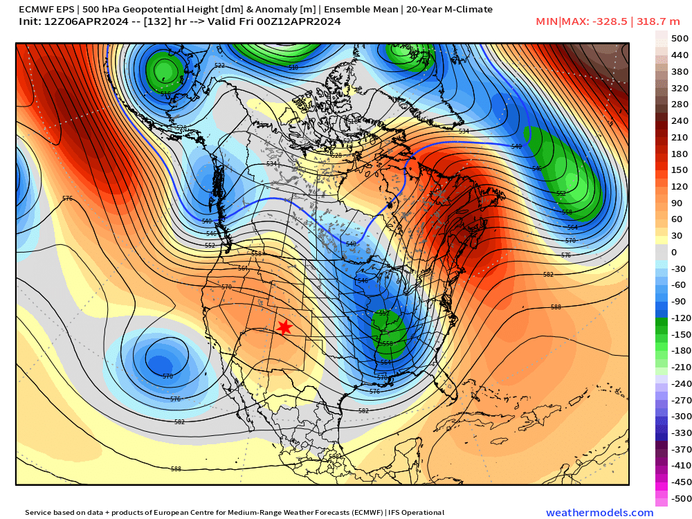
Wolf Creek has announced on their web page that their last day of operations is tomorrow, Sunday, April 7th.
I will have another post out tomorrow afternoon. First I have to walk pups at the Humane Society!
– Arleen


