

A Kaleidoscope of colors appeared at sunrise at 06:39 this morning over Wolf Creek Ski Resort. Wolf Creek Summit Web Cam Image
Today & Saturday will be windy with snow and possible thunderstorms overnight!
If images fail to load in the email, just click the title of the post.
Friday – 5 Apr 2024 – 3:50pm
The past…
At Stevens Field the high temperature yesterday afternoon was 64 and the low this morning was only 36.
The peak wind at the airfield this afternoon was 39mph.
| Average High | Record High / Year | Average Low | Record Low / Year |
| 56 | 73/ 1959 | 22 | 6 / 1955 |
Precipitation summary… There wasn’t any precipitation in our area yesterday or last night.
Forecast discussion…

A very complex area of low pressure systems with prefrontal trof and an associated cold front are moving east from the Great Basin area and across Colorado.
Forecast highlights…
*** Windy Today through Saturday evening; Wind Advisory***
*** Rain turning to snow Friday evening to Saturday evening; Winter Weather Advisory. ***
***Possible Thunderstorms Saturday morning!***
***Possible Dust; Air Quality Health Advisory***
Friday and Saturday… A complex area of low pressure systems with prefrontal trof and an associated cold front are moving from the Great Basin area and across Colorado. We’ve been under the influence of a pleasant dry continental airmass and spring like weather. Before the night is over that will be replaced by a polar maritime airmass and winter will have returned!
Today will be mostly cloudy with pops of sun from time to time due to dry air moving into our area ahead of the main cold front. Clouds and winds will increase throughout the afternoon especially after sunset. With the high winds coming with a long fetch from the southwest there is a chance of dust being advected into our area. Saturday will start out cloudy with with decreasing clouds through the day.
...AIR QUALITY HEALTH ADVISORY FOR BLOWING DUST FROM 1200 PM
FRIDAY UNTIL 900 PM FRIDAY...
WHAT...Air Quality Health Advisory for Blowing Dust.
WHERE...Locations include, but are not limited to, Saguache, Alamosa, Del Norte, San
Luis, Conejos, Pagosa Springs, Creede, Lake City, Durango,Silverton, Cortez, Dove Creek, Telluride, Ouray, and Montrose.

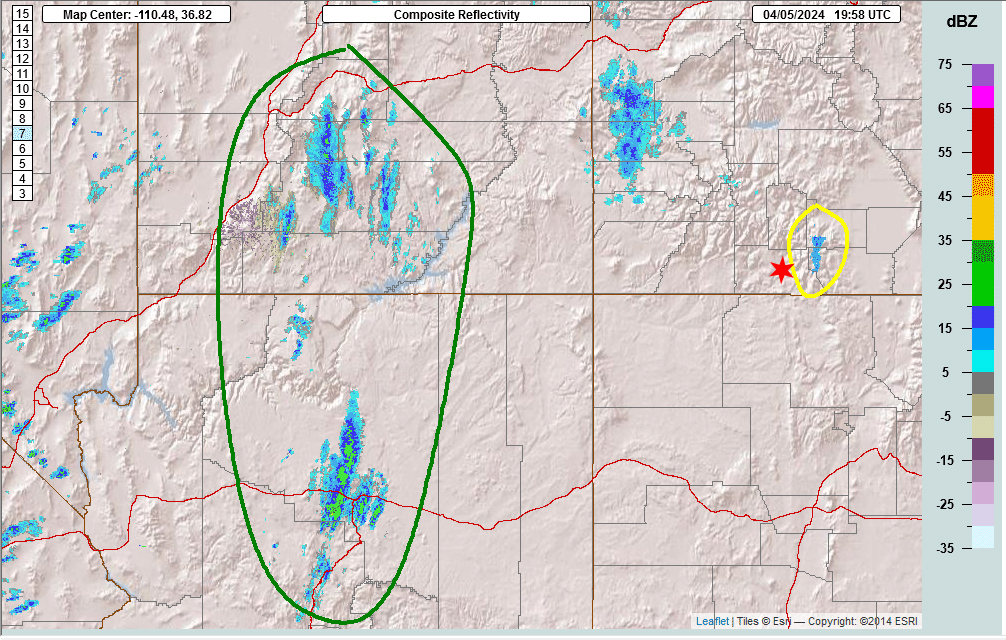
Timing of Showers… The first few scattered showers are developing over the mountains now and then over the valley Friday evening. The best chance for precip is Friday evening to around noon Saturday. However, showers could persist into Saturday evening over the mountains.
Note: this system is going to try to exit with a bang with the possibility of thunderstorms this evening and tomorrow morning!
Snow levels… Friday afternoon rain is possible up to 9,000ft. The snow level will drop to 7,600ft by midnight Friday and continue to drop to around 4,000ft (!) by sunrise Saturday. So most valley locations should see rainshowers Friday afternoon which will start switching to snow after sunset and all locations will have snow by Saturday morning. That is some chilly air to drop snow levels 5,000 feet in 12 hours!!!
Precipitation Amounts…
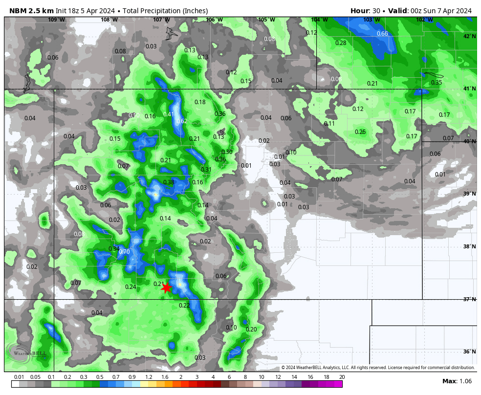
Pagosa and valley areas could see .21″ of precipitation between the rain and the snow by 6pm Saturday. Eastern areas of the county to include Chromo will see higher amounts. The mountains could see 1.00″ snow water equivalent by 6pm Saturday.
Snow amounts…
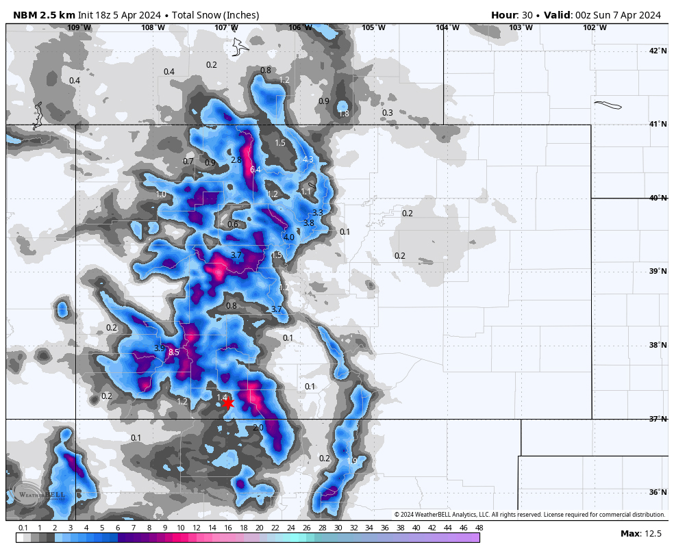
Valley: 1-3”
Mountains: 8-12”
URGENT - WINTER WEATHER MESSAGE
National Weather Service Pueblo CO
1207 PM MDT Fri Apr 5 2024
Including the cities of North Pass, Cumbres Pass, and Wolf Creek Pass
...WINTER WEATHER ADVISORY REMAINS IN EFFECT FROM 6 PM THIS
EVENING TO 6 PM MDT SATURDAY...
* WHAT...Snow expected. Total snow accumulations of 5 to 10
  inches with locally higher amounts across the eastern San Juan
  Mountains. Winds gusting as high as 60 mph.
* WHERE...La Garita Mountains Above 10000 Feet and Eastern San
  Juan Mountains Above 10000 Feet.
* WHEN...From 6 PM this evening to 6 PM MDT Saturday.
* IMPACTS...Travel could be very difficult. Widespread blowing
  snow could significantly reduce visibility. Strong winds could
  cause tree damage.
PRECAUTIONARY/PREPAREDNESS ACTIONS... Slow down and use caution while traveling.
The latest road conditions for the state you are calling from can
be obtained by calling 5 1 1.***
Winds… Geek Alert! Winds are caused by Pressure Gradient and Thermal Gradient. We have a pressure gradient from the exiting high pressure and the advancing low. We are looking at a strong thermal gradient across the area as a robust cold front moves through tonight!
Winds are already breezy with some areas hitting 39mph. There are small white caps on Hatcher Lake. Valley area will be 35-45mph. The winds will let up a little bit overnight but pick up again Saturday afternoon with gusts of 30-40mph in the valley. In the mountains, winds will blow 45 to 55mph the entire period from Friday afternoon through sunset on Saturday.
***National Weather Service Grand Junction CO
1122 AM MDT Fri Apr 5 2024
Including the cities of Durango, Bayfield, Ignacio, and Pagosa Springs
…WIND ADVISORY REMAINS IN EFFECT UNTIL 9 PM MDT THIS EVENING…
* WHAT…South winds 25 to 35 mph with gusts up to 55 mph
expected.
* IMPACTS…Gusty winds could blow around unsecured objects.
Tree limbs could be blown down.***
Temps… Highs Friday will be in the lo-50s to hi-50s. Lows Saturday morning will be lo-20s to hi-20s. HIGHS on Saturday will be in the lo-30s to hi-30s. Not very HIGH!
Sunday through Tuesday
Sunday will be partly to mostly cloudy with increasing clouds. An upper level “disturbance” will approach us from the northwest. As it drops into the base of the trof, it will deepen and an area of low pressure will form by Tuesday. Monday and Tuesday will be Mostly Cloudy.
Snow Levels: Snow levels on Sunday will be at 4,000′ and increase to 7,000′ by late Monday and up to 7,700′ .
Precipitation and Snow amounts:
There will be snow showers in the area Monday afternoon but they are going to stick to over the mountains. The mountains could see a few inches of snow by Tuesday morning. They could see another few inches Tuesday for a total of 2 to 4″ of snow
All areas will see showers off and on throughout the day Tuesday. They’ll all start as snowshowers but by Tuesday afternoon lower valley areas will see those snowshowers transform to rainshowers. Lower valley areas will see a trace to 1/2″ of snow. Upper valley areas could see 1/2″ to 2″ of snow.
Winds… Winds will continue to be breezy with gusts of 20-25mph in the valley areas and 35mph in the mountains on Sunday in the afternoon. They’ll ease up on Monday and Tuesday with gusts to 20mph in the valley areas and 25mph in the mountains.
Temps… Low temps on Sunday morning will be lo-teens to upper teens! Brrrr! Highs on Sunday and Monday will be mid-40s to lo-50s. Low temps on Monday will be in the lo-20s. Low Temps on Tuesday will be in mid to hi-20s. High temps on Tuesday till recover to the hi-40s to the low 50s.
We’ll continue to adjust the details as the data gets better.
Wolf Creek has announced on their web page that their last day of operations is this Sunday, April 7th.
I will have a post out tomorrow morning.
– Arleen


