
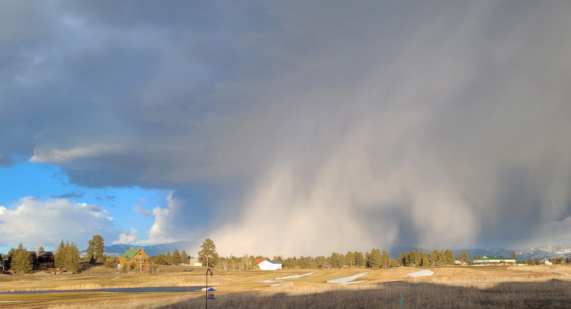
We had some impressive showers move quickly in & out of the area yesterday afternoon. Karen’s timing was perfect and she caught this one in the long afternoon light.
Snow returns this weekend with gusty winds.
If images fail to load in the email, please click the title of the post. Thanks!
Wednesday – 20 Mar 2024 – 4:30pm
The past…
At Stevens Field the high temperature this afternoon was 53 and the low this morning was 25.
The peak wind at the airfield today has been 18mph.
| Average High | Record High / Year | Average Low | Record Low / Year |
| 51 | 68/ 1997 | 17 | -1 / 1917 |
Precipitation summary… Showers yesterday afternoon were very isolated but a few looked impressive. We had some snow showers hugging the mountains from around 1pm to 4pm but Wolf Creek reported zero for new snowfall.
This afternoon, we again have some isolated rain and snowshowers. We even had a thunderstorm to the west!

CoCoRaHS 24-hour precip reports range from zero to .03”. Mark in the Reserve reported .2”of snowfall otherwise it was mostly rain .
Forecast discussion…
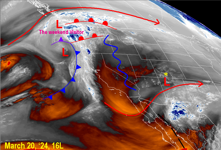
Water Vapor satellite this afternoon.
The cut-off low is currently being from northwest New Mexico into eastern New Mexico. As it moves east and with the afternoon warmer temperatures, our atmosphere is unstable and showers are popping up – the white dots. Note the complex area of low pressure systems to the northwest. That will be our weather maker this weekend and into next week as it sinks in along the coast and pushes east.
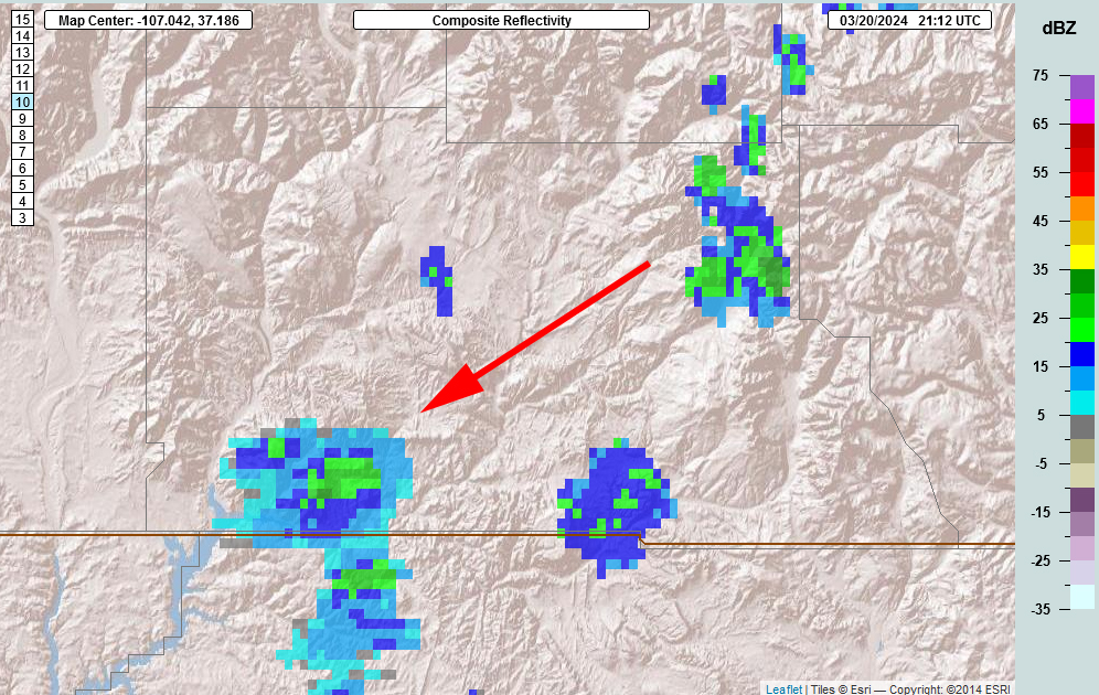
Radar
A number of isolated showers are in the area – more than what show up on the radar – some are under the lowest beam. They are moving from the northeast to the southwest weakening as they move off the mountains.
Forecast highlights…
*** An ejecting cut-off low is causing isolated showers this afternoon. ***
*** Avalanche danger in our mountains is rated “considerable”. ***
*** A weather system moves into the area starting on Saturday***
*** Expect significantly colder temperatures starting on Sunday – Winter will be back!***
Rest of Wednesday… The pesky cut-off low, currently in New Mexico is finally being picked up by the subtropical jet and being ushered to the east of New Mexico. We’ll be Mostly Cloudy all afternoon becoming Partly Cloudy overnight with areas of stratus and fog overnight.
The low is close enough to kick up spotty showers and maybe even an isolated thunderstorm.
Snow levels could pop up to 8,600ft this afternoon. That means rain in the afternoon for all locations less than 8,600 feet. Though, all types of precip are possible: rain, snow, graupel, and small hail. It will be all snow over the mountains.
Definition of “spotty showers”: Cover small areas, precip changes intensity quickly. Plus, they start & stop abruptly. Most of the time it will be dry with brief periods of “fun”.
Snow totals for Wednesday Afternoon…
Valley below 8,600ft: mostly rain
Valley above 8,600ft: up to 2” in the lucky spots
Mountains: Trace to 3” but it will be spotty
Winds… Gusts will be around 20mph Wednesday afternoon.
Temps… Wednesday highs will be in the upper-40s to low-50s and lows will be in the low 20s to upper 20s.
Thursday: Ridge Moves IN! The big, beautiful blue skies will be out! After areas of morning fog, we’ll be mostly sunny with temperatures warming up and a lot of melting going on.
Highs Thursday will be in the low 50s to low 60s and lows will be in the mid 20s.
Thursday afternoon gusts will be 10-20mph.
Friday: Transition Day! After areas of morning fog and stratus, Friday will be Partly Cloudy with mid and upper level clouds as moisture starts to stream in from the southwest ahead of the next system. We can also expect to see a stray snowshower over the mountains.
Highs Friday will be in the mid 50s to low 60s and lows will be in the mid 20s to low 30s.
Friday afternoon gusts will be 15-25mph.
Saturday: After areas of morning fog and stratus, Saturday will be Partly Cloudy becoming Mostly Cloudy to Cloudy as moisture starts to stream in from the southwest with the next system.
Expect to see snowshowers over the mountains after noon.
We can also expect to see rainshowers and snowshowers in the area after 3pm. Snow level will start at 8,500 and drop to 6,500 feet by 9am on Sunday. Most areas will see rainshowers first will switch over to snow throughout the evening and overnight hours.
Winds will pick up by noon and gust into the 30-35mph range.
Highs Saturday will be in the low 50s to upper 50s and lows will be in the mid 20s to low 30s.
Sunday: Sunday will be cloudy and chillier with snowshowers for most locations. Snow levels will drop from 6,500 feet to 5,900 feet.
Winds gust into the 20-25mph range.
Highs Sunday will be in the mid 30s to upper 30s and lows will be in the mid 20s to low 30s.
Snow totals for Saturday and Sunday…
Valley below 8,000ft: Start as rain and change to snow Saturday evening. 3-5″ of heavy wet snow.
Valley above 8,000ft: Start as rain and change to snow Saturday afernoon. 4 to 8″ of heavy wet snow.
Mountains: Snow begin on Saturday around noon. 10 to 16″ of snow.
Both the GFS and Euro agree with the timing and strength of the major features with the weekend system. The GFS brings in slightly more snow but the Euro has it more widespread throughout the county by Monday morning.


THANKS for all the love everyone gave to us and to Dr. Leo Milner on our post yesterday!
Shawn will have the next weather post out on Friday with details of what other weather we can expect next week.
– Arleen


