

Arleen “blowing snow” while I work on this weather post. We’re a good team! – Pic taken 7 Feb 2024
If images fail to load in the email, please click the title of the post. Thanks!
Wednesday – 7 Feb 2024 – 10:45am
The past…
At Stevens Field the high temperature yesterday afternoon was 48 and the low this morning was 32.
The peak wind at Stevens Field yesterday afternoon was 28mph.
| Average High | Record High / Year | Average Low | Record Low / Year |
| 41 | 58 / 1963 | 4 | -26 / 1989 |
Precipitation summary… Snow started falling above 7,800ft yesterday 4-5pm. It was rain below that for much of the night. Rain switched to snow for most locations 5-6am.
Most of the Facebook snow reports below 7,800ft are in the 2-5” range and are 5-9” above that. So far, more snow has fallen in the northern part of Archuleta County.
Wolf Creek reported 12” of new snow this morning.
THANKS so much for your reports!
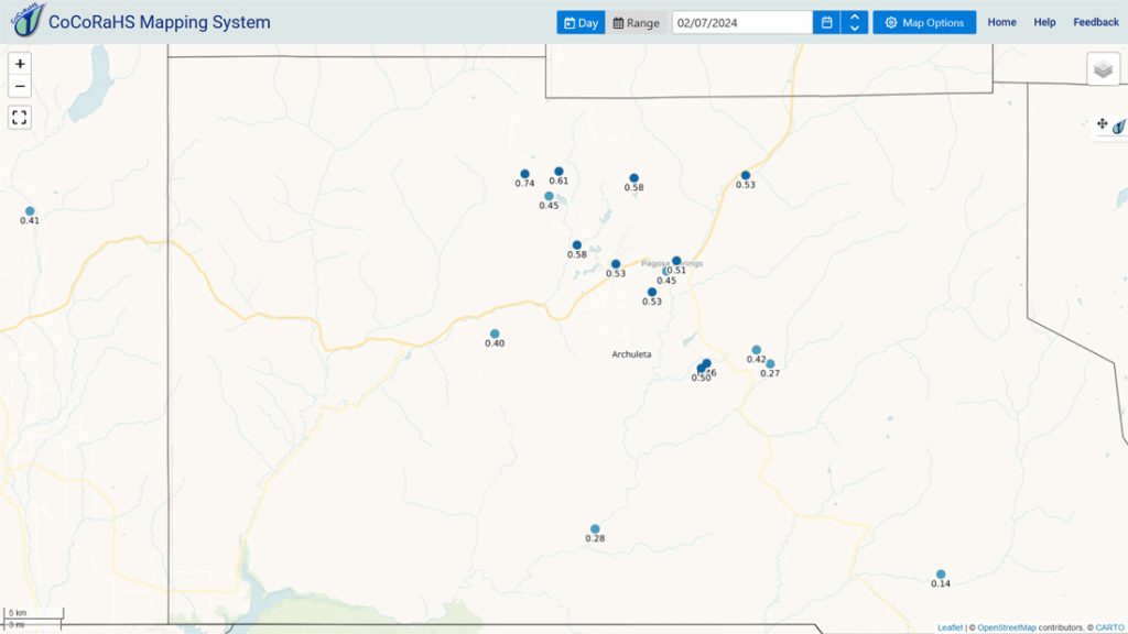
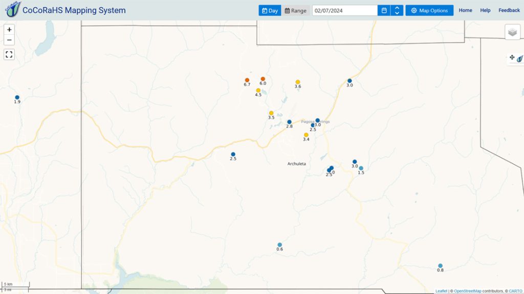
Forecast discussion…


Forecast highlights…
*** Snow will come in waves with occasional gusty winds, blowing snow, poor visibility, and maybe an isolated thunderstorm into Wednesday evening. ***
*** Heavy wet snow and gusty winds could lead to spotty power outages. ***
*** A WINTER STROM WARNING has been issued by the Pueblo NWS for the eastern San Juan Mountains above 10,000ft for 2-3ft of snow and 55mph winds valid until 5pm Thursday. ***
*** An AVALANCHE WARNING has been issued for the San Juan mountains valid until 9am Friday. Avalanche danger is rated “high” – it’s dangerous! ***
*** The Grand Junction NWS issued a WINTER WEATHER ADVISORY for the San Juan River Basin/Pagosa Springs area above 6,500ft area valid until 8am Thursday for up to 8” of total snowfall. ***
*** Another round of snow late Thursday afternoon into Thursday evening. ***

Rest of Wednesday into Thursday morning – The storm is less organized than I’d like to see but will continue to push waves of snow across Archuleta County into Wednesday evening. Snowshowers will become more hit and miss late Wednesday evening through Thursday morning.
Snow levels… Are around 6,500ft as I type and will continue to drop through the period.
Snow amounts 8am to 8pm Wednesday…
Valley below 7,400ft: 1-3” – wet snow
Valley above 7,400ft: 3-6”
Mountains: 10-16”
Snow amounts 8pm Wednesday to 8am Thursday…
Valley: 1-2” – this will be more spotty
Mountains: 4-8”
Winds… *** Gusts will be around 25mph into early Wednesday evening. ***
Temps. Highs Wednesday will be in the mid-30s and lows will be in the high teens to mid-20s. Highs Thursday will be near 30 to the mid-30s.

Thursday afternoon through Friday morning… The next trough will move through Thursday evening. The best chance for snow is late Thursday afternoon to late Thursday evening. Cold air will be in place, so snow levels won’t be a concern – yay. The system is fast-moving and has limited moisture so snow amounts will be low.
Snow amounts…
Valley: 2-5”
Mountains: 5-10”
Winds… Gusts Thursday afternoon will be around 20mph.
Temps… Highs Thursday afternoon will be in the high 20s to mid-30s and lows Thursday night will be in the mid-teens to low 20s.
Friday afternoon through Saturday… The next trough will move through from the northwest which isn’t favorable for us. Additionally, storm energy and moisture are weak, so my expectations are low.
Snow amounts…
Valley: 1-3” – it will be spotty
Mountains: 3-6”
Winds… Peaks will be 10-15mph both afternoons.
Temps… Highs Friday afternoon will be in the high 20s to mid-30s and lows Friday night will be in the high single digits to high teens. Highs Saturday afternoon will be in the low to high 30s and lows Saturday night will be around zero to the low teens.

I might do a quick post this evening and again first thing tomorrow morning, otherwise the next in-depth post will be later tomorrow morning.
– Shawn


2 Responses
Shawn, thank you for all of your weather reports. I really appreciated what you guys do and look forward to reading them every day.
I’ll echo the thanks for the dedication and hard work; but as a guy with a roof in the shade, I don’t look forward to reading all of them 😀