
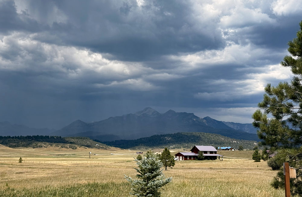
Storm over Pagosa Peak Tuesday afternoon – pic taken 8/11/2026
Tuesday – 11 Aug 2026 – 4:15pm
The past…
Stevens Field Observations
Sunday: High: *91*, Low: 52, Peak wind: 38mph, Afternoon humidity: 9-14%
Monday: High: 89, Low: 52, Peak wind: 40mph, Afternoon humidity: 15-20%
* New record high beat previous record high of 90 set in 1969.*
| Average High | Record High / Year | Average Low | Record Low / Year |
| 81 | 94 / 1940 | 45 | 32 / 1974 |
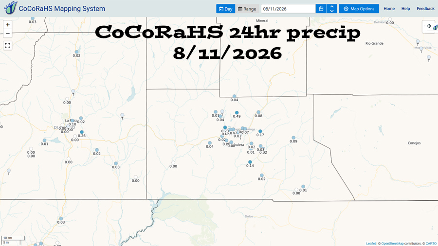
Precipitation summary… A few lucky folks got a soaking Monday afternoon.
Current satellite, radar, and smoke…
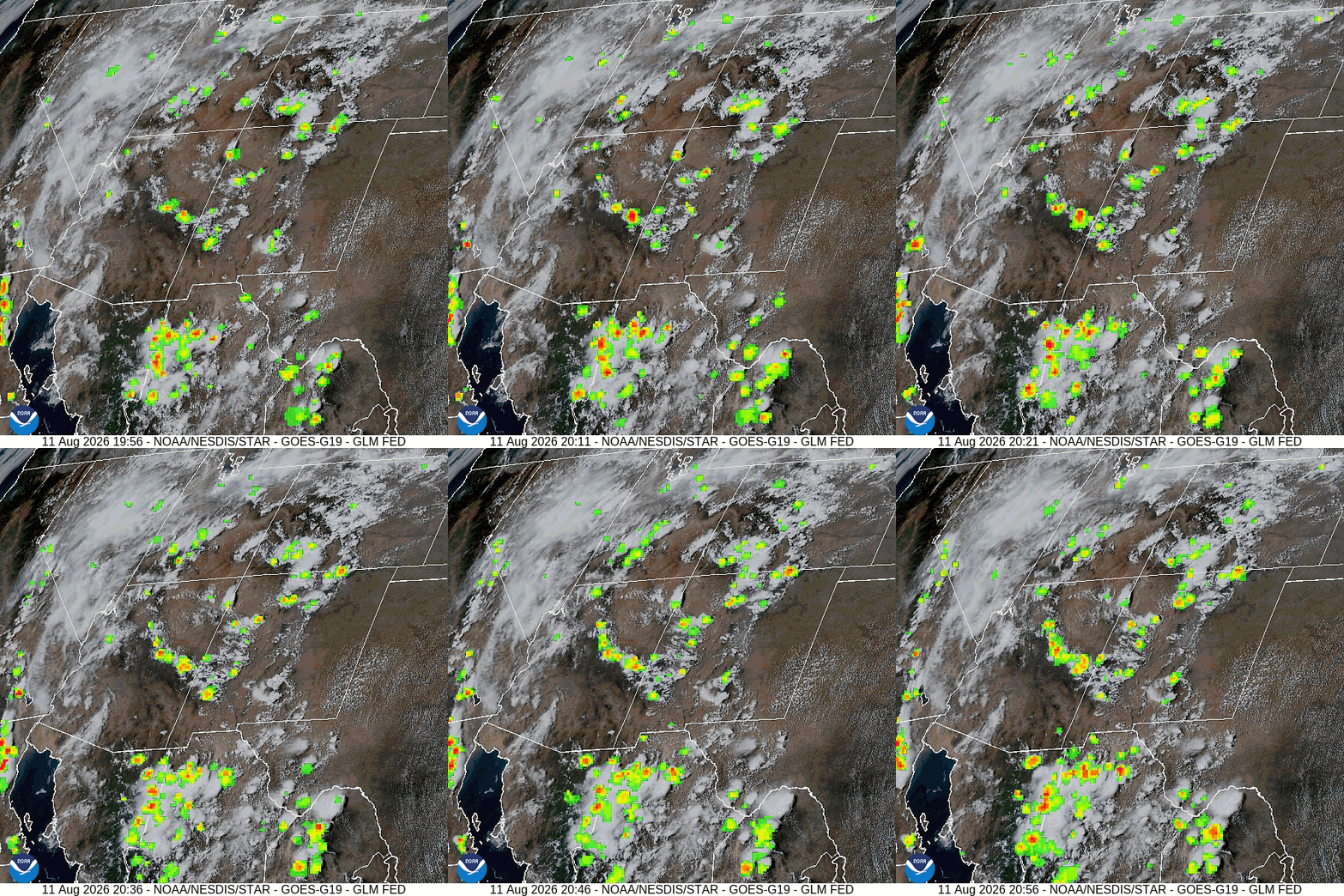
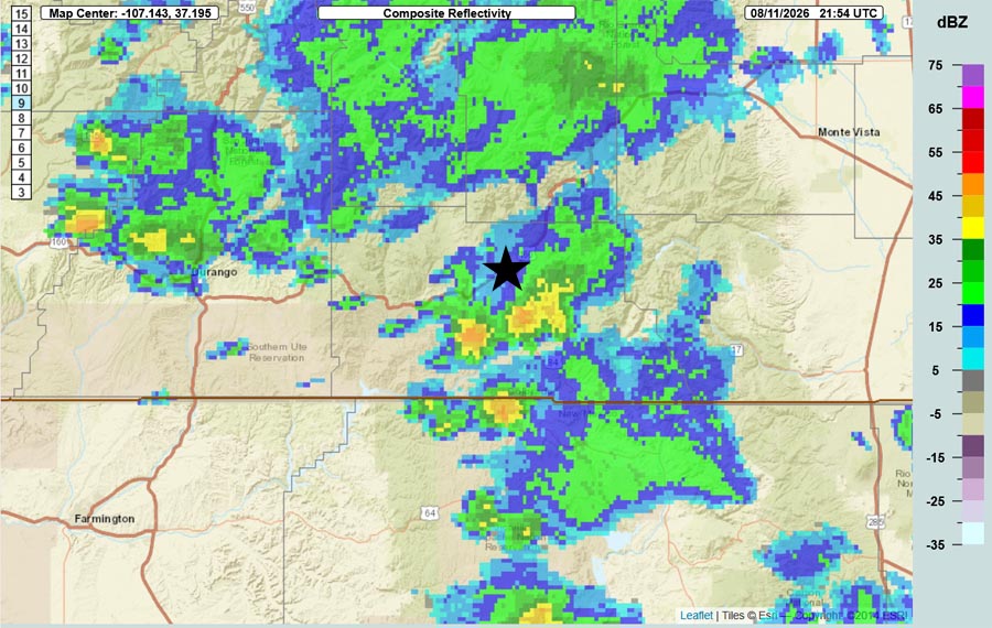
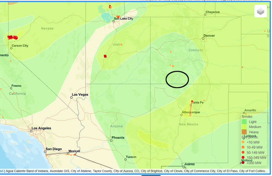
Air quality was “moderate” into Monday evening and has been “good” since.
Forecast highlights…
*** Fire danger remains high. Warm, breezy afternoons have dried things out. The San Juan National Forest and Archuleta County are under stage 1 fire restrictions. ***
*** There will be hit and miss storms each afternoon and evening. Some of these storms will be soakers. The most favorable days for a good soaking are Wednesday, Thursday, and Friday. Saturday and Sunday there will be a brief lull with less activity, and then it will ramp up again. Do your rain dances! ***
*** Rio Blanco Fire… Thanks to the efforts of everyone tackling the fire, containment is 91% and property owners have returned! For the most current information follow Archuleta County, CO Sheriff’s Office or Rio Blanco Fire on Facebook or Watch Duty. ***
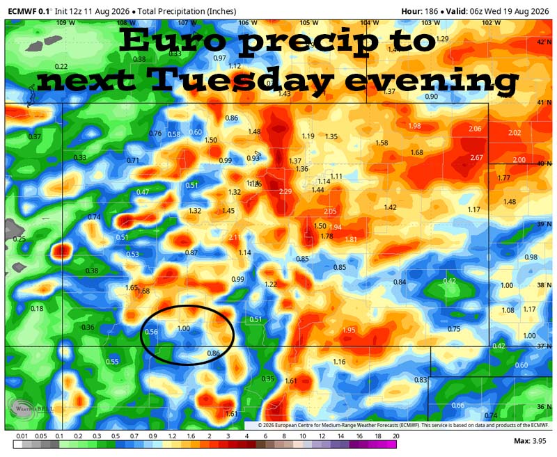
Rest of Tuesday through next Tuesday… The subtropical high will finally move to our east – where we want it! Monsoon moisture and instability will increase. There will be scattered storms each afternoon and evening.
The most favorable days for a good soaking are Wednesday, Thursday, and Friday. Saturday and Sunday there will be a brief lull with less activity, and then it will ramp up again.
Storms Wednesday, Thursday, and Friday will be capable of producing heavy rain, small hail, gusty winds, poor visibility, and lightning over small areas for short periods.
Temps…
Tuesday night lows will be near 50 to the mid 50s.
Wednesday highs will be near 80 to the high 80s and lows will be near 50 to the mid 50s.
Thursday through the weekend highs will be in the mid 70s to the low 80s and lows will be near 50 to the high 50s.
Monday and next Tuesday highs will be in the high 70s to the mid 80s and lows will be in the in high 40s to the mid 50s.
Winds…
Each afternoon gusts will be around 20mph though isolated stronger gusts are likely near showers and thunderstorms.
18 Aug to 26 Aug… The subtropical high will wobble between the Four Corners area and the TX/OK panhandle area. When it’s near the Four Corners, it’s marginal for us, but when it’s to the east, it’s game on. I expect the pattern to stay active for us with scattered storms each afternoon and evening.
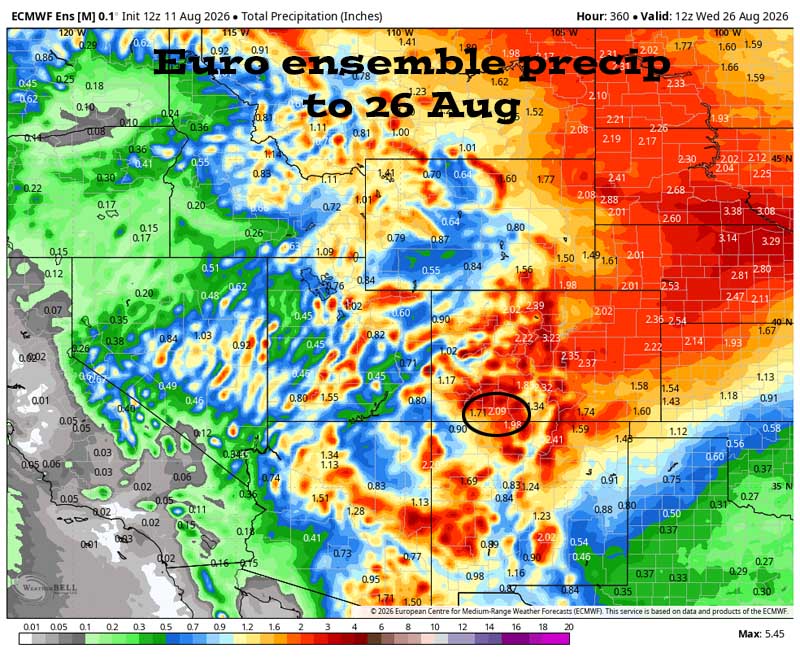
Forecast precip amounts have trended down a little over the last two days.
Much of Colorado should get a soaking over the next two weeks.
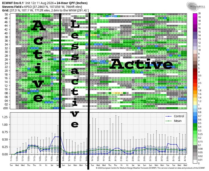
It’s active Wednesday, Thursday and Friday. There’s a brief lull with less activity over the weekend and then it’s a little more active through the rest of the period.
The next post will be Thursday afternoon.
– Shawn


One Response
Shawn and Arlene, what kind of rain amounts do we need for the SJ river and its tributaries to recover to decent volume?
Thanks!
Tyler Shepperd