
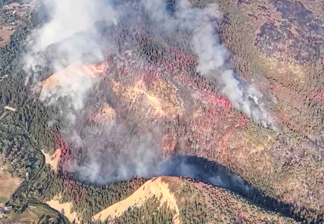
Rio Blanco Fire : Aerial footage captured yesterday, highlighting the work taking place across the incident. Update at bottom of this report. Photo courtesy USFS (Picture taken 8/4/2026)
Wednesday – 5 Aug 2026 – 8:20pm
The past…
Stevens Field Observations
Tuesday: High: 91, Low: 48, Peak wind: SWG28mph, Afternoon humidity: 9-12%
Wednesday: High: 90, Low: 52, Peak wind: WG28mph, Afternoon humidity: 9-15%
O’Neal Park had a low of 43 Wednesday morning.
| Average High | Record High / Year | Average Low | Record Low / Year |
| 82 | 97 / 1940 | 46 | 29 / 1956 |
Precipitation summary… There has not been any precipitation in our area in the last two days.
Current satellite and radar…
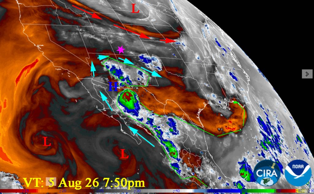
There are not any radar reports near us this evening. Thunderstorms/Rainshowers formed in Mineral county and moved east over into the San Luis Valley this evening.
Forecast highlights…
*** Fire danger remains high. Warm, breezy afternoons are drying things out. The San Juan National Forest and Archuleta County are under stage 1 fire restrictions. ***
*** Spotty Thunderstorms/showers Saturday/Sunday/Monday with outflow winds & lightning. ***
***Monsoon Thunderstorms on Tuesday with gusty winds/small hail/lightning and isolated moderate/heavy rains***
*** Rio Blanco Fire: 1,388 Acres with 55% Containment! See Fire Smoke Report below ***
This week… The subtropical High is to our south today. It will wobble to our west tomorrow. Over the weekend it wobbles over the four corners area. By Sunday evening it should be to our east where it belongs for a good monsoon pattern. It will take a few days for it to pick up good moisture.
The next few days will be hot and dry with only the slightest chance of a rainshower despite the pretty cumulus clouds that form each afternoon.
Over the weekend through Monday, monsoon moisture and instability will increase a little. There will be a few hit and miss storms most afternoons and evenings. It’s weak. Expect only a few sprinkles. And expect outflow gusty winds and lightning associated with the thunderstorms. Watch for new fires!
Finally on Tuesday, expect Monsoon Thunderstorms with gusty winds/small hail/lightning and isolated moderate/heavy rains. Those will continue into the second week.
Temps…
Lows: mid 40s to Low 50s.
Highs: Upper 80s to mid 90s. We could break records on Thursday: 91 set in 1981, Saturday & Sunday: 90 set in 1969. Tuesday will “Cool” to mid 80s to near 90.
Winds…
Friday, Saturday, Sunday afternoon gusts will be around 15mph though isolated stronger gusts are likely near any showers and thunderstorms. Thursday as the gradient tightens expect an evening drainage wind with gusts as high as 30mph from 6pm till midnight.
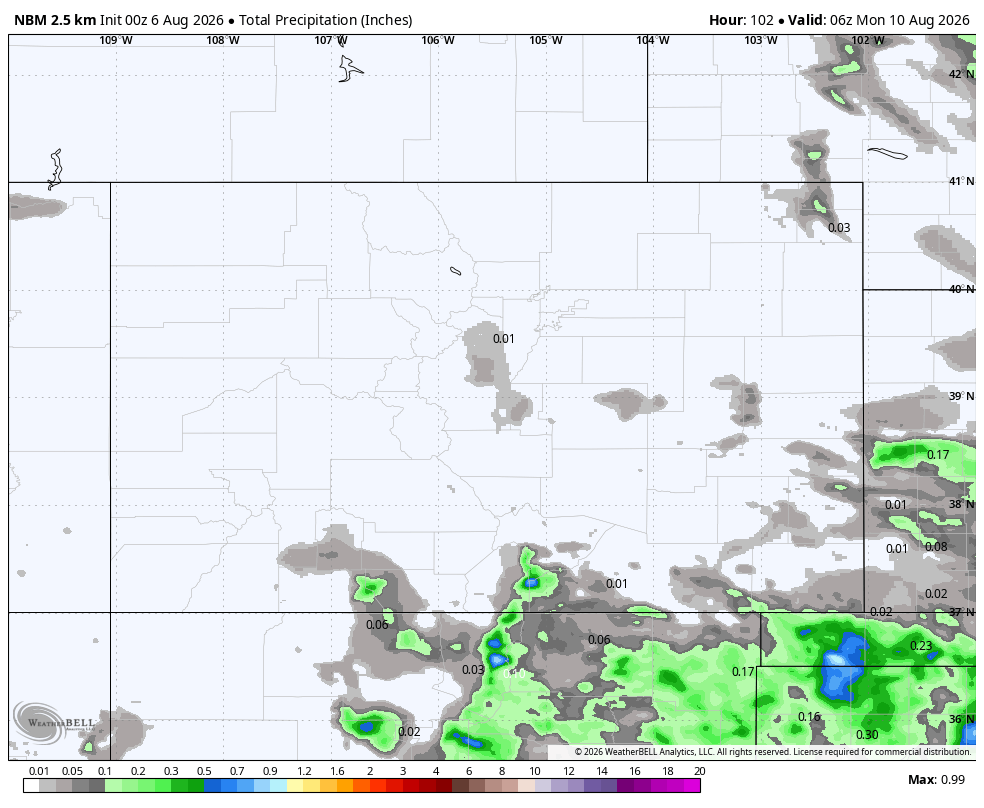
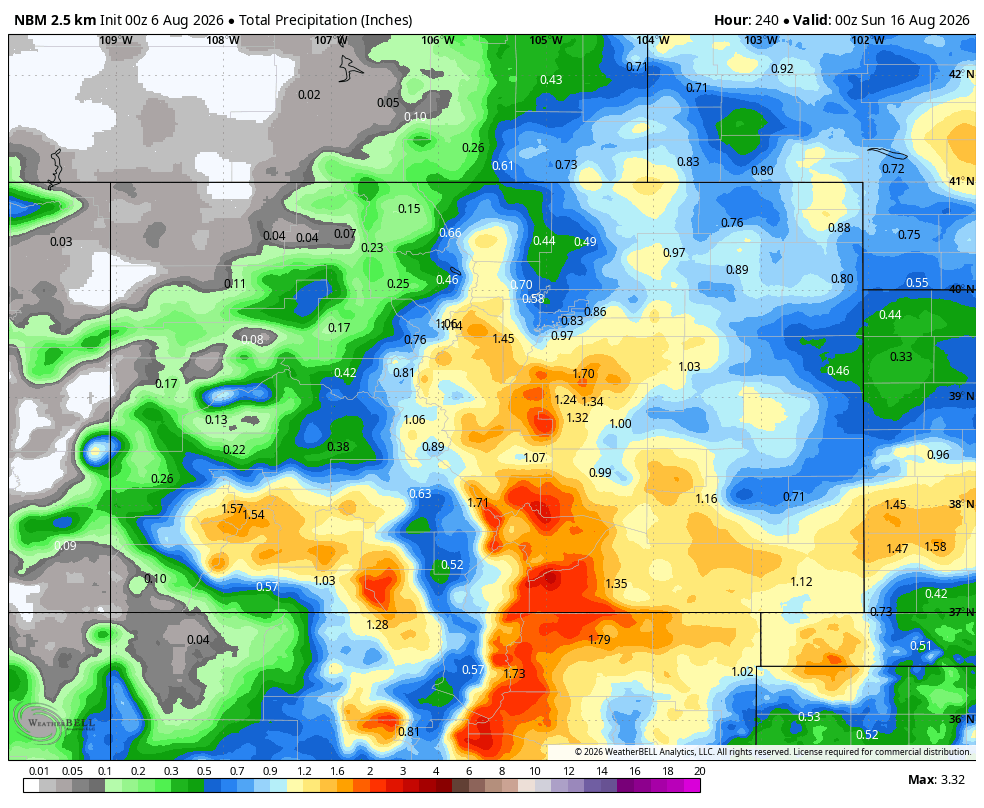
12 Aug to 20 Aug… The ridge will slide to our east Sunday into Monday. Monday will see weak showers and thunderstorms through out the area with small hail, gusty winds. Tuesday (11th) and beyond will see widespread monsoon thunderstorms with potential for moderate to heavy rain.
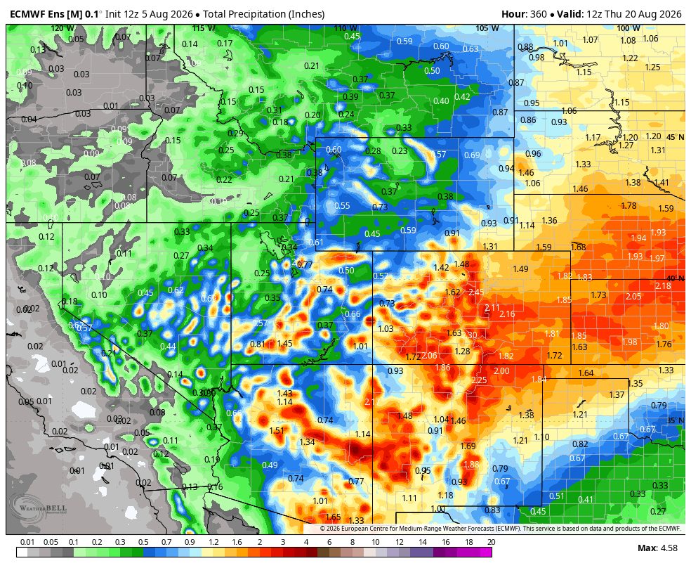
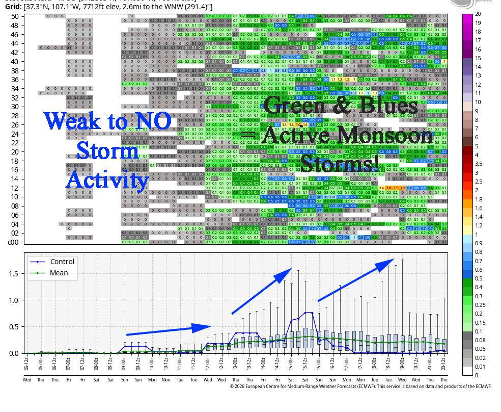
It’s read left to right, and times are in Zulu. The top chart shows 24-hour precip amounts for 50 versions of the Euro forecast model. The bottom chart graphs the control, mean, and range of the 50 versions.
Fire/Smoke Report
Rio Blanco Fire: 1,388 Acres with 55% Containment! Those guys & gals on the ground and in the air have worked extremely hard in the last eight days. They came up with an incredible plan of attack and it worked! They “coordinated line construction and planned burnout operations… fire managers anticipated a substantial increase in containment today as crews secured additional sections of the fire’s edge.” And they got it! There is still a lot of work to be done, but I know evacuated folks with homes in line of the fire were able to breath a bit today.
For the most current information follow Archuleta County, CO Sheriff’s Office or Rio Blanco Fire on Facebook and the Watch Duty app.
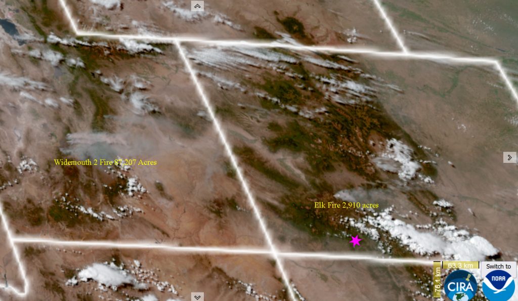
Smoke: We had a lot of smoke in the area last night and that will persist throughout the week. The smoke is coming from the Widemouth 2 fire in Utah (96,702 acres – updated #) to our northwest.
The next post will be Friday evening.
– Arleen


