

The WPC “Excessive Rainfall and Flash Flood Potential” is elevated for us on Wednesday
Monday – 20 Jul 2026 – 5:30pm
The past…
Stevens Field Observations
Saturday: High: 79, Low: 51, Peak wind: 22mph, Afternoon humidity: 32-36%
Sunday: High: 89, Low: 51, Peak wind: 25mph, Afternoon humidity: 21-30%
| Average High | Record High / Year | Average Low | Record Low / Year |
| 83 | 94 / 1910 | 46 | 36 / 1987 |
Precipitation summary… Scattered showers and thunderstorms continue to soak some spots while mostly missing others.


Current satellite and radar…
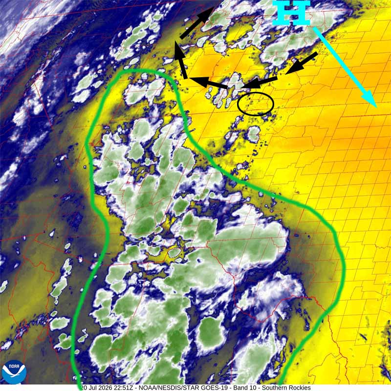
Archuleta County is circled in black.
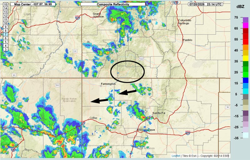
Forecast highlights…
*** Fire danger remains very high. The entire San Juan National Forest and Archuleta County are under stage 2 fire restrictions. ***
*** MONSOON action is here for a while – yay! There will be a lull through early Tuesday afternoon and then the rest of the week will be more active. Our best surge of moisture happens Wednesday. Let it rain! ***
Rest of Monday through early Tuesday afternoon… There’s just a slight chance for a few weak, spotty storms late Monday evening. Consider yourself lucky if you get a few raindrops.
Late Tuesday afternoon through Thursday evening… Things line up well for us to get some soaking monsoon storms.
We will see an increase of afternoon and evening storms that could persist into the early morning hours each night. Storms will produce short periods of heavy rain, small hail, gusty winds, and lightning over small areas.
Friday and through the following week… Monsoon moisture and instability will stick with us. We will have scattered storms each afternoon and evening. Storms will be capable of producing short periods of heavy rain over small areas.
Temps…
Monday night lows will be in the high 40s to mid 50s.
Tuesday highs will be in the mid 80s to low 90s and lows will be near 50 to the mid 50s.
Wednesday through next Monday highs will be in the high 70s to high 80s and lows will be in the near 50 to the high 50s.
Winds…
Each afternoon gusts will be 15-20mph though isolated stronger gusts are likely near showers and thunderstorms.
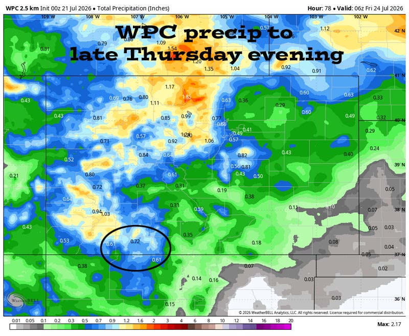
20 Jul to 4 Aug… The subtropical high pressure will wobble around the Four Corners region for much of this period which is ok for us. At the end of this period, the high could shift towards the lower Colorado River basin which would result in a less active and dryer pattern for us.
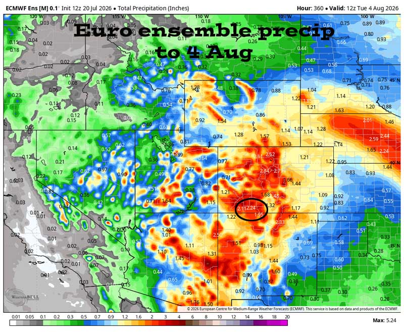

It’s mostly dry through early Tuesday afternoon then activity ramps up late Tuesday afternoon and peaks Wednesday and Thursday. The rest of this period looks active with scattered afternoon and evening storms each day.
The next post will be Wednesday afternoon.
– Shawn


