This pattern will persist…

The mother ship is arriving! – Pic taken 7/17/2025

The mother ship is arriving! – Pic taken 7/17/2025

Saturday – 19 Jul 2025 – 4:30pm

The past…

At Stevens Field the high temperature on Thursday was 81, and on Friday it was 83. The low this morning was 54. The cold spots were in the mid-40s.

The minimum relative humidity Thursday afternoon was 16% and Friday afternoon it was 19%.

The peak wind at Stevens Field on Thursday was 26mph and on Friday it was 21mph.

Average HighRecord High / YearAverage LowRecord Low / Year
8296 / 19894635 / 1956

Precipitation summary… Same trend – most of us hardly get any rain while a few lucky areas get a decent soaking.
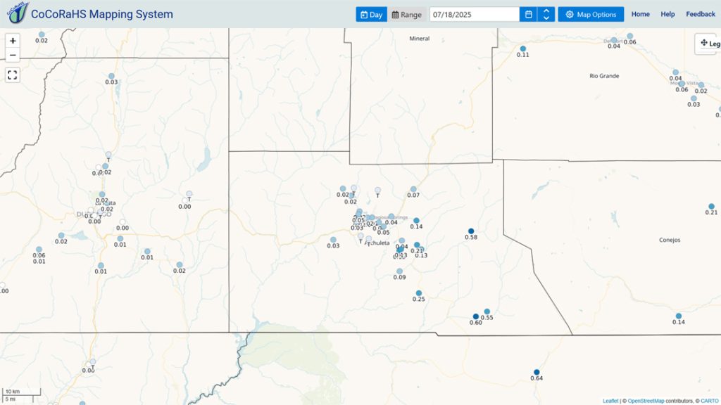
CoCoRaHS 24-hour precip reports from Friday morning range from a trace to 0.60”.
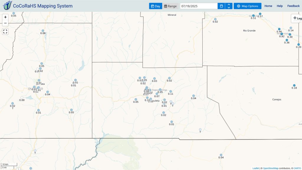
CoCoRaHS 24-hour precip reports from Saturday morning range from a track to 0.11”.

Fires, smoke, and air quality…

Thankfully there have been no new fires reported in our area.

The smoke and AQI map Saturday afternoon shows that the smoke has cleared, and air quality is good.

Forecast discussion…

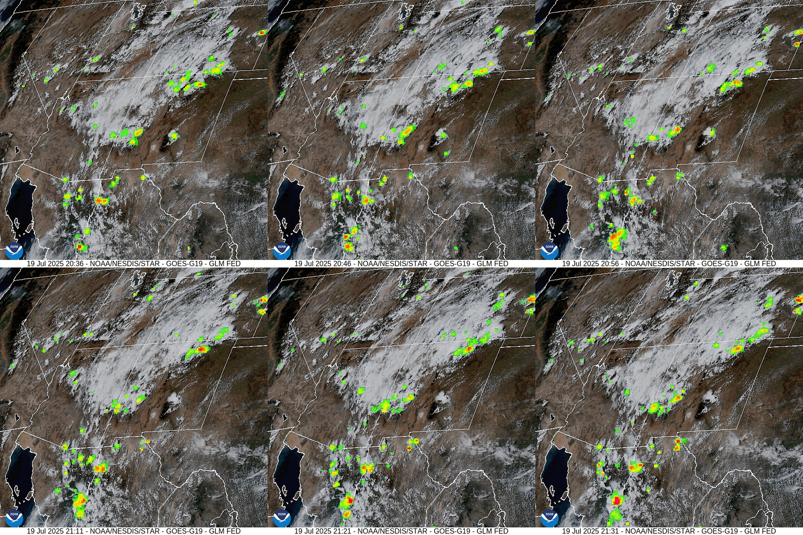
Visual satellite and lightning loop roughly 2:30pm to 3:30pm Saturday – There is a weak monsoon moisture plume with moderate instability over our area today. There was quite a bit of lightning between 1:30pm and 3pm.
Radar at 4:04pm Saturday – Things are pretty quiet over Archuleta County at this time. A few showers and thunderstorms moved through northern parts of the county between 1:30pm and 3:30pm.

Forecast highlights…

*** Stage 1 Fire Restrictions are in effect for the entire San Juan National Forest. ***

*** Weak monsoon activity will ebb and flow for the next 7-10 days and then get a little more active during the 10-15 day period. ***

*** Fire danger will remain high until our forests get a good soaking. New lightning fires are possible. If you spot smoke, call Archuleta County dispatch at 970-731-2160. ***

Rest of Saturday through next Saturday… The weak monsoon plume will wobble back and forth across the region.

More details… Moderate moisture will stick with us through Wednesday and then moisture will decrease Thursday through next Monday.

Instability is moderate today, low on Sunday and Monday, moderate Tuesday through Thursday, and then low Friday through next Monday.

And what does that mean? The recent trend will persist with isolated rainshowers and thunderstorms each afternoon. Most folks will hardly get any rain while a few lucky spots get a decent soaking.

Temps… Highs will be in the high 70s to high 80s and lows will be in the low 40s to low 50s.

Winds… Afternoon gusts will be 15-20mph. As always, stronger isolated gusts are likely near a shower or thunderstorm.
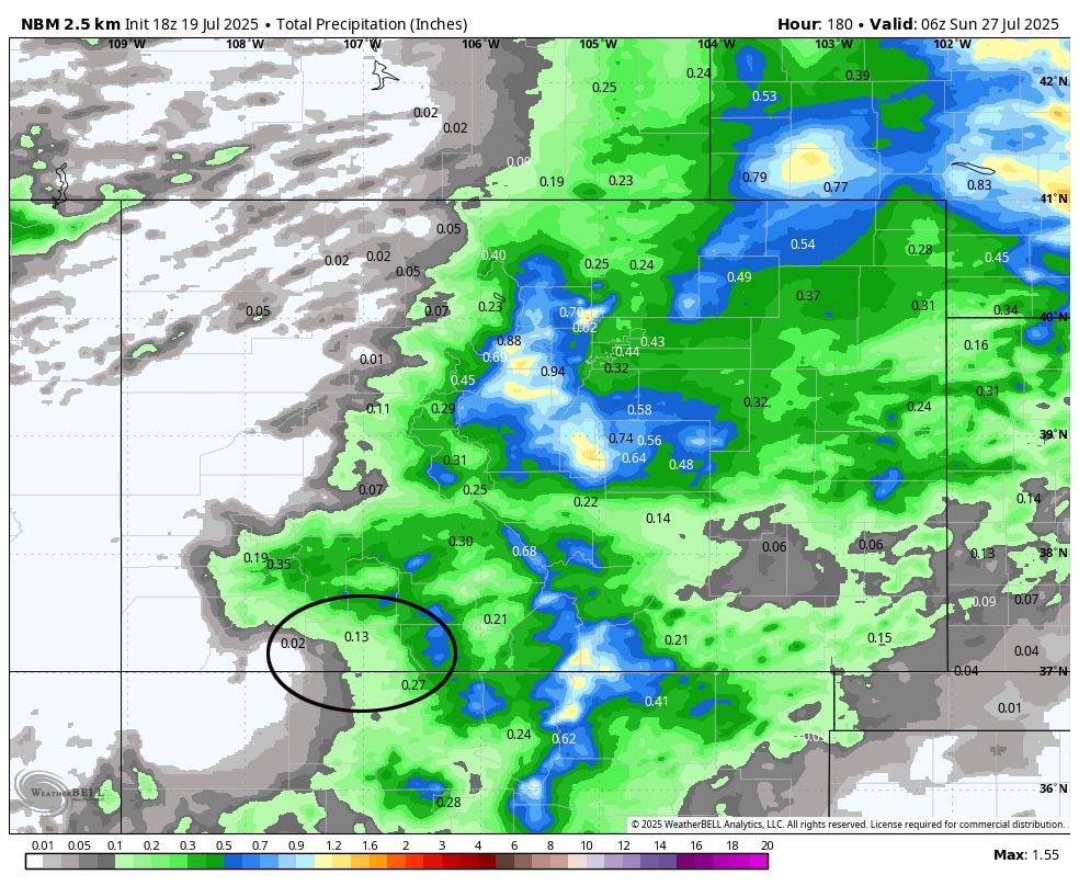
NBM precip to next Saturday evening shows 0.13” in the Pagosa area and up to 0.70” in our mountains. Precip amounts will vary considerably.

The 8-14 day period… I see potential for an increase in monsoon activity starting around the 30th but it isn’t the big soaking that we need. We’ll continue to see hit and miss showers and thunderstorms most afternoons. Precip amounts will vary considerably.
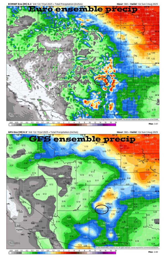
On the top, Euro ensemble precip to 3 Aug at 6am shows 0.73” in the Pagosa area. On the bottom, GFS ensemble precip shows 1.02”.
The CPC 8-14 day precip outlook shows “near normal” precip for us.

The next post will be on Monday.

– Shawn

Pagosa Weather Blizzard Level Sponsor

Pagosa Weather Storm Sponsor

Picture of Shawn Pro

Shawn Pro

I’ve been a “weather geek” since I was young child. I joined the military out of high school and was lucky to get my dream job in weather. I have 20 years of military weather experience which includes forecasting the weather all over the world. Highlights were six years in Alaska and making life and death weather decisions during deployments. I love mountains, I love snow, and I love summertime thunderstorms. I spend a bunch of time playing outdoors and found my paradise in Pagosa Springs. I do Pagosa Weather as a community service. Hopefully you find us helpful!

One Response

  1. What is wrong with the weather station @ the airport? It has been out of service for 2 days. How do I get in touch with them?

Leave a Reply

Your email address will not be published. Required fields are marked *

Pagosa Weather Disclaimer and Release of Liability

This website makes no guarantees about nor bears any responsibility or liability concerning the accuracy or timeliness of the weather information published on this website. All weather information published on this website is for educational and weather enthusiast purposes only. We do not issue Storm Watches, Warnings or Advisories as that ability falls with the National Weather Service, who is the only institution allowed to issue such warnings by law. We are not in any way linked nor affiliated with the National Weather Service, although we do share information and relay weather watches/ warnings, etc. Use of the information on page is at your own risk/discretion, and we are not responsible for any personal/property damages, injury or death associated with weather forecasts, reports or other information as well as communication exchanged in private messages and/or person.

Terms of Use                  Privacy Policy

© 2026 Pagosa Weather 

Website Design by : Brandon