

Happy 4th of July! – No fires and no fireworks please!
Friday – 4 Jul 2025 – 9:10am
The past…
At Stevens Field the high temperature on Wednesday was 85, and on Thursday it was 77. The low this morning was 46. The cold spots were near 40.
The minimum relative humidity Wednesday afternoon was 11% and Thursday afternoon it was 31%.
The peak wind at Stevens Field on Wednesday was 20mph and on Thursday it was 28mph.
| Average High | Record High / Year | Average Low | Record Low / Year |
| 83 | 93 / 1989 | 42 | 28 / 1956 |
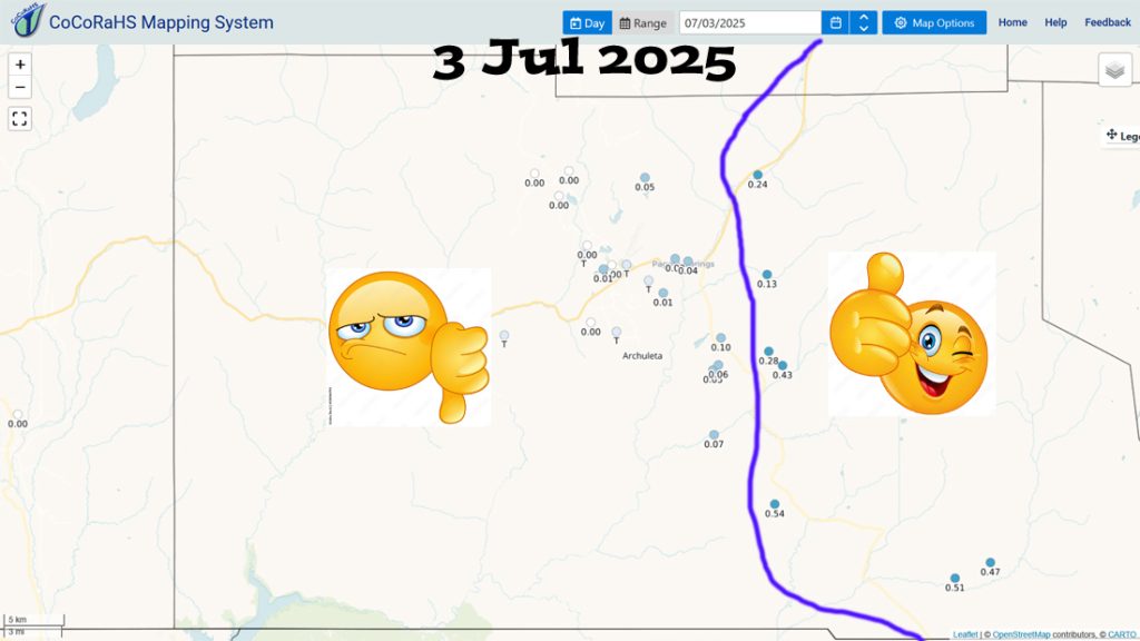
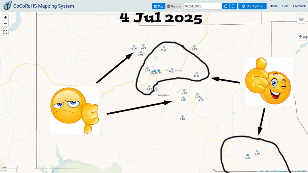
Precipitation summary… A few areas got decent rain while other areas hardly got anything – pretty typical for this time of year.
Forecast discussion…
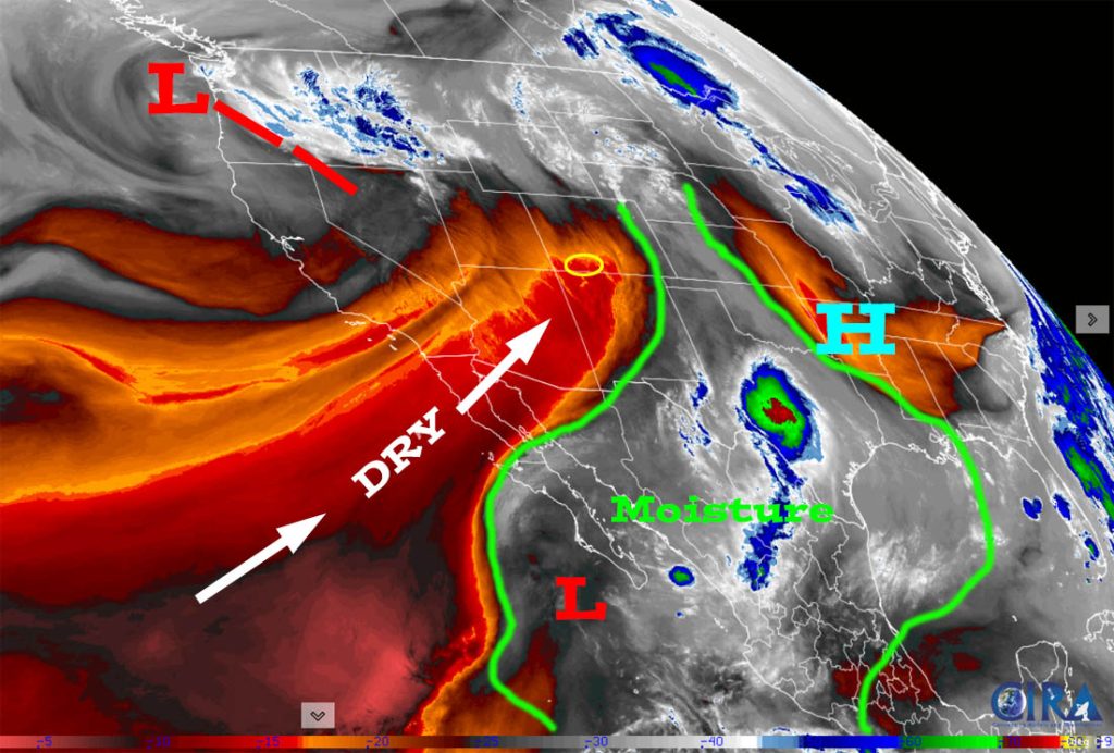
There is nothing on radar in our area Friday morning.
Forecast highlights…
*** Stage 1 Fire Restrictions are in effect for the lower elevations of the San Juan National Forest. ***
*** Lots of sun and mostly dry through next week. ***
*** Weak monsoon activity will start again next weekend. ***
*** FIRE DANGER WILL REMAIN HIGH. ***
Friday through next Friday… Drier, more stable air will stick with us. There’s a slight chance for an isolated afternoon shower or thunderstorm, mostly over the mountains. Monday and Thursday are the best chance to see a spotty afternoon shower or thunderstorm, but most of the Pagosa area will stay dry.
Temps… Friday highs will be in the high 70s to high 80s and lows will be near 40 to near 50. For the rest of this period highs will be in the low 80s to low 90s and lows will be in the low 40s to low 50s.
Winds… Friday afternoon gusts will be 20-25mph. For the rest of this period, afternoon gusts will be 15-20mph.
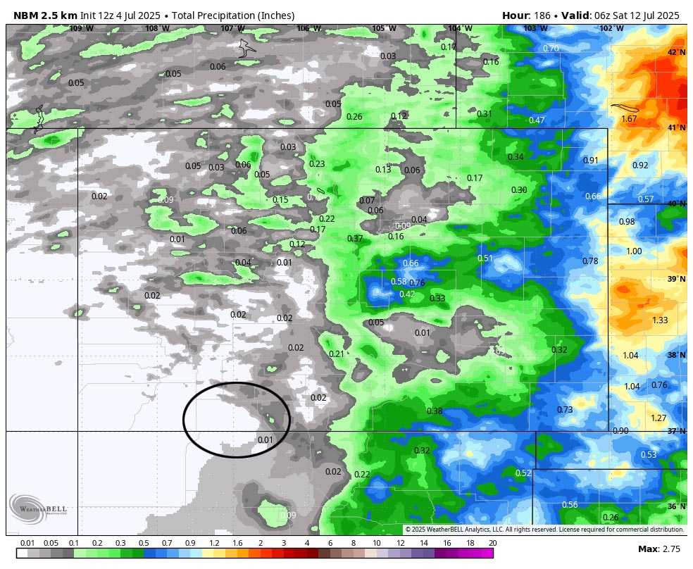
The 8-14 day period… Weak monsoon activity will start back up, so we’ll see isolated showers and thunderstorms most afternoons. I don’t see any big soakings on the horizon.


The next post will be on Sunday.
– Shawn


