

Tommy enjoyed a great view of Wolf Creek! – Pic taken 3/12/2024
If images fail to load in the email, please click the title of the post. Thanks!
Tuesday – 12 Mar 2024 – 4:30pm
The past…
At Stevens Field the high temperature this afternoon was 52 and the low this morning was 27.
The peak wind at the airfield was 23mph.
| Average High | Record High / Year | Average Low | Record Low / Year |
| 47 | 68 / 1989 | 14 | -13 / 1962 |
Precipitation summary… There has been no recent measurable precip.
Forecast discussion…

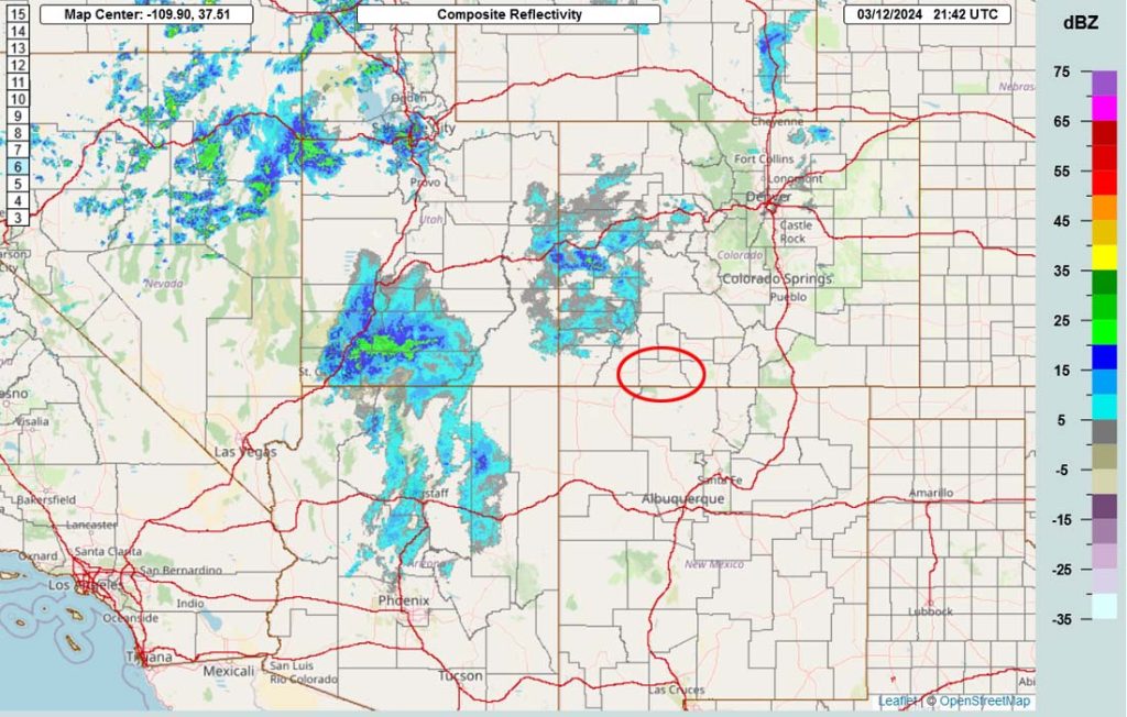
Forecast highlights…
*** A slow-moving cut-off low will keep things unsettled Tuesday night into Saturday. ***
*** Travel into the mountains or to the Front Range will be treacherous Wednesday night through Friday. ***
*** WINTER WEATHER ADVISORY is out for the eastern San Juan Mountains above 10,000ft for up to 10” of snow 6pm Tuesday to 6am Thursday. ***
*** WINTER STORM WARNING is out for the eastern San Juan Mountains above 10,000ft for up to 20” of snow 6am Thursday to 6pm Friday. ***
Tuesday night into Saturday… The next system will move through. It will come in waves with the first trough moving through Wednesday morning and then a cut-off low spinning over AZ Thursday into Saturday.
Forecast concerns… 1. Transition season (spring) is beginning. Forecast models struggle with transition seasons. 2. Forecast models also struggle with cut-off lows. They are cut-off from upper-level steering flow and wobble around, similar to hurricanes. A hundred-mile “wobble” in any direction significantly impacts the forecast. 3. Daytime temps will be in the high 30s to mid-40s so snow will be slow to accumulate.
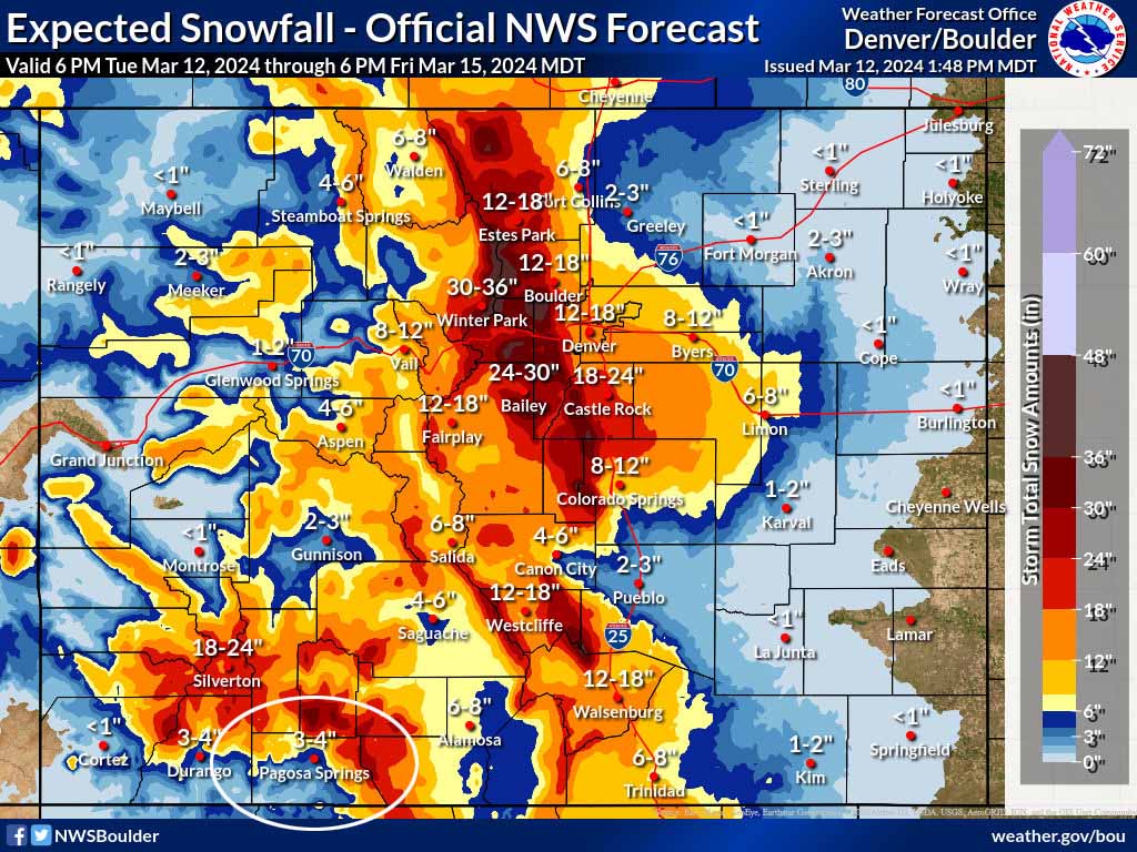
Snow amounts…
Valley below 7,500ft: 2-4”
Valley above 7,500ft: 4-8”
Mountains: 18-24”
Most of this snow will fall Thursday night and Friday. An isolated thunderstorm is also possible Wednesday and Thursday afternoons.
*** There is still uncertainty with this system. I will adjust timing & snow amounts as the data gets better. ***
Winds… Wednesday and Thursday afternoons, Thursday night, and Friday afternoon: 15-20mph. Saturday afternoon: 10-15mph.
Temps… Lows Tuesday night will be in the mid-20s to low 30s. Highs will be near 40 to the mid-40s and lows will be in the low to high 20s.
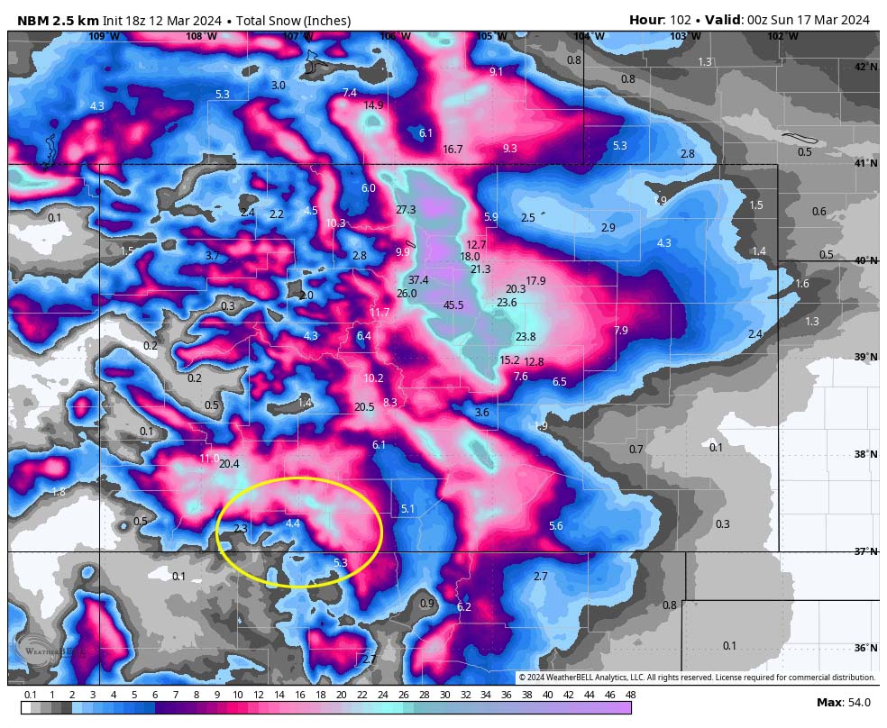

Temps will be above freezing each afternoon making it difficult for snow to accumulate.
My next forecast will be Wednesday morning.
– Shawn


One Response
Shawn, I like your Forecast Snow Levels Elevation chart at the end of the article. This is very useful !