

Tommy checking things out this morning – Pic taken 22 Feb 2024
If images fail to load in the email, please click the title of the post. Thanks!
Thursday – 22 Feb 2024 – 11:00am
The past…
At Stevens Field the high temperature yesterday afternoon was 47 and the low this morning was 18.
The peak wind at Stevens Field yesterday afternoon was 37mph.
| Average High | Record High / Year | Average Low | Record Low / Year |
| 43 | 61 / 1995 | 9 | -20 / 1955 |
Precipitation summary… Yesterday’s system brought clouds and gusty winds but no measurable precip.
Forecast discussion…
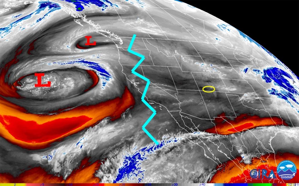
There is nothing on radar in our area this morning.
Forecast highlights…
*** Things are lining up for a potentially strong storm Monday and Tuesday. ***
*** Concerns: 1. Strong winds and heavy wet snow could lead to spotty power outages Tuesday. 2. In the valley, warm temps and rain could lead to isolated flooding and rising streams. 3. Occasional blizzard-like conditions are possible Tuesday morning through Tuesday afternoon, especially above 7,400ft. ***

Rest of Thursday through Sunday evening… Ridging will be in control and give us mostly sunny skies and near average temps. Sunday clouds and winds will increase as the ridge pushes to our east.
Winds… Peaks Thursday, Friday, and Saturday afternoons will be 10-15mph. Peaks Sunday afternoon will be 15-20mph.
Temps… Highs Thursday afternoon will be in the low 40s to near 50 and lows Thursday night will be in the low teens to low 20s. Highs Friday, Saturday, and Sunday will be in the mid-40s to mid-50s. Lows Friday night will be in the low teens to low 20s. Lows Saturday night will be in the high teens to high 20s. Lows Sunday night will be in the high 20s to mid-30s.
Sunday night through Tuesday… Things are lining up for an interesting storm. A strong jet stream will set up Monday pushing warm air and lots of moisture into the region. Tuesday a strong system with colder air will move through the region from the northwest.
Timing… The first scattered showers will start over the mountains late Sunday evening and over the valley early Monday morning. The best chance for precip is Monday morning to Tuesday evening. Scattered showers will linger Tuesday night into Wednesday morning, mostly over the mountains.
Snow levels… This is the trickiest part of the forecast. Sunday night through Monday evening there will be rain below 8,000ft and a rain/snow mix 8,000ft to 8,400ft. Monday night snow levels will gradually lower to around 7,200ft. Tuesday snow levels will bounce around between 6,500ft and 7,000ft.
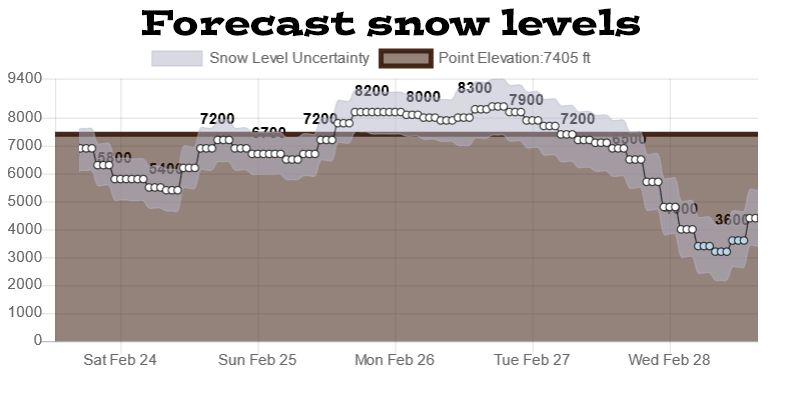
Snow amounts…
Valley below 7,900ft: 2-4”
Valley above 7,900ft: 4-8”
Mountains above 9,000ft: 18-24”
Winds… *** Gusts Monday afternoon and Monday night will be 25-35mph. Tuesday afternoon gusts will be 30-40mph. Winds will gust to around 50mph in the mountains. ***
Temps… Highs Monday will be in the low to high 40s and lows Monday night will be in the high 20s to mid-30s. Highs Tuesday will be in the mid to high 30s and lows Tuesday night will be in the mid-single digits to mid-teens.
*** Timing, snow levels, and snow amounts could change as the data gets better. ***

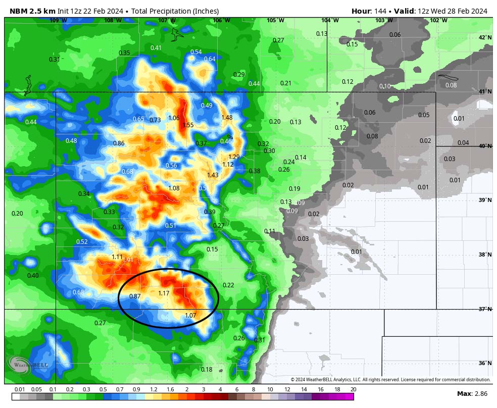
Compare these maps. The first part of this system on Monday will be warm. More than half of that 1.17” of precip near Pagosa will be rain below 8,000ft.
Unless something pops up, my next post will be on Saturday and then I’ll do posts each day to Wednesday. – Shawn


