

Hot air balloons over the San Juan River – Colorfest in Pagosa Springs CO – pics taken 9/19/2026
Sunday – 20 Sep 2026 – 2:30pm
The past…
Stevens Field Observations
Friday: High: 71, Low: 51, Peak wind: 14mph, Afternoon humidity: 40-45%
Saturday: High: 71, Low: 45, Peak wind: 24mph, Afternoon humidity: 26-31%
| Average High | Record High / Year | Average Low | Record Low / Year |
| 72 | 83 / 1984 | 35 | 18 / 1971 |
Precipitation summary… Precip amounts were mostly under 0.05” each of the last two days but a few lucky folks got a bit more.
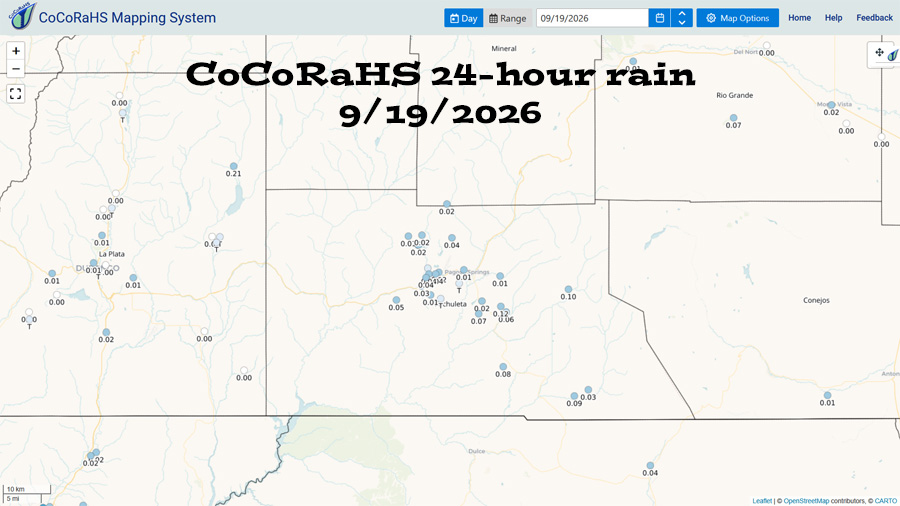
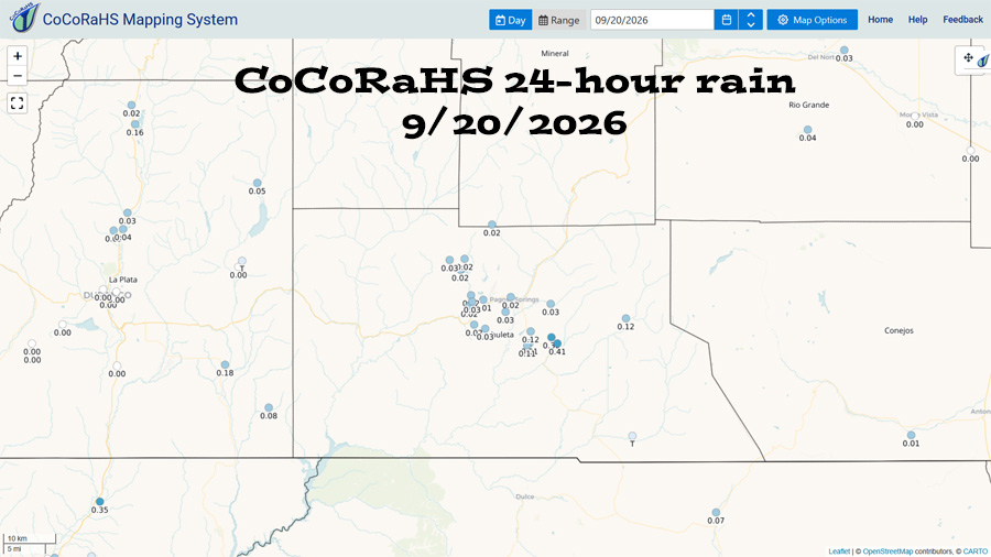
Current satellite and radar…
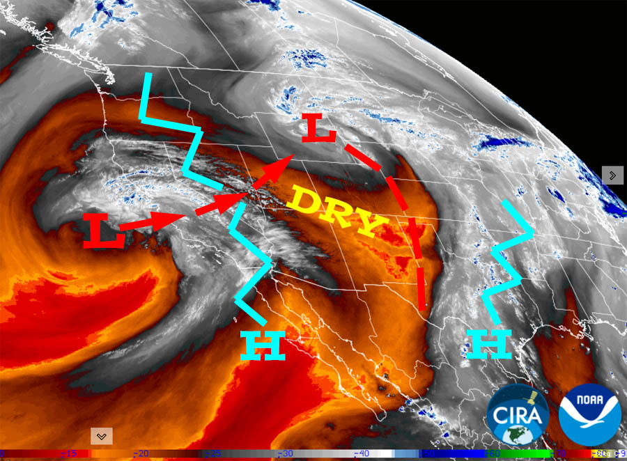
There is nothing on radar in our area Sunday afternoon.
Forecast highlights…
*** The Swiss Roll Fire, burning about 14 miles northwest of Pagosa Springs, is 777 acres and 36% contained. The fire has received quite a bit of rain recently. ***
*** Rest of Sunday through Tuesday morning will be mostly sunny with temps near average. ***
*** Tuesday afternoon into Friday evening will be wet with off and on showers and thunderstorms. ***
Rest of Sunday and Monday… Upper-level flow is more westerly and has pushed the moisture to our east. We will see a few clouds build over the mountains each afternoon, but I expect us to be dry.
Tuesday through Friday… The high is expected to wobble around the TX region while a weak low moves over the Vegas area and then over the Salt Lake area Tuesday and Wednesday. Southerly flow between these two features will funnel subtropical moisture into our area while instability is marginal.
I feel more confident about rain Tuesday afternoon and Wednesday than I do about Thursday and Friday.
The forecast models are lining up better, but there is still a variance in outcomes. *** At this point, I expect us to get 0.75” to 1.25” between Tuesday afternoon and Friday evening. ***
Temps…
Sunday night lows will be in the mid 30s to the mid 40s.
Monday highs will be in the high 60s to the mid 70s and lows will be in the mid 30s to the mid 40s.
Tuesday highs will be in the mid 60s to the low 70s and lows will be in the low to high 40s.
Wednesday highs will be in the low to high 60s and lows will be in the low to high 40s.
Thursday and Friday, each day highs will be in the mid 60s to the low 70s and lows will be in the low to high 40s.
Saturday and next Sunday, highs will be in the high 60s to the mid 70s and lows will be in the high 30s to the mid 40s.
Winds…
Sunday afternoon gusts will be around 25mph.
Monday through next weekend, each afternoon gusts will be 15-20mph.
*** As always, isolated stronger gusts are likely near showers and thunderstorms. ***

24 Sep to 5 Oct… It’s transition season. We are gradually switching from a summer monsoon to a fall pattern. Forecast models always struggle during transitions seasons. They are widely fluctuating and unreliable.
Right now, I’m sticking with the typical seasonal shift of the summer high weakening and the jet stream slowly dipping farther south. I don’t expect much precip during this period.
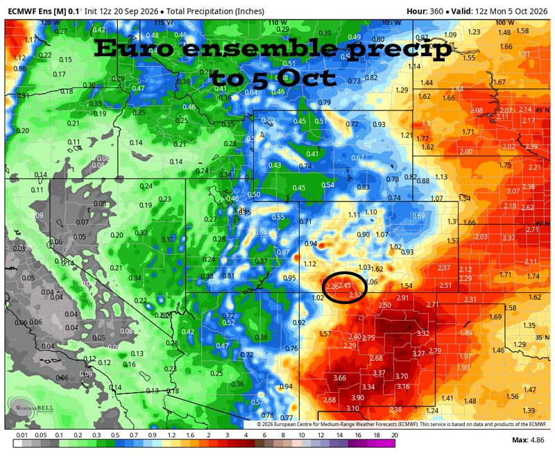
I think this is on the high end. I’d be surprised if we get this much.


On and off showers are likely Tuesday afternoon into Friday evening. There’s a lull next weekend. Another round of hit and miss showers is possible next Monday and Tuesday, and then it’s less active and drying out for the rest of the period.
The next post will be on Tuesday.
– Shawn


