

The current drought map shows a little improvement for some of Archuleta County.
Sunday – 2 Aug 2026 – 2pm
July summary…
The average high for July is 83 and the average low is 44. The record high of 99 occurred on 7 July 1989. The record low of 24 occurred on 5 July 1912. Precip in July averages 2.01″ and the average snowfall is zero. Wolf Creek Pass averages 3.61″ of precip and zero snow.
At Stevens Field the highest temp was 94 on 20 Jul and the lowest temp was 37 on 2 Jul. There was one new record high set on 26 Jul.
There were 8 days with winds at or over 30mph. The highest wind was 45mph on 23 Jul.
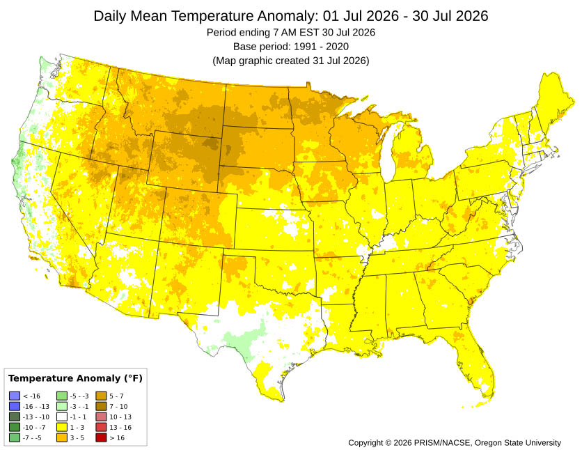
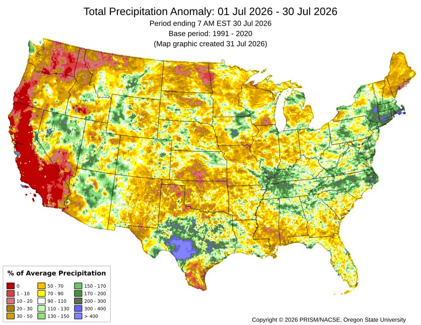
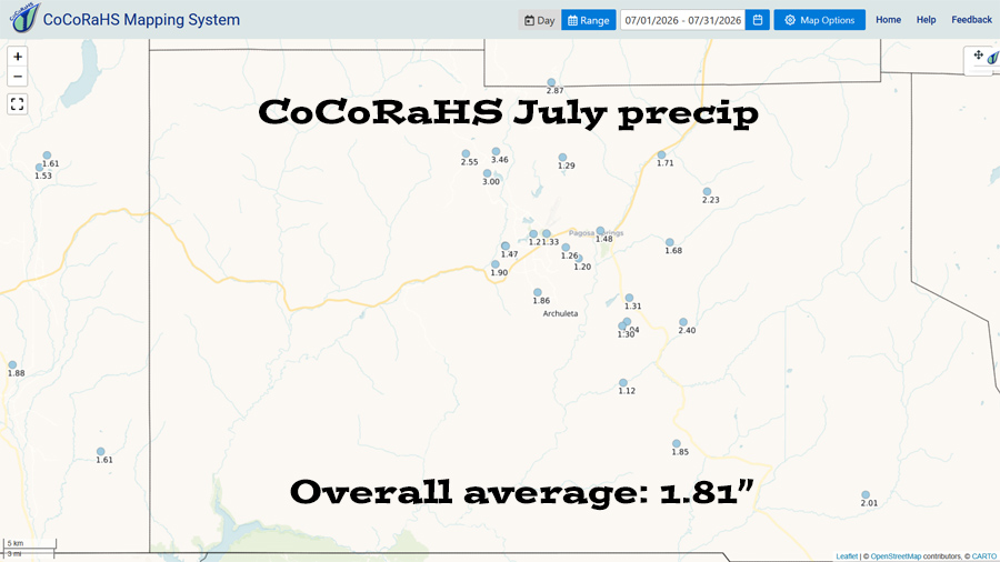
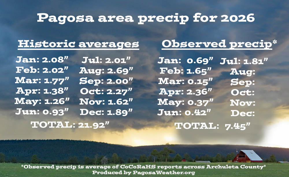
How did we do?
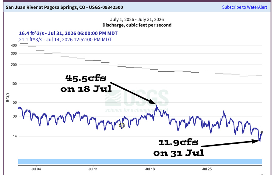
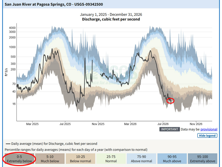
Drought and river levels…
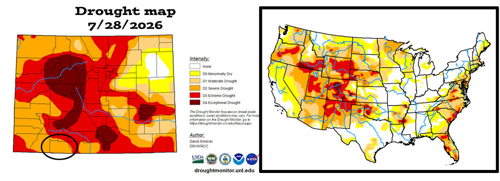
The US drought map on the right shows that much of the US is experiencing drought conditions.
August outlook…
The average high for August is 80 and the average low is 45. The record high of 97 occurred on 5 August 1940. The record low of 28 occurred on 30 August 1978. Precip in August averages 2.69″ and the average snowfall is zero. Wolf Creek Pass averages 4.32″ of precip and zero snow.
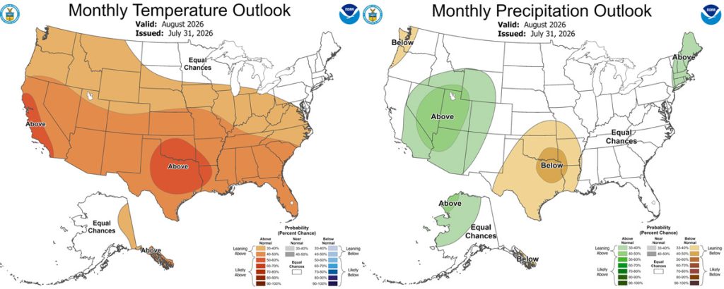
The precip outlook on the right shows a 33-40% chance for above average precip.
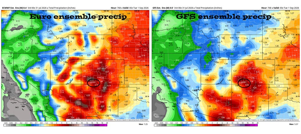
July verification: The Euro expected 2.99″ and the GFS expected 3.26″. We got 1.81″ so both models over-forecast precip.
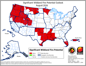
Arleen’s August outlook…
August is our wettest month of the year. Monsoon flow and afternoon thunderstorms are responsible for that.
CPC and model forecasts are looking for above average precipitation. But they have been saying that all summer long. When our average precipitation is 2.7” for the month, we need to see consistent daily precipitation. That is not going to happen this month.
The first few days of the month will be dry. Then we’ll have a week of hit and miss showers under a wobbly subtropical ridge. Finally, as we enter the second week of August, we should have good monsoon flow and widespread thunderstorm activity with a strong subtropical area of high pressure set up over the southern plains. But during the last week of August the ridge will weaken, and the monsoon moisture will start to dissipate.
We should see close to average precipitation for the month with above average temperatures. If the high does not move to the east, we will have less than average precipitation. On the flip side, the Eastern Pacific is really warming up. We could see remnants from tropical storms. If we do, there is the potential to see above average precipitation.
A HUGE thanks for your precip reports and pictures! Reports help verify our forecasts and make us better forecasters.
Another HUGE thanks to our donors and sponsors! You help cover the cost of this web page and our weather subscriptions, necessary to provide you accurate weather reports!
- Shawn


