
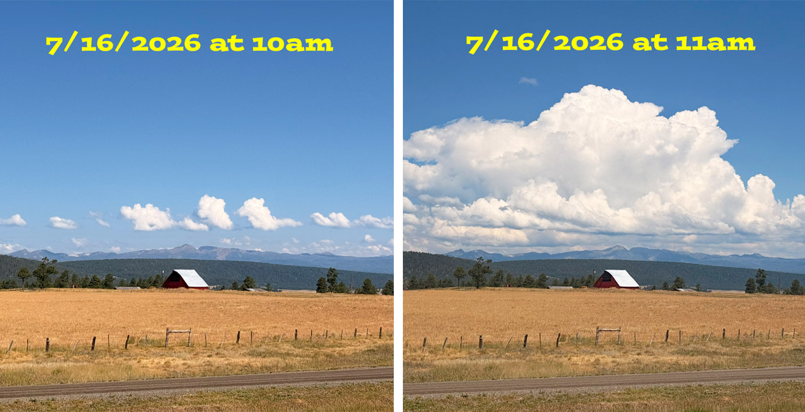
We wake up to clear skies. Around 10am little cumulus clouds develop over the mountains and then just an hour later they are big cumulus clouds! – pics taken 7/16/2026 one hour apart
Thursday – 16 Jul 2026 – 1:50pm
The past…
Stevens Field Observations
Tuesday: High: 86, Low: 55, Peak wind: 28mph, Afternoon humidity: 25-28%
Wednesday: High: 81, Low: 50, Peak wind: 32mph, Afternoon humidity: 28-32%
| Average High | Record High / Year | Average Low | Record Low / Year |
| 83 | 92 / 1956* | 46 | 36 / 1956* |
* It’s very unusual to have a record high and record low on the same day. A 56 degree temperature swing tells me that is was very dry on this day in 1956! *
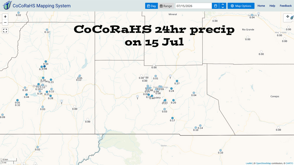
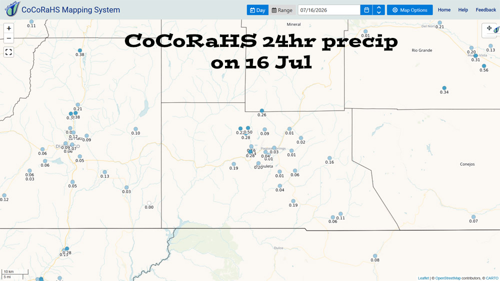
Precipitation summary… Scattered afternoon storms are soaking some spots while missing others. This is typical for our monsoon season.
Current satellite and radar…

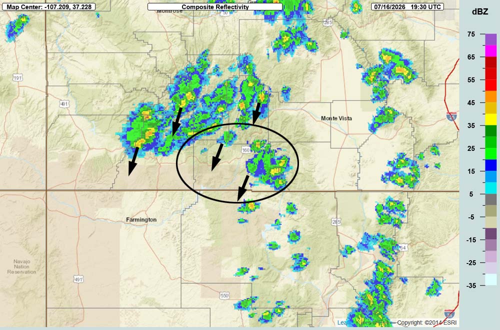
The best moisture is to our west and flow is out of the north over us. Neither is ideal for us, but it’s still active.
Forecast highlights…
*** Fire danger remains very high. The entire San Juan National Forest and Archuleta County are under stage 2 fire restrictions. ***
*** MONSOON action is here for a while – yay! Thursday and Friday will be active. There will be a lull this weekend with fewer storms and then next week will be more active. ***
Rest of Thursday through next week… Today through Sunday we are on the eastern edge of the monsoon moisture plume. Upper-level flow is out of the north-northeast. This isn’t ideal for us but it’s working!
Thursday and Friday will be active with good moisture and instability.
Saturday and Sunday afternoon and evening storms will be more hit and miss with less moisture and instability.
By the middle of next week the high will be near the Texas panhandle. This is more favorable for us.
Monday and through the rest of next week looks active with more moisture and instability.
Storms will be capable of producing short periods of heavy rain over small areas.
There will be rain lottery winners and losers. Do your rain dances!
Temps…
Thursday night lows will be in the high 40s to mid 50s.
Friday through next week highs will be in the high 70s to high 80s and lows will be near 50 to the mid 50s.
Winds…
Each afternoon gusts will be 15-20mph though isolated stronger gusts are likely near showers and thunderstorms.
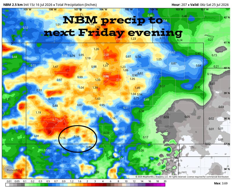
16 Jul to 31 Jul… The subtropical high pressure will wobble around between the Texas panhandle and the Four Corners. Monsoon moisture and instability will remain in place to produce scattered storms each afternoon and evening.
Precipitable water is pretty high for much of this period, so showers will be capable of producing brief periods of heavy rain over small areas.
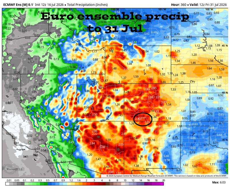
Forecast precip amounts have been fairly consistent over the last two days.
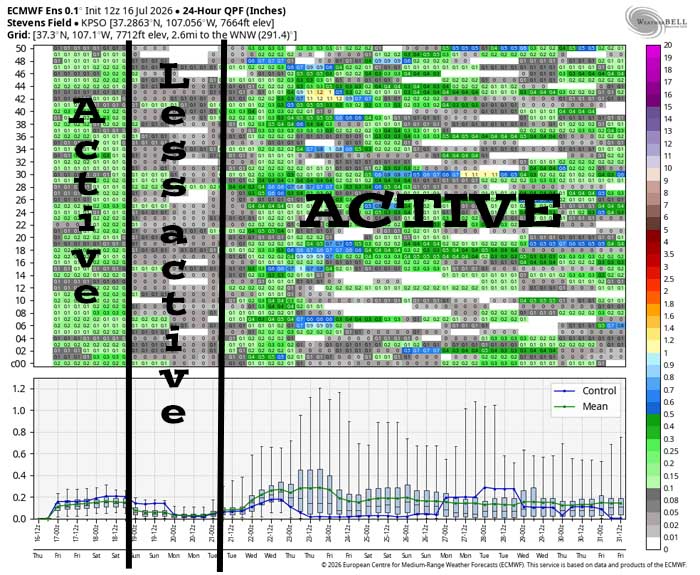
It’s active today and tomorrow and then less active over the weekend. There rest of the period looks active.
The next post will be Saturday afternoon.
– Shawn


