

It looks like winter again up Wolf Creek Ski Area! – web cam capture 4/1/2026 around noon
Wednesday – 1 Apr 2026 – 3:30pm
The past…
Stevens Field Observations
Monday: High: 68, Low: 32, Peak wind: 39mph
Tuesday: High: 59, Low: 34, Peak wind: 39mph
| Average High | Record High / Year | Average Low | Record Low / Year |
| 54 | 72 / 1966 | 20 | -4 / 1980 |
Precipitation summary… Wolf Creek Ski Area reported 5” of new snow this morning and an additional 12” by 2pm for a storm total of 17”.
Much of southwest CO and northwest NM got a decent soaking!
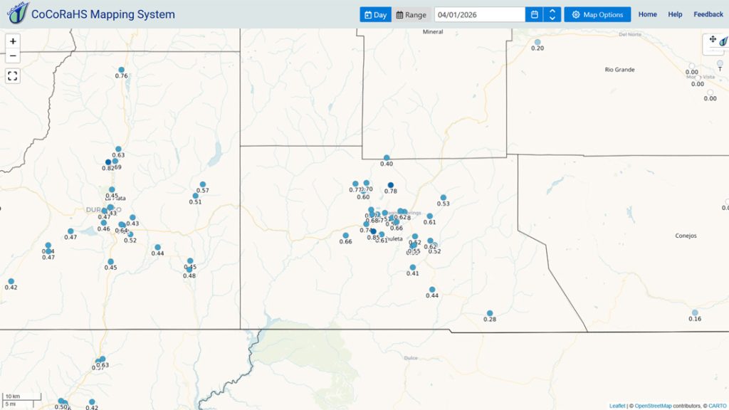
Note that La Plata County and down towards Aztec and Farmington also got a decent soaking.
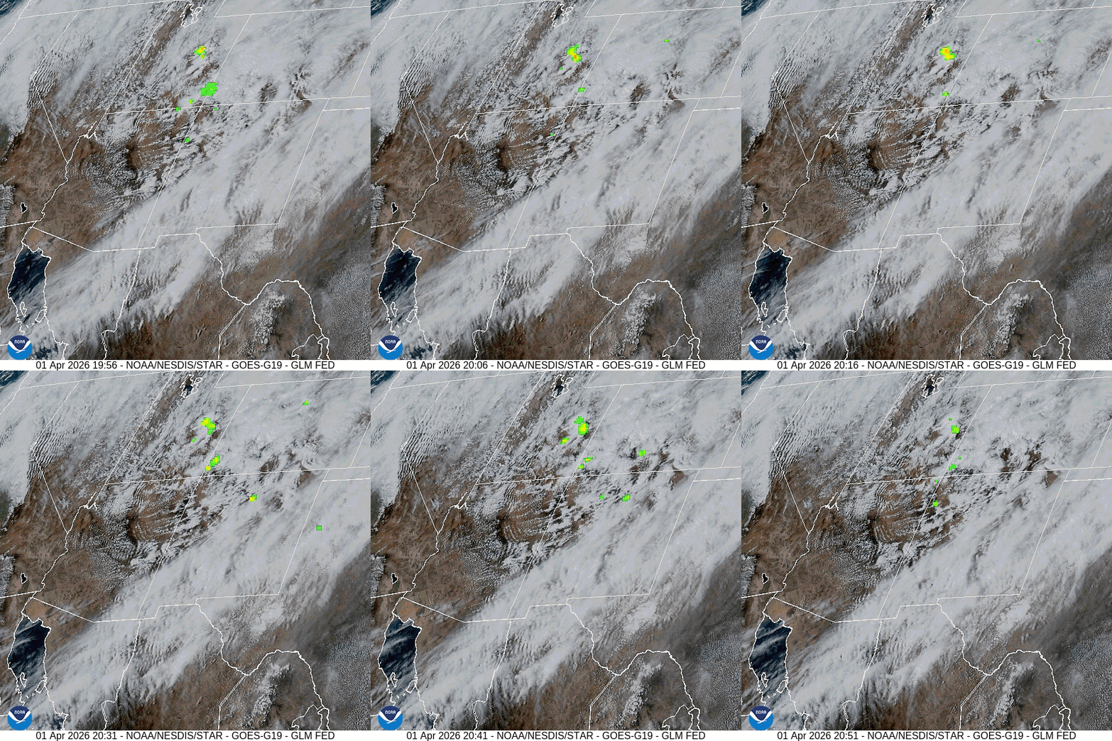
Current satellite and radar…

Forecast highlights…
*** Hit and miss showers and a spotty thunderstorm or two will persist into early Wednesday evening. ***
*** Low temps below FREEZING each morning through Saturday. NOTE: The average last freeze is 31 May. Don’t be fooled by the recent heat wave! ***
*** Mostly sunny and mostly dry through the weekend. ***
*** A few more clouds and a few more scattered showers Monday and Tuesday. ***
Forecast details…
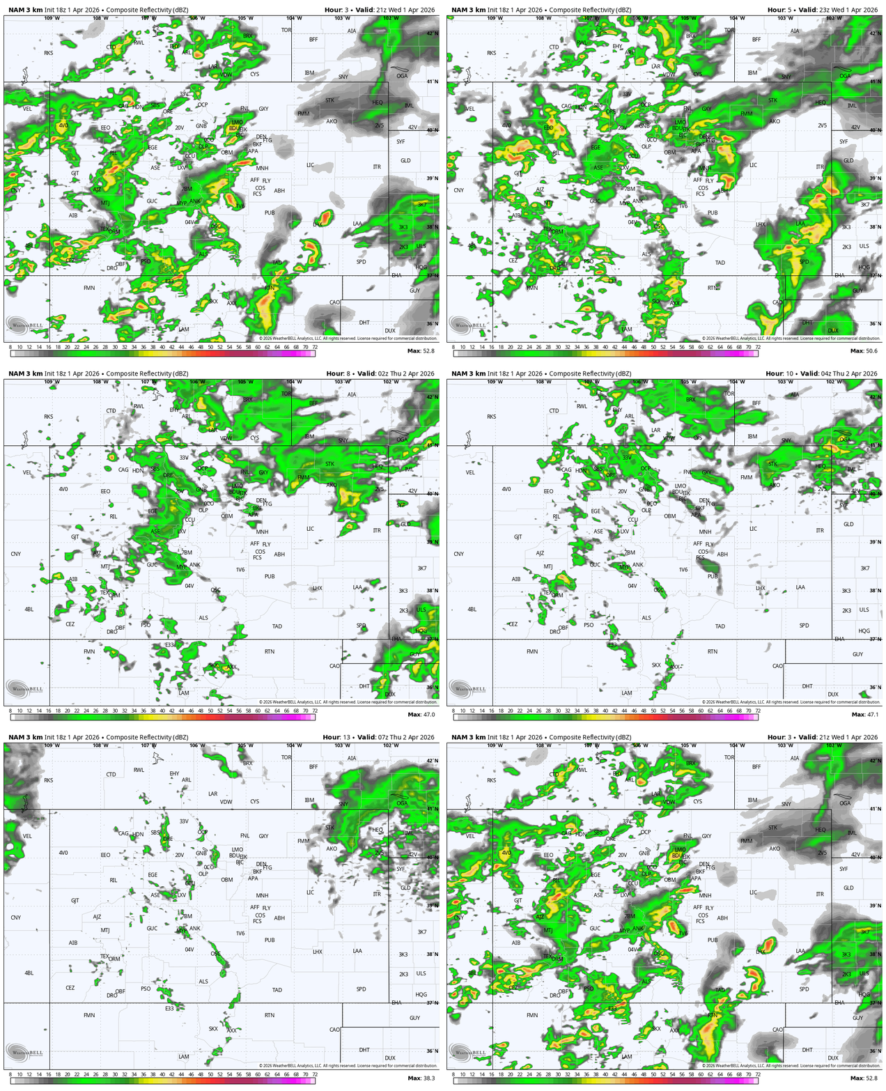
Late Wednesday afternoon into Thursday morning… Precip will be more hit and miss through the afternoon and there could be a thunderstorm or two. The trough will move through around 6-7pm ending precip in the Pagosa area while scattered showers will persist over the mountains a few extra hours.
*** Patchy low clouds and fog are possible Thursday morning. ***
Snow levels…
Wednesday evening around 8,600ft
Additional Precip 3pm to midnight Wednesday…
Mountains above 9,000ft: 2-4” of snow
Pagosa Springs area: up to 0.20” rain – it will be spotty
Thursday through Sunday… Thursday there could be a few residual spotty showers over the mountains as the system clears out. Precip amounts will be low.
Friday a trough will move through northern Colorado and kick up our winds, and maybe a few showers over the mountains along The Divide.
A weak ridge will build over the region during the weekend and keep us dry.
Monday and Tuesday… A little surge of moisture and instability could kick up a few scattered showers and thunderstorms each afternoon, especially over the mountains. Precip amounts will be light and spotty.
Snow levels will be above 9,500ft.
Temps…
Wednesday night lows will be in the mid 20s to the low 30s.
Thursday, Friday, and Saturday highs will be in the low 50s to near 60. Thursday night lows will be in the mid 20s to the low 30s. Friday night lows will be in the mid-teens to the mid 20s. Saturday night lows will be near 20 to the high 20s.
Sunday highs will be in the high 50s to the mid 60s and lows will be in the mid 20s to the low 30s.
Monday and Tuesday highs will be near 60 to the high 60s and lows will be in the mid 20s to the mid 30s.
Winds…
Wednesday and Thursday, each afternoon gusts will be around 30mph in the Pagosa Springs area and 40-45mph in the high country.
Friday afternoon gusts will be 20-25mph in the Pagosa Springs area and 30-35mph in the high country.
Saturday, Sunday, Monday, and Tuesday, each afternoon gusts will be 15-20mph in the Pagosa Springs area and 25-30mph in the high country.
8 Apr to 16 Apr… The good news is that the models are getting more consistent about chances for precip, especially around 10 & 11 April.
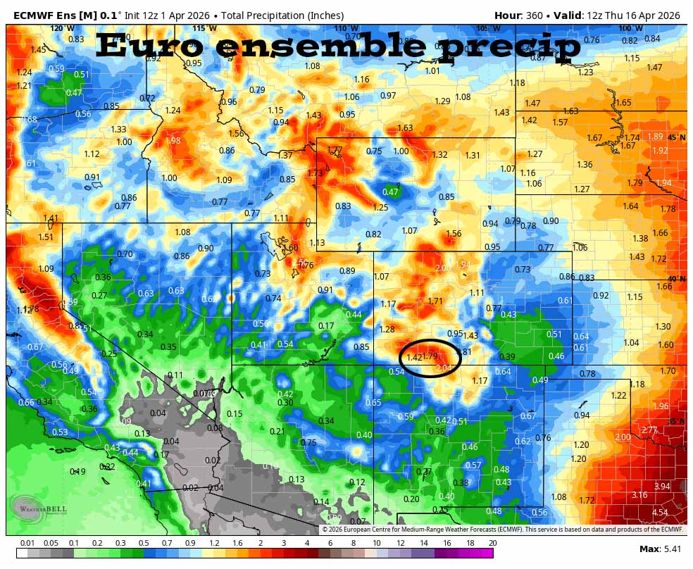
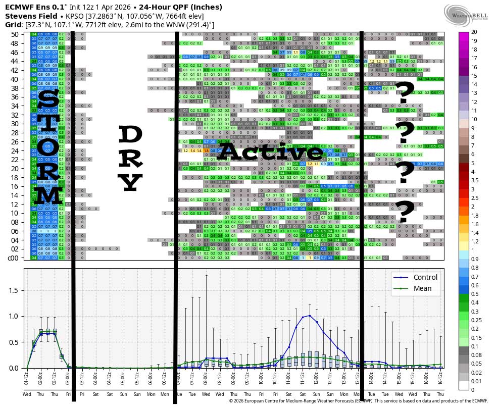
It clearly shows today’s storm. Then it’s dry Thursday through most of Monday. Then it’s active late Monday to around 13 April. After that there’s no consensus either way.
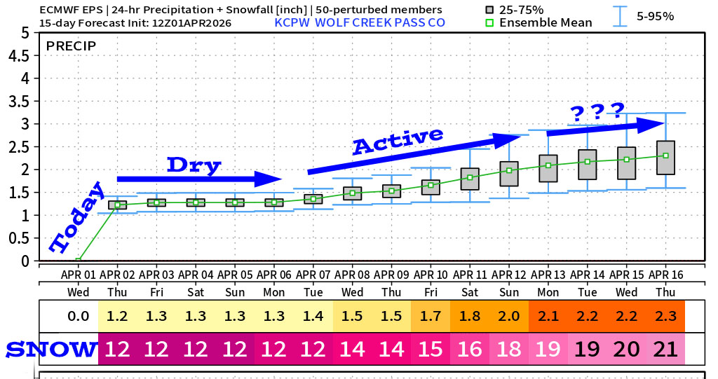
I’ll do a quick Facebook post Thursday morning with precip totals. The next thorough post will be Friday afternoon. Plus we are working on the monthly newsletter and monthly weather summary.
– Shawn


