

Sun setting behind a big ponderosa. See the photo bomber? – Pic taken 8/20/2025
Friday – 22 Aug 2025 – 5:10pm
The past…
Stevens Field Observations
Wednesday: High: 86, Low: 56, Minimum relative humidity: 20%, Peak Wind: 25mph
Thursday: High: *90*, Low: 52, Minimum relative humidity: 16%, Peak Wind: 24mph
*Tied the record high that occurred in 1910*
| Average High | Record High / Year | Average Low | Record Low / Year |
| 80 | 91 / 1910 | 44 | 29 / 1956 |
Precipitation summary…
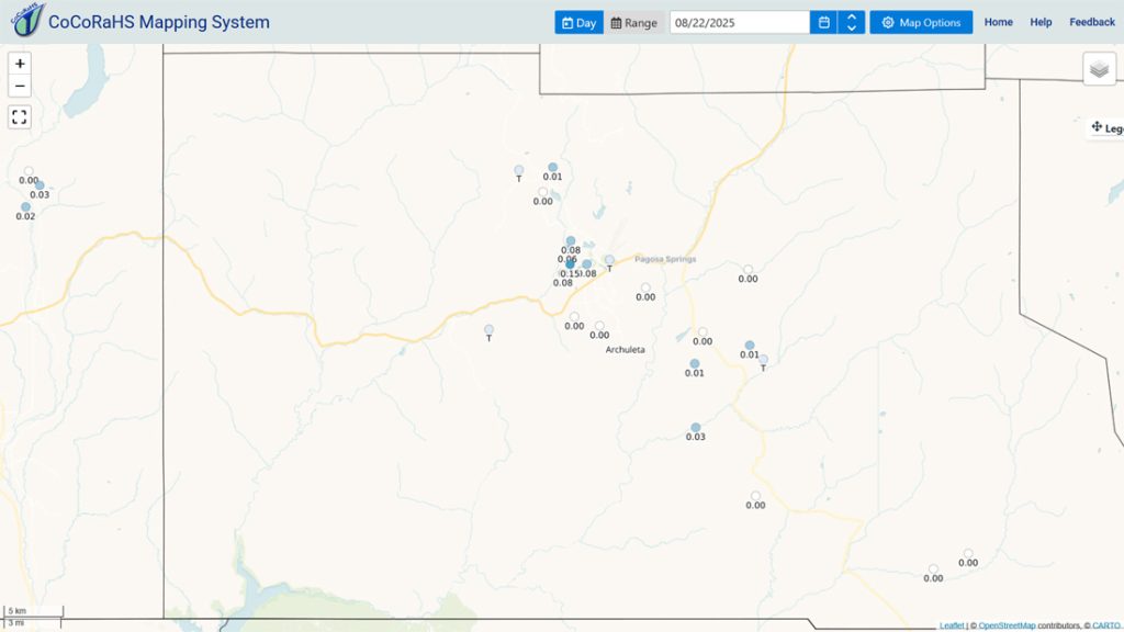
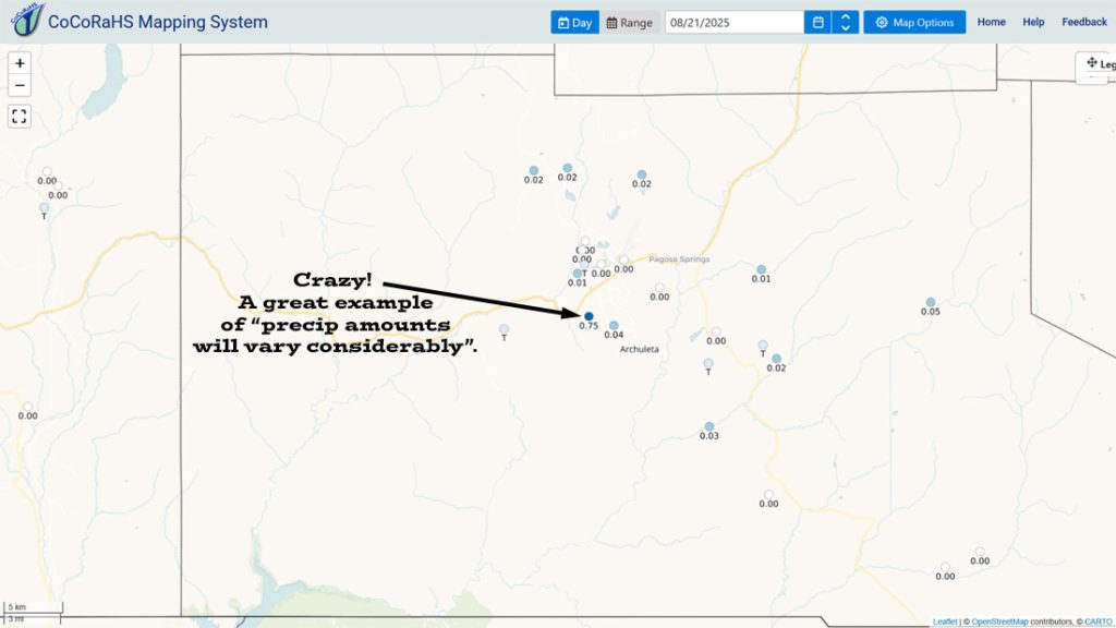
Fire and smoke…
A few small fires popped up in nearby La Plata County and New Mexico’s San Juan County, but they were contained quickly.
Stoner Mesa, just west of Rico, is the most active fire near us. It has burned 9,913 acres and is 27% contained.

Forecast discussion…
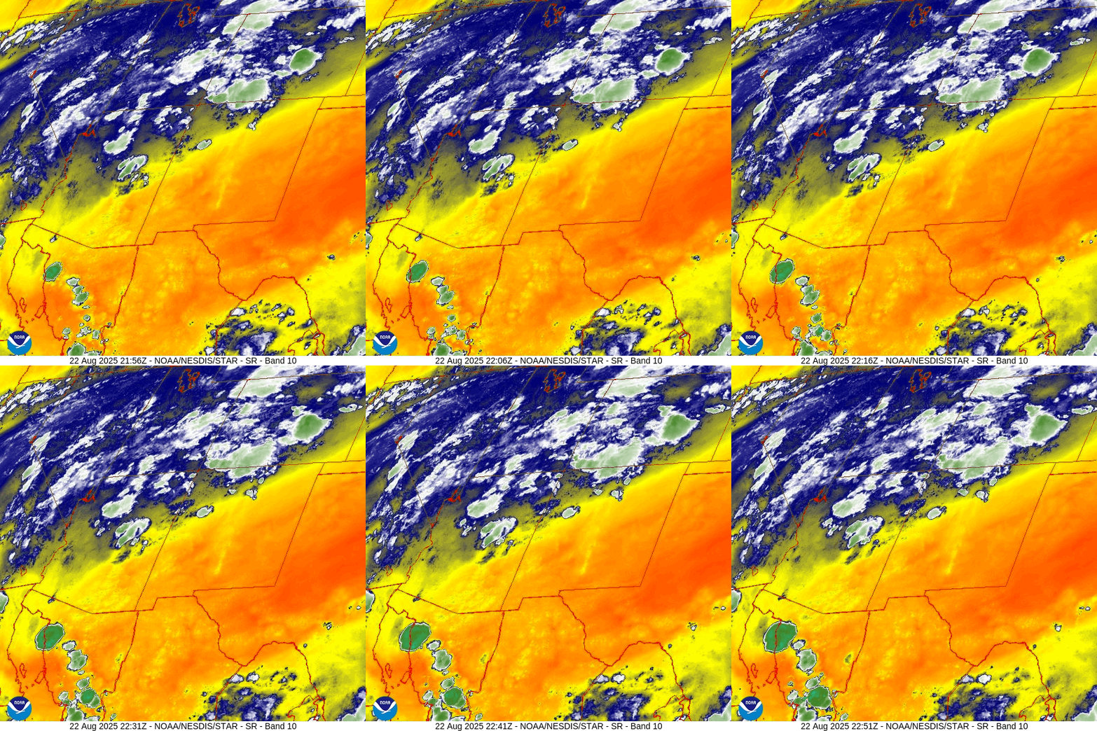

Forecast highlights…
*** Stage 2 Fire Restrictions are in effect for the entire San Juan National Forest. ***
*** Stage 1 Fire Restrictions are in effect for Archuleta County and the Town of Pagosa***
*** Scattered afternoon and evening showers and thunderstorms to next Friday. ***
*** The best chance for a good soaking is Tuesday and Wednesday. ***
*** If you spot smoke, call Archuleta County dispatch at 970-731-2160. ***
Rest of Friday through next Friday… The monsoon is back!
Precipitable water, a measure of the amount of moisture in the atmosphere, and Cape, a measure of instability, will both be high – as they should be this time of year! Expect scattered showers and thunderstorms each afternoon and into each evening.
*** The ingredients come together best on Tuesday and Wednesday. The rain lottery winners will get over an inch of rain! ***
Thursday and Friday will be transition days as monsoon moisture and instability gradually decrease so we’ll see less storm activity.
Monsoon storms can produce brief periods of heavy rain, small hail, gusty winds, and lightning.
Temps…
Friday night lows will be in the high 40s to mid-50s.
Saturday highs will be in the low to high 80s and lows will be in the mid-40s to mid-50s.
Sunday highs will be in the high 70s to mid-80s and lows will be in the mid-40s to mid-50s.
Monday through next Wednesday highs will be in the low to high 70s and lows will be in the mid-40s to low 50s.
Winds… Afternoon gusts will be 15-20mph. As always, stronger isolated gusts are likely near a shower or thunderstorm.

The 8-14 day period… Monsoon activity will taper off during this period. There will still be a few afternoon showers and thunderstorms most days, but we’ll be playing the rain lottery.


I’m more pessimistic about the 8-14 day period. I think we’ll be lucky to get average precip.
Unless something interesting pops up, the next post will be on Sunday.
– Shawn


