

Snow in May! – pic taken 5/5/2025
Monday – 5 May 2025 – 12:30pm
The past…
At Stevens Field the high temperature on Saturday was 66, and on Sunday it was 61. The low this morning was 32.
The peak wind at Stevens Field on Saturday was 33mph and on Sunday it was 41mph – a convective gust associated with a shower.
| Average High | Record High / Year | Average Low | Record Low / Year |
| 65 | 83 / 1947 | 28 | 13 / 1965 |
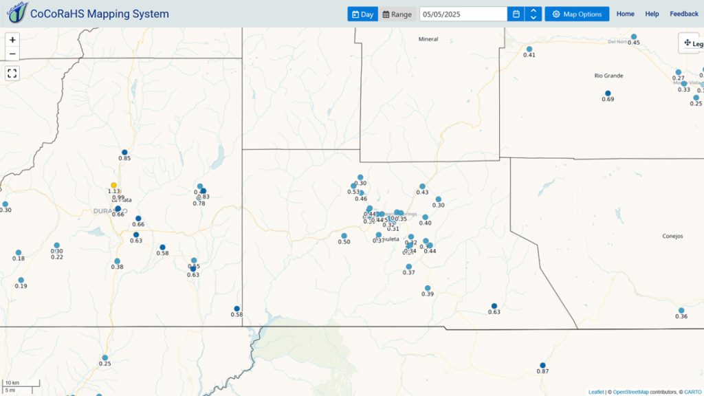
Precipitation summary… Yesterday afternoon precip danced all around the Pagosa area and then finally moved in overnight. Though it came late, precip totals for round 1 were close to what I expected.
Snowflakes in town?! Snow levels were 1,000ft to 1,500ft lower than I expected. Why?
Two reasons…
1. Evaporative cooling. The process of evaporation can cool an entire column of air. Last night, steady light falling rain (liquid) also evaporated (liquid turned to water vapor) as it fell. This process absorbs heat which cools the surrounding air.
2. Instability. Showers and thunderstorms are caused by instability. Mixing, up and down air currents, occur in various stages of the showers and thunderstorms. The mixing can push colder air aloft down towards the surface.
These 2 processes are also the main reasons our summertime showers and thunderstorms often cool us 10-20 degrees!
I estimate that the Wolf Creek Pass area got 4-6” by 8am this morning.
Forecast discussion…


Forecast highlights…
*** Scattered showers and thunderstorms Monday afternoon and then again Tuesday afternoon. ***
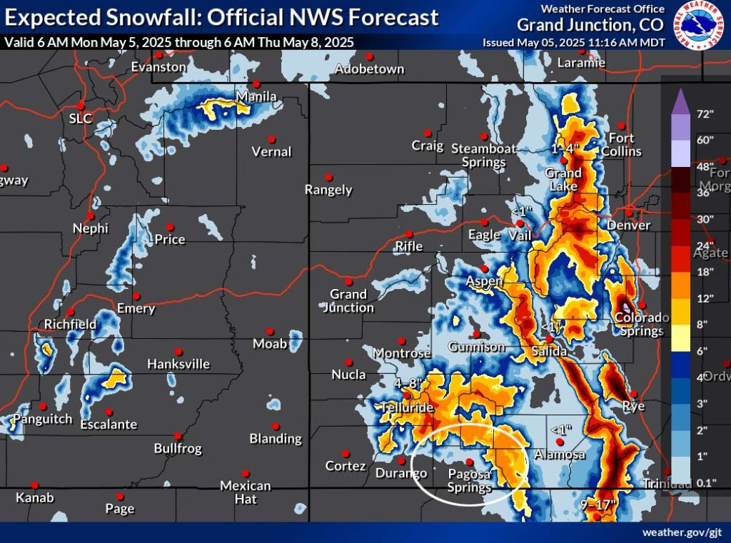
*** There is a Winter Weather Advisory for the eastern San Juan Mountains above 10,000ft – this includes Wolf Creek and Cumbres Passes. Another 3-8” of snow is expected by 6am Tuesday. Expect occasional poor travel conditions in the mountains. ***
*** Heads-up travelers… La Veta Pass could get 20” of snow Monday night through Tuesday evening. ***
*** Hit and miss spotty showers and thunderstorms Wednesday, Thursday, and Friday afternoons. ***
*** Better chance for scattered showers and thunderstorms Saturday and Sunday. ***
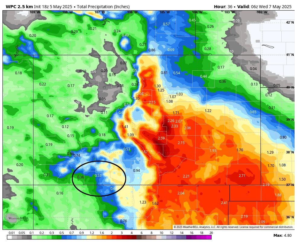
Rest of Monday and Tuesday… A low-pressure system will slowly move through AZ today and then slowly move east through NM on Tuesday. Storm energy and moisture are lining up for a decent soaking.
Timing… Bands of showers and scattered thunderstorms will move through Monday and Tuesday afternoons. A few hit and miss showers are also possible Monday night.
*** Snow levels… hmmm. Monday afternoon the snow level will rise to 9,000ft, but a strong shower or thunderstorm could briefly drop it down to 8,000ft. By sunrise Tuesday snow levels will drop to 7,500ft. Tuesday afternoon the snow level will rise to 9,000ft again. ***
Snow amounts…
Favored peaks above timberline: 12-18”
Mountains above 9,500ft: 6-10”
Pagosa area above 7,500ft: up to a half inch – it will be spotty
Pagosa area below 7,500ft: a few “rainflakes” – no snow accumulation
Temps… Monday highs will be in the mid-40s to low 50s and lows will be in the high 20s to mid-30s. Tuesday highs will be in the high 40s to the high 50s and lows will be in the mid-20s to mid-30s.
Winds… Afternoon gusts will mostly be 15-20mph, but thunderstorms and strong showers will produce stronger gusts for brief periods.
Wednesday through Friday… A weak ridge will slowly move over the region. There will be less moisture, and we’ll remain marginally unstable, so afternoon shower and thunderstorm activity will decrease but will not go away.
Temps… Wednesday highs will be in the mid-50s to mid-60s and lows will be in the mid-20s to mid-30s. Thursday highs be near 60 to the high 60s and lows will be in the high 20s to high 30s. Friday highs will be in the mid-60s to low 70s and lows will be near 30 to the high 30s.
Winds… Afternoon gusts will mostly be 15-20mph, but thunderstorms and strong showers will produce stronger gusts for brief periods.
Saturday and Sunday… A weak low will skirt to our south. We’ll see another surge of moisture and instability leading to a good chance for scattered afternoon showers and thunderstorms.
Temps… Highs will be in the mid-60s to low 70s and lows will be in the high 20s to high 30s.
Winds… Afternoon gusts will mostly be 15-20mph, but thunderstorms and strong showers will produce stronger gusts for brief periods.
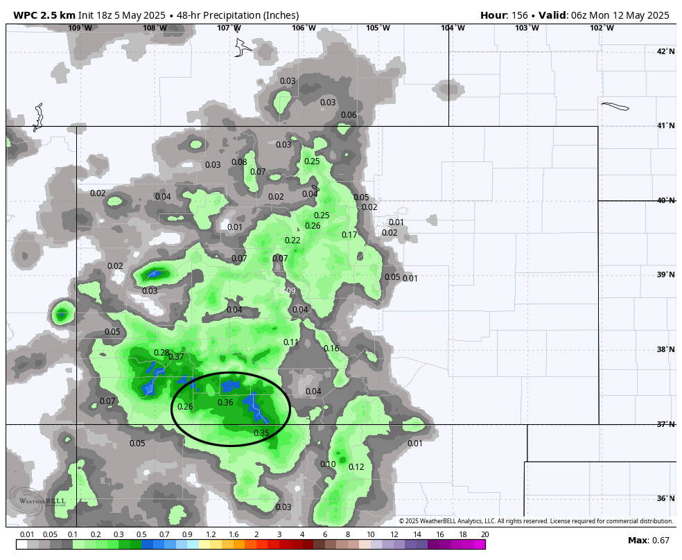
The 8-14 day period… The weather pattern will get less active with just a slight chance for spotty afternoon showers and thunderstorms starting around 13/14 May.
The next post will be on Wednesday.
– Shawn


