
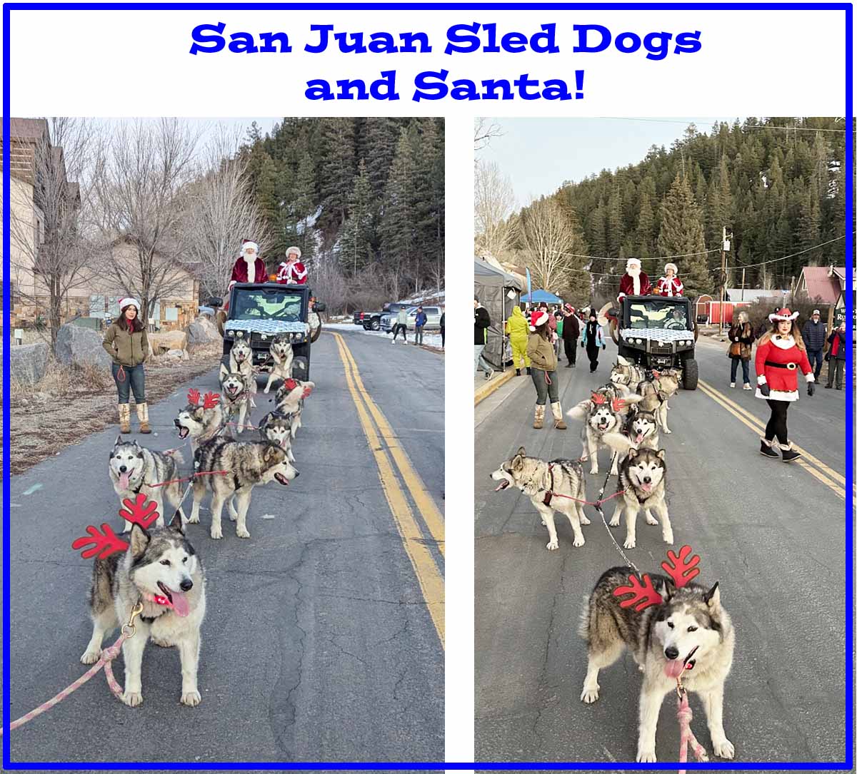
The San Juan Sled Dogs brought Santa to the Christmas Celebration in Pagosa Springs! – pics taken 12/21/2024
Sunday – 22 Dec 2024 – 6:30pm
There has been no data from Stevens Field since 11:19am on 9 December.
Highs yesterday were mostly in the mid to high 50s and lows this morning were mostly in the mid-teens to low 20s.
| Average High | Record High / Year | Average Low | Record Low / Year |
| 37 | 57 / 1906 | 4 | -30 / 1949 |
Precipitation summary… There was no measurable precip in the last 48 hours.
Forecast discussion…
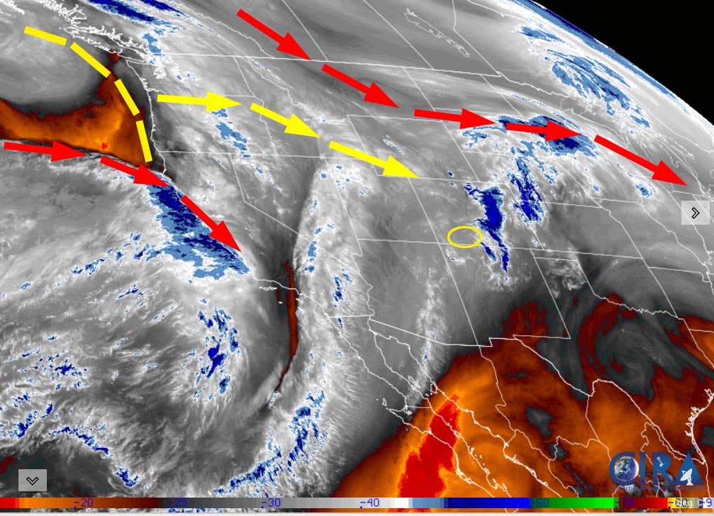
There is nothing on radar in our area.
Forecast highlights…
*** Dry with above average temps through Tuesday. ***
*** A little snow on Christmas Day ***
*** A few more snowflakes possible Thursday and Friday. ***
Sunday night through Tuesday… The ridge has finally flattened, and clouds have increased.
Monday a weak trough will skirt through northern Colorado and bring us variably cloudy skies and maybe a snowflake or two over our mountains.
Tuesday a transient ridge will give us mostly sunny skies during the day and then increasing clouds through the evening when the ridge moves to our east.
Winds… Afternoon peaks will be around 10mph.
Temps… Sunday night lows will be in the mid-teens to mid-20s. Monday and Tuesday highs will be in the mid-40s to low 50s and lows will be in the mid-teens to low 20s.
Christmas Day… Santa will bring us a low-pressure system and some snow.
Timing…The first few scattered snowshowers will start over the mountains early Christmas morning and over the valley around sunrise. The best chance for snow is sunrise to sunset. Scattered snowshowers will taper off over the mountains by midnight.
Snow levels will be 7,000ft or lower.
Snow amounts…
Wolf Creek area: 2-4”
Pagosa area: a dusting to 1”
Winds… Afternoon gusts will be 15-20mph.
Temps… Highs will be in the mid-30s to low 40s and lows will be in the low teens to low 20s.

Thursday and Friday… Moisture will continue to stream through the region but there won’t be much storm energy. A weak upper-level trough will move through Friday evening and then clouds will clear and isolated snowshowers will end.
Snow amounts…
Near Pagosa: zero to a half inch
Mountains: 1-2”
Winds… Afternoon peaks will be 10-15mph
Temps… Highs will be in the mid-30s to low 40s and lows will be in the low teens to low 20s.
The 7-15 day period… The pattern will stay active along the West Coast and Pacific Northwest. Unfortunately it looks like a pretty typical La Nina pattern. We’ll pick up a few “scraps”. I don’t see anything significant on the horizon.
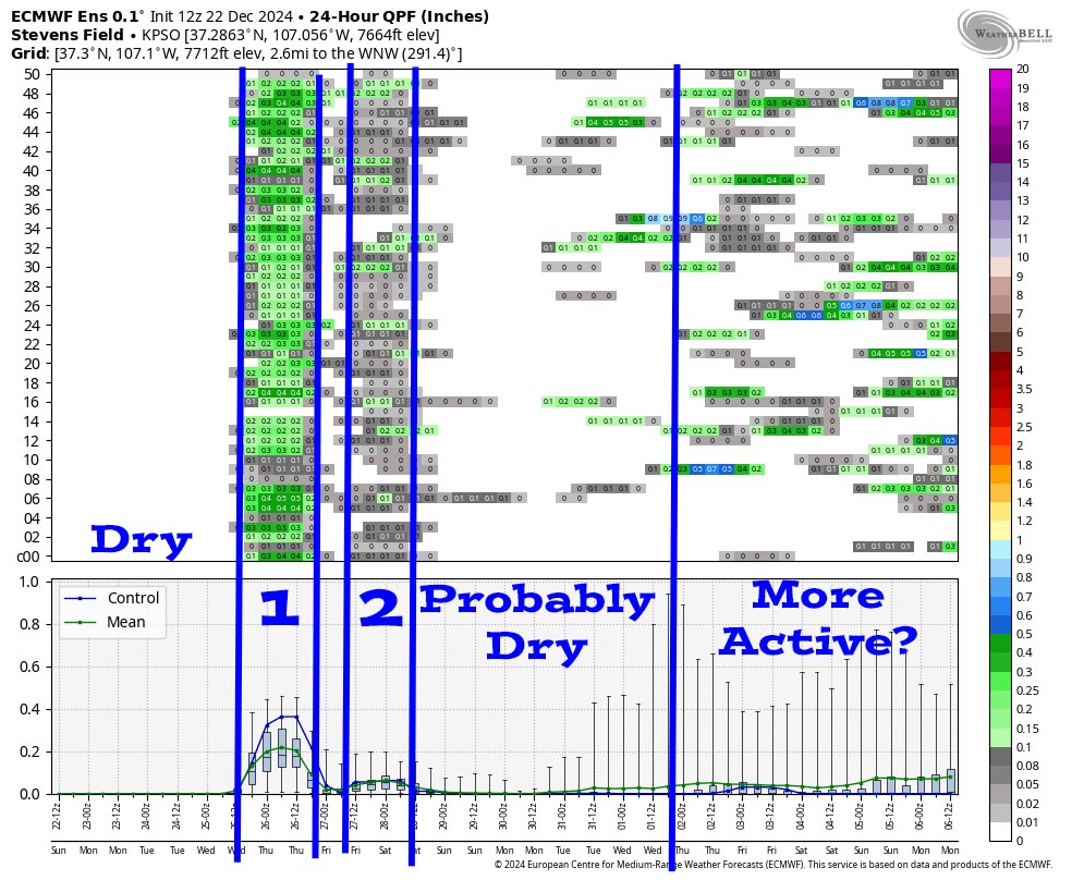
It starts dry to Christmas morning. System 1 is on Christmas day. System 2 is mostly on Friday and has precip amounts less than 0.10”. Then it could be dry to 1 Jan. It gets more active at the end but it’s a weak pattern for us.
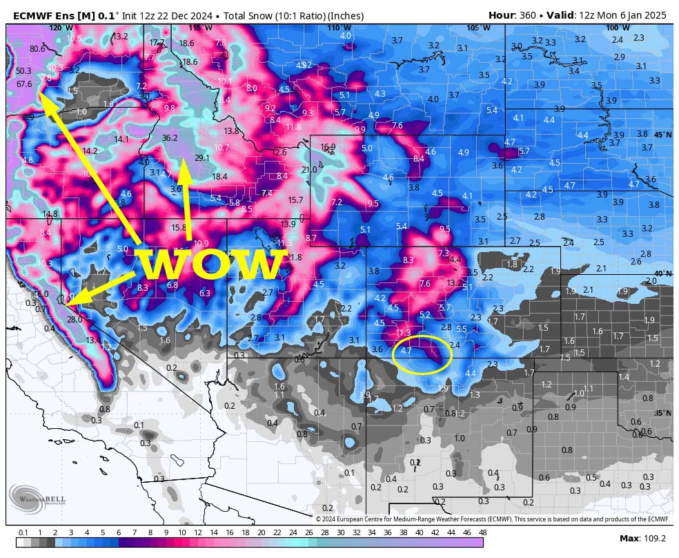
Potential snow amounts in the coastal mountains and the Idaho mountains are 30-80”! Upper-level flow is mostly out of the west and northwest. We just get “scraps” in this pattern. If systems sink farther south, we could get considerably more snow. Do your snow dances!
Unless there is a surprise change to the forecast, my next post will be on Tuesday.
– Shawn


