

Tommy enjoys this pleasant weather but prefers more snow! – Pic taken 30 Jan 2024
If images fail to load in the email, please click the title of the post. Thanks!
Tuesday – 30 Jan 2024 – 4:50pm
The past…
At Stevens Field the high temperature yesterday afternoon was 53 and the low this morning was 20.
The peak wind at Stevens Field yesterday afternoon was 6mph.
| Average High | Record High / Year | Average Low | Record Low / Year |
| 40 | 58 / 1986 | 2 | -27 / 1949 |
Precipitation summary… There has been no recent measurable precip.
Forecast discussion…
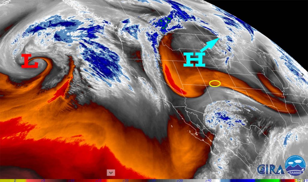
There is nothing on radar in our area this afternoon.
Forecast Highlights…
*** Dry and warm through Thursday morning. ***
*** The first storm will impact our area Thursday afternoon to Saturday afternoon. ***
*** The Grand Junction NWS has issued a WINTER STORM WATCH for the southwest San Juan Mountains. 10-20” of snow is possible with up to 2ft in favored areas from Thursday afternoon late Friday night. *** This does not include Pagosa Springs.
*** A potentially long-duration storm could impact us Tuesday night, 6 Feb into Saturday, 10 Feb. ***
Tuesday evening through Thursday morning… An upper-level ridge will keep us dry and warm. The ridge will move over us Thursday morning and then upper-level southwest flow will push more clouds into the region.
Winds… Peaks will 5-10mph each afternoon.
Temps… Lows tonight will be in the mid-teens to mid-20s. Highs Wednesday will be in the high 40s to mid-50s and lows Wednesday night will be in the low to high 20s.
Thursday afternoon to Saturday evening… A series of storms could impact us through the first 10 days of February. I’ll focus on the first one for now.
Timing… The first scattered showers will start over the mountains Thursday afternoon and then over the valley Thursday evening. The best chance for precip is late Thursday evening to late Friday evening. The heaviest precip will fall Thursday evening to Friday afternoon and then precip will become more scattered Friday evening to Saturday evening.
Snow levels… Will start around 8,500ft Thursday afternoon, drop to around 8,000ft by midnight, continue to drop to 7,300ft by sunrise Friday, and then continue to slowly drop to 6,500ft by Friday afternoon, and remain below 6,500ft through the weekend. Forecast snow levels have lowered but temps will remain above freezing in town making it difficult for the snow to accumulate.
So, what do these snow levels mean? Precip will start as a rain/snow mix up to 8,500ft late Thursday afternoon then up to 8,000ft by midnight. Thursday night, the rain/snow mix will gradually lower to 7,300ft by sunrise. Finally, around noon Friday, precip will turn to snow in town. Unfortunately, the snow that falls will be heavy and wet and struggle to accumulate, especially below 7,500ft.
Snow amounts…
Valley below 7,500ft: 2-5”
Valley above 7,500ft: 4-9”
Mountains: 14-20”
Winds… Peaks will be around 15mph each afternoon.
Temps… Highs Thursday afternoon will be in the low to mid-40s and lows Thursday night will be in the low to mid-30s. Highs Friday will be in the mid-30s to low 40s and lows Friday night will be in the mid-20s to low 30s. Highs Saturday will be in the low to high 30s and lows Saturday night will be in the mid-teens to mid-20s.

By Friday at 5am less than 1.1” of snow has fallen near Pagosa and 4-8” has fallen near Wolf Creek.
By Friday at 5pm, 3.9” of snow has fallen near Pagosa and 10-15” has fallen near Wolf Creek.
By Saturday at 5am, 5” has fallen near Pagosa, and 14-18” has fallen near Wolf Creek.
By Saturday at 5pm, 5.7” has fallen in the Pagosa area, and 18-24” has fallen near Wolf Creek.
*** My thoughts… I agree with the snow amounts for the mountains. Snow amounts are a little high in town because temps will be above freezing and snow will struggle to accumulate. ***
Sunday and beyond… Sunday and Monday we’ll have a lull with spotty snowshowers, mostly over the mountains, and limited snow amounts.
Roughly Tuesday evening to Friday or Saturday evening, the next system will move through. It appears promising. Right now it looks like double digit snow totals are possible in the valley and 2-3ft is possible in the mountains. Forecast confidence is low that far out. There is considerable uncertainty with timing and precip amounts.

*** I’ll continue to post products to track the trends, but this is not my forecast. ***
Unless there is considerable change to the forecast, my next post will be Thursday morning. Then I’ll probably do posts every day to Saturday, 10 February. Plus I’ll do quick Facebook posts as things get interesting. And I’ll get the January summary/February outlook posted by the end of the week.
This storm cycle should keep us busy – YAY!
– Shawn


