
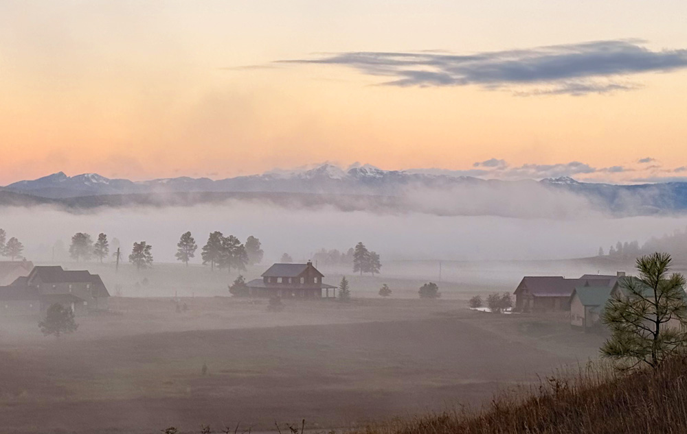
A little rain last night helped form fog this morning – Pic taken 10/20/2026
Tuesday – 20 Oct 2026 – 4:15pm
The past…
Stevens Field Observations
Sunday: High: 63, Low: 28, Peak wind: 12mph
Monday: High: 65, Low: 40, Peak wind: 17mph
| Average High | Record High / Year | Average Low | Record Low / Year |
| 61 | 77 / 1991 | 25 | 10 / 1946 |
Precipitation summary… Parts of the county got a decent soaking last night and early this morning.

Current satellite and radar…

There is nothing on radar in our area Tuesday afternoon.
Forecast highlights…
*** It will be mostly dry through Wednesday morning. ***
*** Late Wednesday afternoon through Friday morning there will be periods of heavy rain. A FLOOD WATCH is in effect. ***
*** Expect occasional winter driving conditions on Wolf Creek Pass starting Friday afternoon and persisting through the weekend. ***
*** Hit and miss showers are likely through the weekend. ***
Rest of Tuesday into early Wednesday afternoon… Upper-level southwest flow will gradually push more moisture and instability into the region.
There will be a few scattered light showers, mostly over the mountains. Most of us will stay dry.
Late Wednesday afternoon into Friday evening… Here we go again. The next storm will be similar to the previous storm. Things are lining up for another soaker.
A strong low pressure system will move through southern CA and then the Great Basin. Strong flow out of the southwest will push lots of tropical moisture into the Four Corners region. Precipitable water will be 300-350% of average – very high for us.
Timing… Showers will increase late Wednesday afternoon. Steady light to moderate rain will fall Wednesday evening through Friday morning. The heaviest rain will fall Thursday morning into early Friday morning. Showers and thunderstorms will gradually decrease through the rest of Friday.
Snow levels… Will be 12,500ft to 13,000ft into Thursday evening and then begin dropping Thursday night. By sunrise Friday it will be 11,500ft. By noon Friday it will be 10,500ft to 11,000ft.
Rain and snow amounts…
Mountains above 13,000ft: 12-18”
Mountains 11,500-13,000ft: 4-10”
Mountains 10,500-11,500ft: 1-4” on Friday
Pagosa Springs area: 2” to 3” of rain. Short periods of graupel are likely Friday.
*** I will continue to make adjustments as the data gets better. ***
Friday night through Sunday… A secondary low will slowly move through northern AZ/southern UT and then to our north Sunday night. The main moisture plume will be to our east, but instability from the low will help push occasional bands of storms through our area.
The best chance for showers and thunderstorms is Saturday afternoon through Saturday evening. Isolated cells could produce brief periods of heavy rain, small hail, gusty winds, and lightning.
Snow levels… Friday night into late Saturday evening snow levels will hover around 10,500ft. Saturday night through Sunday they be around 10,000ft.
Precip amounts…
Mountains above 10,500ft: 3-6”
Mountains 9,500-10,500ft: 1-3”
Temps…
Tuesday night lows will be in the mid 30s to the low 40s.
Wednesday highs will be in the high 50s to the mid 60s and lows will be in the low to high 40s.
Thursday through Sunday highs will be near 50 to the mid 50s. Thursday night lows will be in the low to high 40s. Friday and Saturday lows will be in the low to high 30s. Sunday lows will be in the high 20s to the mid 30s.
Monday highs will be in the mid 50s to the low 60s and lows will be in the high 20s to the mid 30s.
Winds…
Wednesday, gusts will be 15-20mph. Stronger gusts are possible near showers and thunderstorms.
Thursday and Friday, gusts will be 20-25mph. Stronger gusts are possible near showers and thunderstorms.
Saturday, Sunday, and Monday, each afternoon gusts will be 10-15mph.

27 Oct to 4 Nov… The pattern will try to remain active with more chances for precip.


The next post will be on Thursday.
– Shawn


