
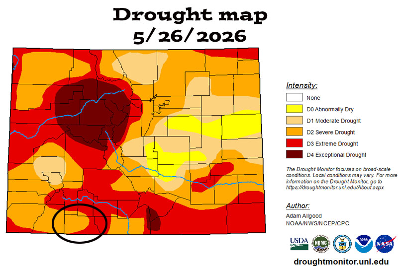
The current drought map shows Archuleta County split between “severe” and “extreme” drought conditions.
Monday – 1 Jun 2026 – 1:20pm
May Summary…
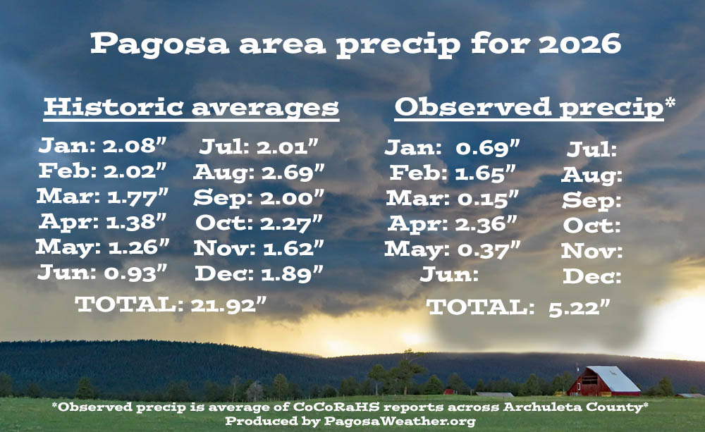
The average high for May is 68 and the average low is 30. The record high of 89 occurred on 30 May 1910. The record low of 8 occurred on 1 May 1967. Precip in May averages 1.26″ and the average snowfall is 1.1″. Wolf Creek Pass averages 2.05″ of precip and 12.9″ of snow.
At Stevens Field the highest temp was 82 on 12 May and the lowest temp was 21 on 7 May. There were no new record highs or lows, but the record high was tied on 12 May.
There were 13 days with winds at or over 30mph. The highest wind was 44mph on 9 May.
How did we do?


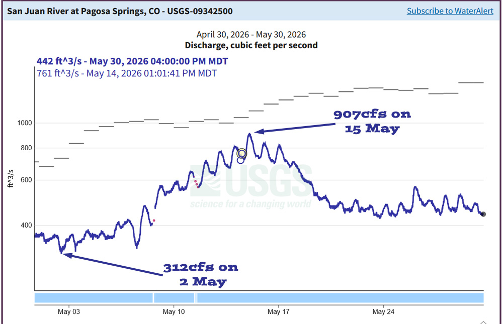
Drought and river levels…

The US drought map on the right shows that much of the US is experiencing drought conditions.
June outlook…
The average high for June is 78 and the average low is 36. The record high of 101 occurred on 30 June 1934. The record low of 20 occurred on 2 June 1908. Precip in June averages 0.93″ and the average snowfall is zero. Wolf Creek Pass averages 1.74″ of precip and 1.2″ of snow.
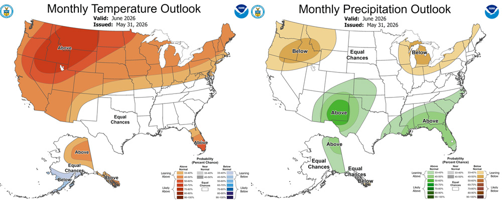
The precip outlook on the right shows a 33-40% chance for above average precip.
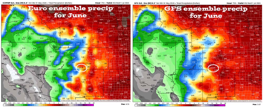
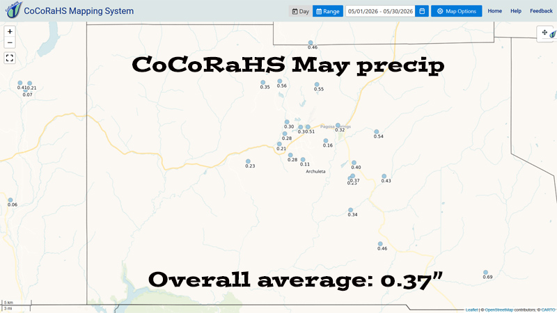
May verification: The Euro expected 1.81″ and the GFS expected 3.08″. We only got 0.37″ so both models way over-forecast precip.

Arleen’s June outlook…

June is the last month of the dry season and averages only 0.93” precip. It takes just a few good storms to be near or above average. However, the recent trend points a different direction.
Last month both the GFS and Euro models expected above average precip. Neither model verified well. We were well below average for the month of May.
The Polar Front Jet is migrating to Canada and weakening. So, we can expect to see fewer baroclinic systems. The Tropical Continental airmass which is hot and dry is the primary airmass influencing our weather.
The ENSO is quickly transitioning from neutral to El Nino. Arctic oscillation is positive to neutral and not impacting our weather. The Madden Julian Oscillation is moderate, becoming weak, and exiting our area.
We should see marginal impacts the first 7-10 days of June with a few afternoon showers and thunderstorms, but precip amounts will be low and spotty. This will be followed by two to three weeks of dry weather. Finally, towards the end of June, we should see the first sputter thunderstorms of the monsoon season. We will closely track the subtropical ridge’s position.
June will have less than average precipitation and above average temperatures.
A HUGE thanks for your precip reports and pictures! Reports help verify our forecasts and make us better forecasters.
Another HUGE thanks to our donors and sponsors! You help cover the cost of this web page and our weather subscriptions, necessary to provide you accurate weather reports!
- Shawn


