

Snowpack is off to a rough start for Colorado
Monday – 1 Dec 2025 – 4:15pm
November summary…
The average high for November is 49 and the average low is 16. The record high of 75 occurred on 2 Nov 1945. The record low of -18 occurred on 17 Nov 1907. Nov precip averages 1.62″ and average snowfall is 10″. Wolf Creek Pass averages 4.13″ of precip and 54.5″ of snow.
At Stevens Field the highest temp was 66 on 2 Nov and the lowest temp was 20 on 29 Nov. There was 1 day with winds at or over 30mph. The strongest wind was 36mph on 16 Nov.
How did we do?
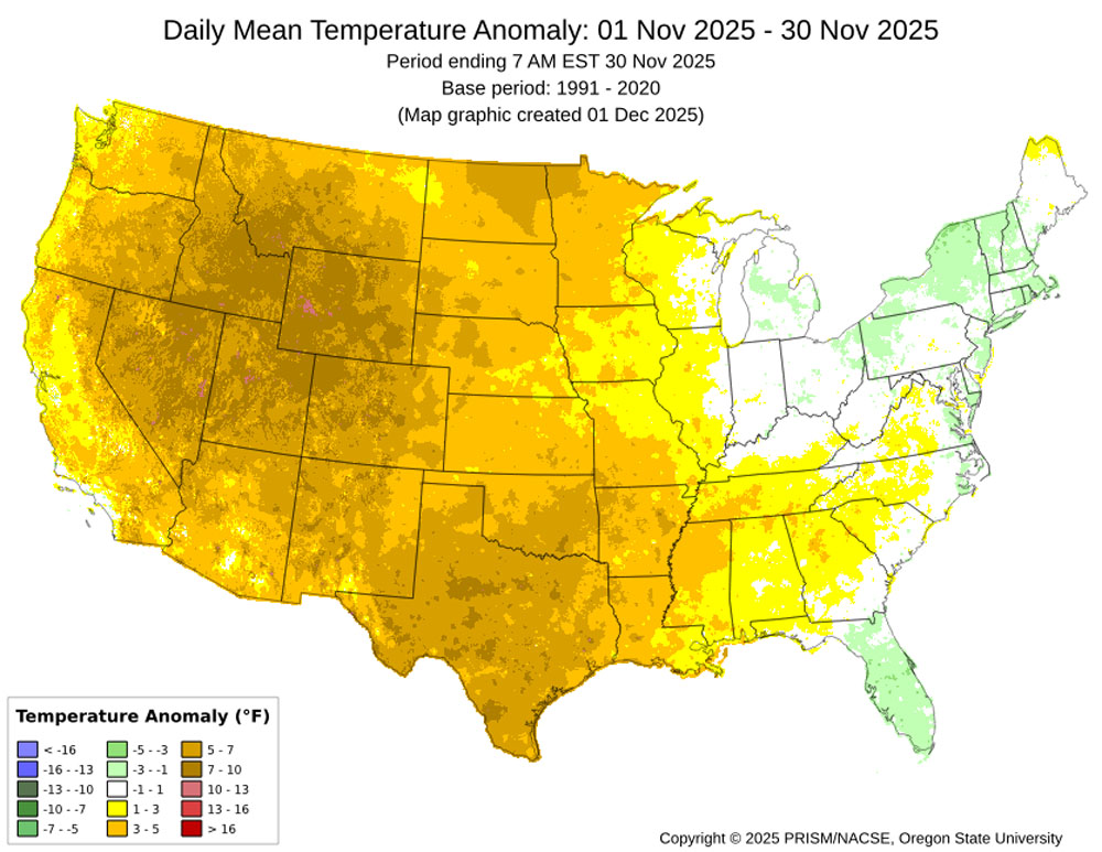
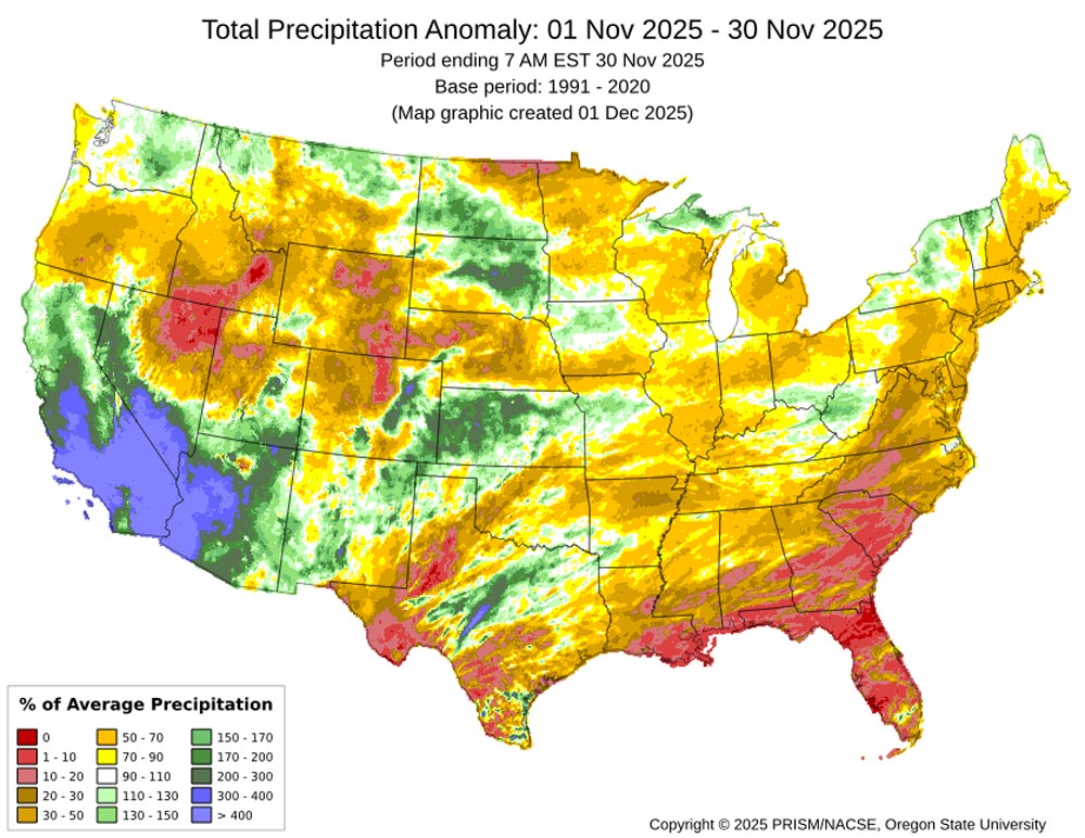
Southern CA, southern NV, and much of AZ did very well due to a couple of slow-moving cut-off lows. If these had tracked a couple of hundred miles farther east, we would have done quite well too.
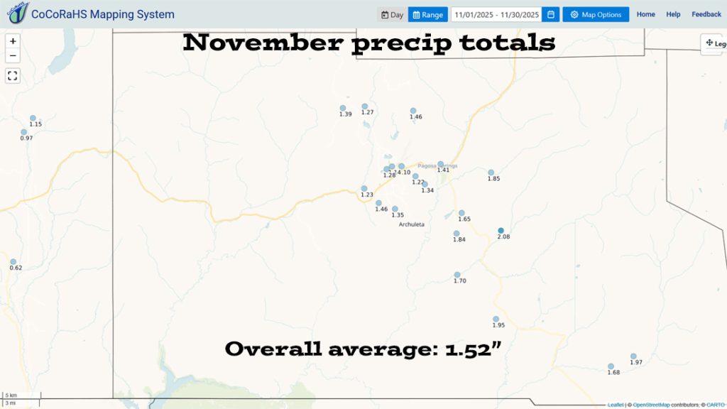
The eastern part of the county did the best.
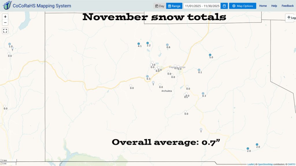


Snowpack and Drought…
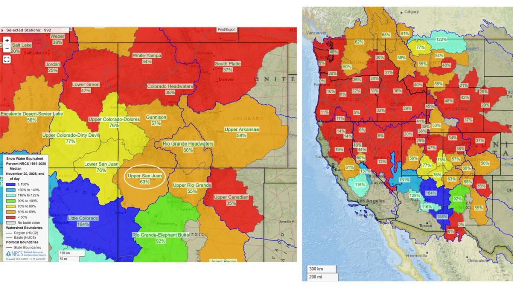
The Upper San Juan snotel is at 69% of the seasonal median and the Wolf Creek Summit snotel is at 56%

The US drought map on the bottom shows that much of the US is experiencing drought conditions.
December outlook…
The average high for December is 39 and the average low is 5. The record high of 70 occurred on 3 Dec 1906. The record low of -35 occurred on 19 Dec 1999. Precip in Dec averages 1.89″ and the average snowfall is 21.2″. Wolf Creek Pass averages 4.42″ of precip and 78.7″ of snow.
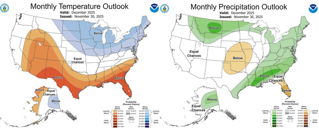
The precip outlook on the right shows “equal chances” for average precip.

The Euro is near the average of 1.89″ while the GFS is above average.
Last month both models were correct in expecting less than average, but the GFS did a little better than the Euro.
And what do we expect?
Arleen is the expert, and this is what she says…

The average amount of precipitation for December for Pagosa Springs is almost two inches – similar to other winter months which are just over two inches.
This month a weak LaNina ENSO is in place. This last storm system reflected that with the ridge over the west coast resulting in the storm approaching us from the northwest.
The Arctic Oscillation is still forecast to go negative and stay disrupted, impacting us towards the end of December with cold air. The MJO just visited and was at a good strength, but the synoptic situation was not ideal for us to see an impact. It will visit again in another 30 to 60 days.
Both major models, the GFS and the Euro, agree that the ridge will break down in about 10 days and reposition over western Alaska. This will put more of a westerly to southwesterly flow over us.
The first 1/3 of the month, there will be just weak systems making their way into our area with similar snow amounts to what we just saw. By the end of the month, the flow will be more favorable and good cold air will be in place, but there are not any significant systems apparent at this time that would push us over average.
So, we’ll have average precipitation with below average temperatures. The Euro is giving hints of a cutoff low system to move in from the southwest at the end of the month. If this happens, we could see more than average.
A HUGE thanks for your precip reports and pictures! Reports help verify our forecasts and make us better forecasters.
Another HUGE thanks to our donors and sponsors! You help cover the cost of this web page and our weather subscriptions, necessary to provide you accurate weather reports!
- Shawn


