

Woke up to a pretty sunrise – pic taken by Arleen on 6/17/2025
Tuesday – 17 Jun 2025 – 4:00pm
The past…
At Stevens Field the high temperature on Sunday was 88, and on Monday it was 87. The low this morning was 41. The cold spots were near freezing.
The minimum relative humidity Monday afternoon was 5% and Sunday afternoon it was 5%.
Temperature swings between daily highs and daily lows have been 45-50 degrees. This is also an indication of how dry it is.
The peak wind at Stevens Field on Sunday was 29mph and on Monday it was 33mph.
| Average High | Record High / Year | Average Low | Record Low / Year |
| 79 | 87 / 1986 | 36 | 24 / 1957 |
Precipitation summary… There has been no recent measurable precip.
Forecast discussion…

There is nothing on radar in our area Tuesday afternoon.
Forecast highlights…
*** Red Flag Warning for critical fire conditions in effect until 8pm Tuesday. ***
*** Warm, dry, and breezy weather through Sunday. Fire danger will remain high. ***
*** Monday through next Wednesday there’s a chance for isolated afternoon showers and thunderstorms. ***
Rest of Tuesday through Sunday…. Dry, stable, warm air will continue to circulate around a high pressure in the region.
The high will shift to our east on Friday causing afternoon winds to be gustier through the weekend. *** I expect Red Flag conditions Friday, Saturday, and Sunday afternoons. ***
Temps… Wednesday through Saturday highs will be in the mid-80s to low 90s and lows will be in the high 30s to high 40s. Sunday highs will be near 80 to near 90 and lows will be in the high 30s to high 40s.
Winds… Afternoon winds Wednesday and Thursday will be around 20mph. Friday and Sunday afternoon gusts will be around 30mph. Saturday afternoon gusts will be 30-35mph.
Monday through next Wednesday… We are going to catch the western edge of a surge of monsoon moisture. There’s a chance for scattered afternoon showers and thunderstorms each day.
Temps… Highs will be in the mid-70s to mid-80s and lows will be near 40 to near 50.
Winds… Monday afternoon gusts will be around 25mph. Tuesday and Wednesday afternoon gusts will be around 20mph. Isolated higher gusts are possible near a spotty shower or thunderstorm.
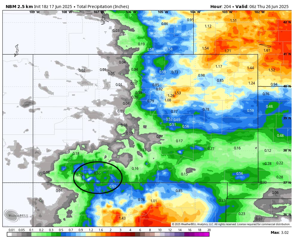
The 8-14 day period… We’ll be in the “sputter” phase of the monsoon where it’s trying to set up and is weak. There will be hit and miss afternoon showers and thunderstorms. Precip amounts will be light and spotty.
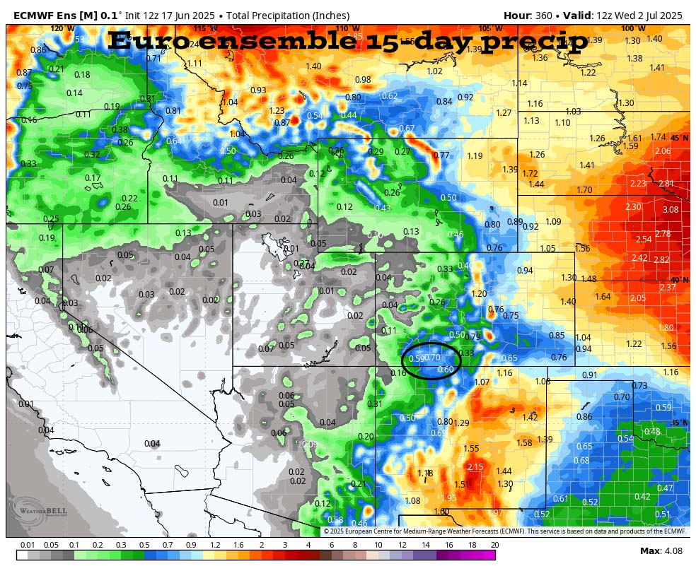
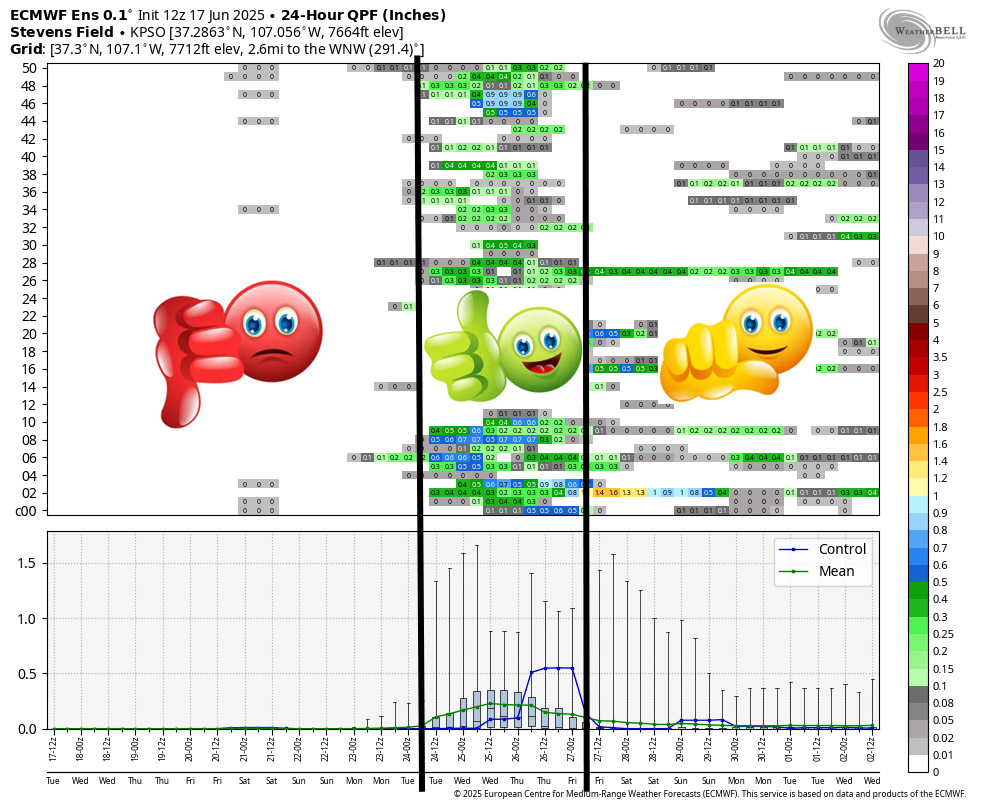
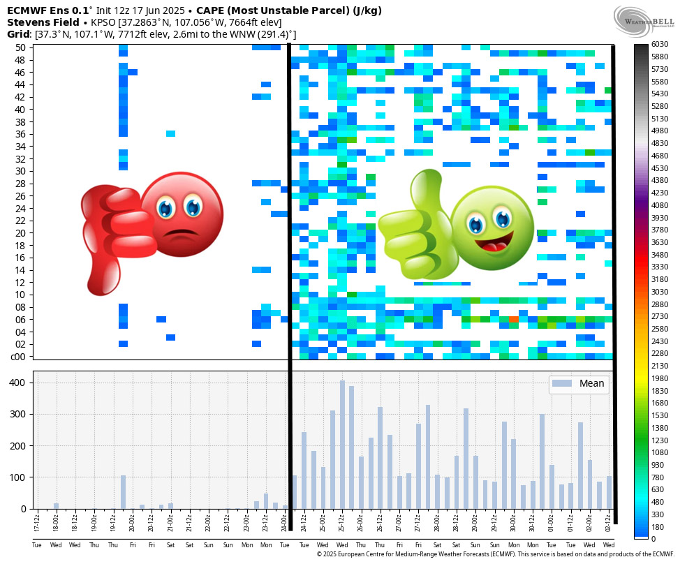

*** These three meteograms are a few of my primary forecast products for the monsoon season. I look at these and similar products twice a day every day to see if the ingredients are expected for convective showers and thunderstorms. ***
The next post will be on Thursday or Friday.
– Shawn


