
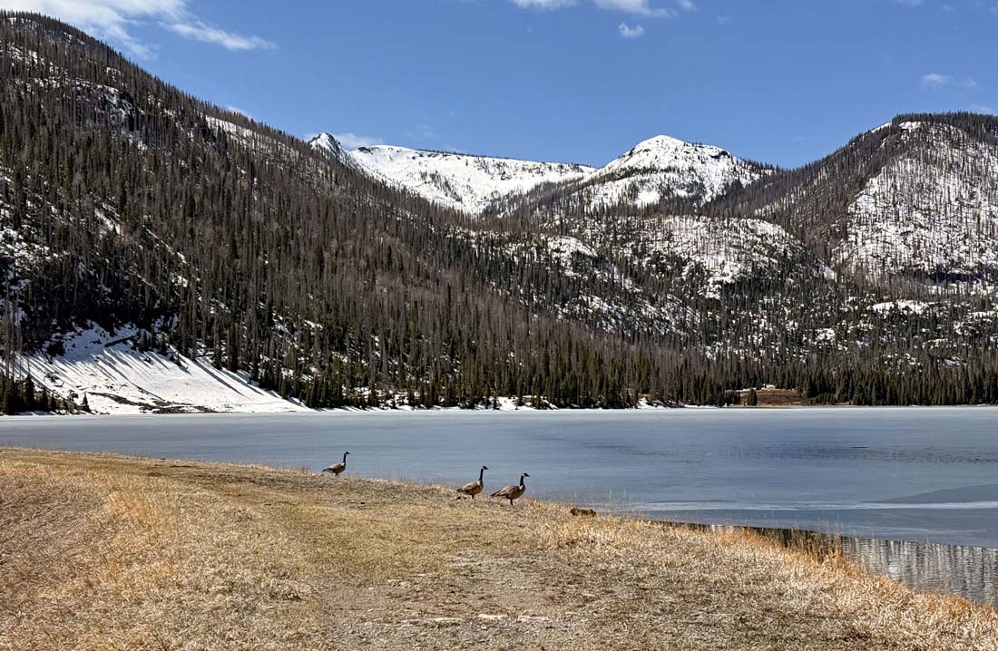
Geese hanging out at the lake – pic taken 4/15/2025
Wednesday – 16 Apr 2025 – 6:00pm
The past…
At Stevens Field the high temperature on Monday was 64 and on Tuesday it was 63. The low this morning was 39 shortly after midnight.
The peak wind at Stevens Field on Monday was 26mph and on Tuesday it was 36mph.
| Average High | Record High / Year | Average Low | Record Low / Year |
| 61 | 75 / 1985 | 24 | 9 / 1951 |
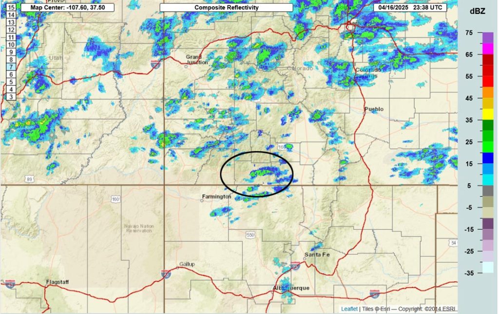
Precipitation summary… A couple of fast-moving thunderstorms moved through the central part of the county between noon and 1pm Tuesday. In fact, a friend nearly got struck by lightning in Turkey Springs!
Wednesday morning a few surprise showers moved through parts of the county.

Forecast discussion…
Forecast highlights…
*** Thursday will be the windiest day of the week with 35-40mph gusts. ***
*** Much cooler with scattered snow showers Friday morning into Saturday afternoon in the Pagosa Springs area. ***
*** Roads in the Pagosa area could be slick Friday night into Saturday morning. ***
*** Expect poor travel conditions on Wolf Creek Pass early Fridy morning into Saturday evening. ***
*** The Grand Junction NWS has issued a WINTER WEATHER ADVISORY for the southwest San Juan Mountains above 8,000ft. 5-12” of snow and winds gusting to 45mph is expected between midnight Thursday night to 6pm Saturday. ***
Rest of Wednesday and Thursday… Upper-level southwest flow is increasing out of the southwest. It’s more unstable than I expected. Spotty showers, mostly over the mountains, will end Wednesday evening.
Thursday will be dry with partly to mostly cloudy skies and gusty winds.
Temps… Wednesday night lows will be in the high 20s to mid-30s. Thursday highs will be in the mid-50s to low 60s and lows will be in the mid-20s to low 30s.
Winds… Thursday afternoon gusts will be 35-40mph.
Friday and Saturday… An interesting “spring” storm is taking shape.
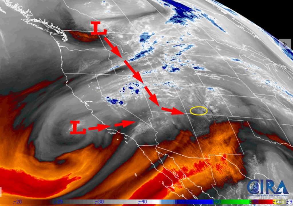
Moist upper-level southwest flow will get entrained into a deep, cold low-pressure system moving south through Idaho, then western Utah, and then turning east towards the Four Corners. It’s an ideal set-up for us to get spring-time snow.
The system is trending towards lower snow-levels and more precip – yay!
Timing…
The first scattered snowshowers will start over our mountains around midnight Thursday night and in the Pagosa area around sunrise Friday. The best chance for precip is Friday afternoon into Saturday afternoon. Showers will end in the Pagosa area by sunset Saturday but will persist into Saturday evening over the mountains.
Snow levels…
– Late Thursday evening: around 8,000ft
– Sunrise Friday: around 7,000ft
– Friday afternoon: around 7,500ft
– Most of Friday night: around 6,500ft
– Saturday afternoon: around 7,500ft
*** A few isolated lightning strikes are possible each afternoon. Rain, snow, graupel, and small hail are all possible. ***
*** Temps will be above freezing each afternoon, and the ground is warm, so snow will struggle to accumulate during the day. ***
Snow amounts…
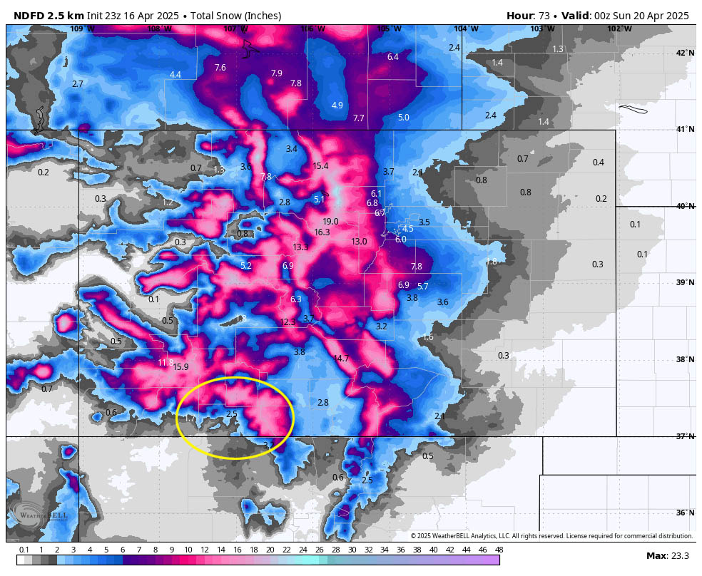
Mountains above 9,000ft: 8-14”
Pagosa area above 7,600ft: 2-4”
Pagosa area below 7,600ft: 1-2”
Temps… Friday and Saturday highs will be near 40 to the mid-40s. Friday night lows will be in the mid-20s to low 30s. *** Saturday night lows will be in the low teens to low 20s. ***
Winds… Friday afternoon gusts will be 20-25mph. Saturday afternoon gusts will be 15-20mph.
Sunday, Monday, and Tuesday… A transient ridge will move through and keep us dry and give us partly cloudy skies.
Temps… Sunday highs will be in the low to high 50s and low will be in the high teens to mid-20s. Monday highs will be in the high 50s to low 60s and lows will be in the mid-20s to mid-30s. Tuesday highs will be in the low to high 60s and lows will be in the high 20s to mid-30s.
Winds… Afternoon gusts will be 20-25mph.
The 8-14 day period… The models are wavering between a dry pattern and an active pattern with a couple of chances for light precip. It could go either way.
Unless there’s a big change to my forecast, the next post will be on Friday. Keep an eye on Facebook for any quick updates.
– Shawn


2 Responses
So lucky to have this service
Thank you for your kind words!