

Snowpack looks good for most of Colorado!
Wednesday – 4 Dec 2024 – 4:30pm
November Summary…
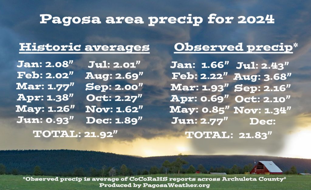
The average high for November is 49 and the average low is 16. The record high of 75 occurred on 2 November 1945. The record low of -18 occurred on 17 November 1907. November precip averages 1.62″ and average snowfall is 10.0″. Wolf Creek Pass averages 4.13″ of precip and 54.5″ snow.
At Stevens Field the highest temp was 58 on 14, 15, and 22 November and the lowest temp was 12 on 20 November.
How did we do?




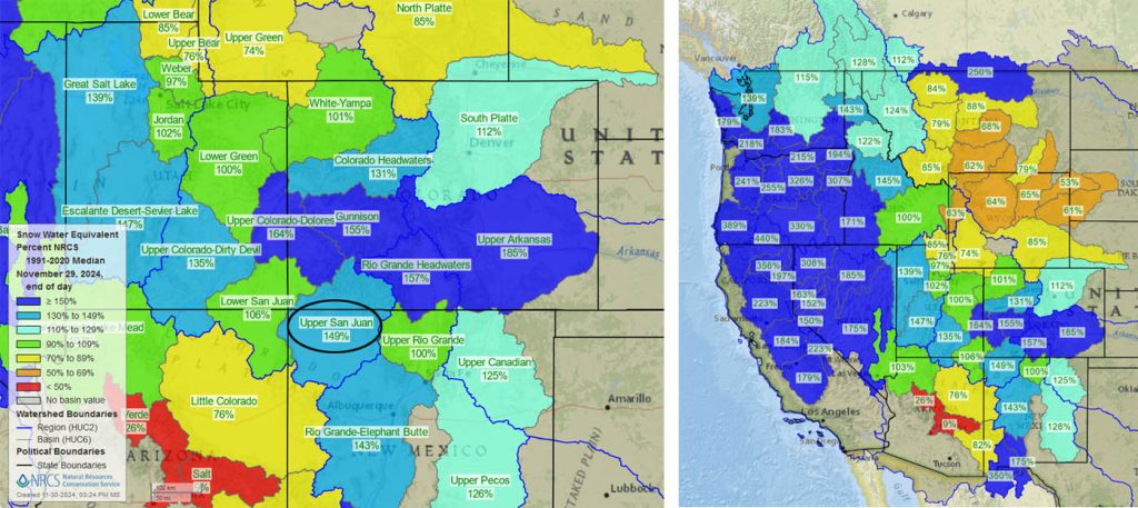
Snowpack and Drought…
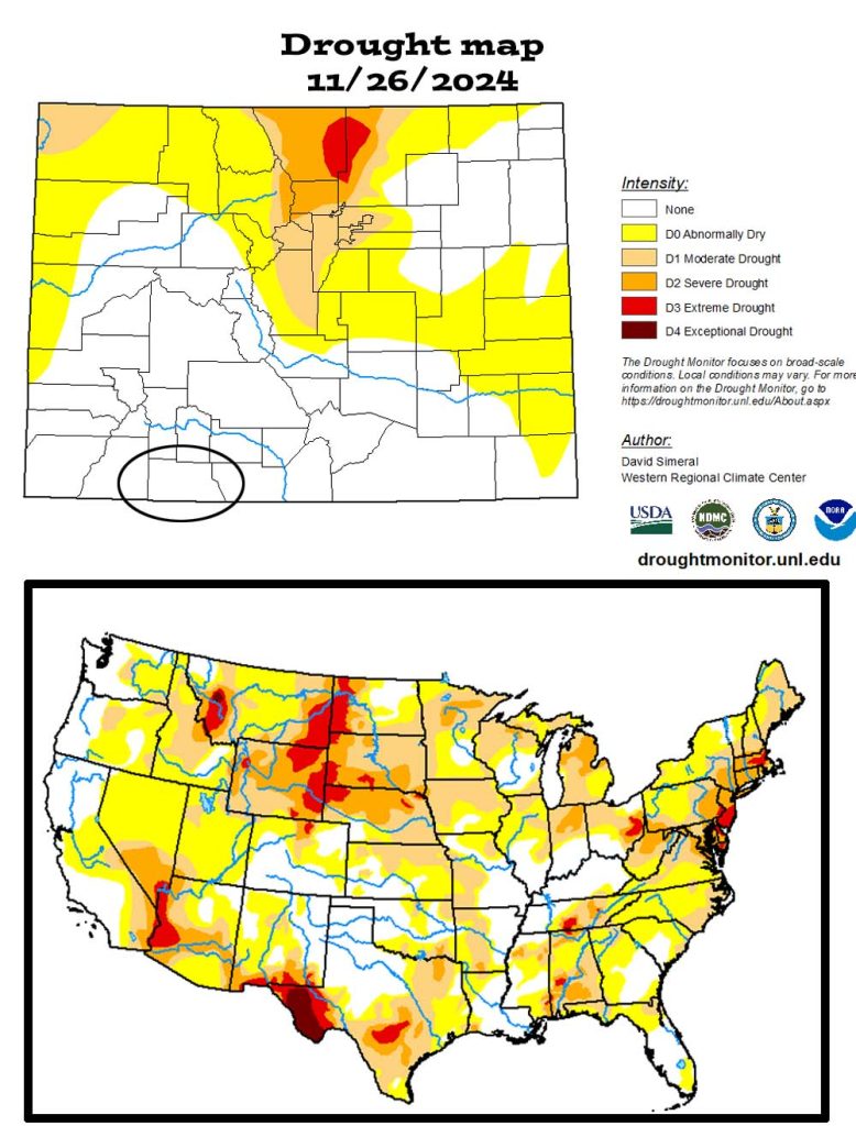
The US drought map on the bottom shows that much of the country is experiencing drought conditions.
December outlook…
The average high for December is 39 and the average low is 5. The record high of 70 occurred on 3 December 1906. The record low of -35 occurred on 19 December 1909. December precip averages 1.89″ and average snowfall is 21.2″. Wolf Creek Pass averages 4.42″ of precip and 78.7″ snow.

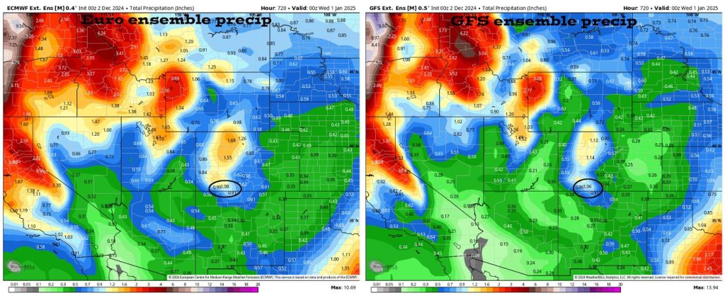
The precip outlook on the right is leaning towards below average precip.
And what do we expect?
Arleen is the expert, and this is what she says…
Unfortunately, the western states are under a blocking pattern. In other words rather than seeing weather systems move west to east across the country, they are stuck and not making forward progression. We will see a few weak systems the first half of the month, but we’ll only get a few “scraps” as Shawn likes to say. It does appear that the ridge will break down the second half of the month and the Madden Julian Oscillation may make some forward progression into our area. Unfortunately, it will be too little too late. We’ll see less than average precipitation and snow during December with higher than average temperatures.
A HUGE thanks for your precip reports and pictures! Reports help verify our forecasts and make us better forecasters.
Another HUGE thanks to our donors and sponsors! You help cover the cost of this web page and our weather subscriptions, necessary to provide you accurate weather reports!
- Shawn


