

Pagosa Peak briefly popping out of the clouds yesterday – pic taken 3/25/2024
If images fail to load in the email, please click the title of the post. Thanks!
Tuesday – 26 Mar 2024 – 9:30am
The past…
At Stevens Field the high temperature yesterday afternoon was 38 and the low this morning was 23. The cold spots dipped into the low to mid-teens.
The peak wind at the airfield yesterday was 20mph.
| Average High | Record High / Year | Average Low | Record Low / Year |
| 52 | 71/ 1940 | 18 | -9 / 1913 |
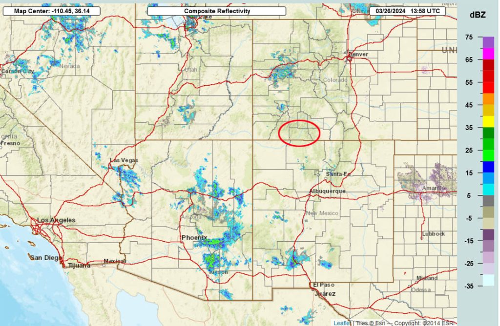
Precipitation summary… Scattered showers and a few thunderstorms hit parts of the area yesterday afternoon. Wolf Creek reported no new snow this morning.

Forecast discussion…

Forecast highlights…
*** Scattered showers and a few thunderstorms again this afternoon. ***
*** Next system will move through Sunday and Monday. ***
Tuesday… Unsettled conditions will persist with residual moisture and instability leading to mostly cloudy skies, scattered afternoon showers, and isolated thunderstorms.
Moderate to heavy snow, graupel, small hail, and lightning are possible for brief periods over small areas. “If you don’t like the weather, just wait a few minutes!”
Snow amounts to Tuesday evening…
Valley: up to 1” in the lucky spots
Mountains: 1-3”
Winds… Afternoon gusts will be 15-20mph.
Temps… Highs will be in the mid-30s to low 40s and lows will be in the low teens to low 20s.

Wednesday through Saturday evening… An upper-level ridge will be in control Wednesday, so we’ll be dry with lots of sun.
Thursday, Friday, and Saturday the ridge will be just to our east so upper-level southwest flow will increase. We’ll see a few more clouds but I don’t expect any precip.
Temps and winds will gradually increase through the period.
Winds… Afternoon gusts Wednesday and Thursday will be 15-20mph. Afternoon gusts Friday and Saturday will be 20-25mph.
Temps… Highs Wednesday will be in the low to high 40s and lows will be in the low-teens to low-20s. Highs Thursday will be in the mid-40s to mid-50s and lows will be in the low 20s to low 30s. Highs Friday and Saturday will be in the high 40s to high 50s. Lows Friday night will be in the low 20s to low 30s. Lows Saturday night will be in the low to high 30s.
Sunday through Monday… The next system will move through. The forecast models are struggling with precip amounts, but here’s my best guess at this time…
Timing… The first scattered showers will start over the mountains early Sunday morning and then over the valley early Sunday afternoon. The best chance for precip is Sunday evening to Monday evening. Hit and miss showers will persist into Tuesday evening.
Snow levels… Will be around 8,500ft early Sunday morning into Sunday evening. By midnight Sunday, snow levels will drop to 8,000ft, and then drop to around 7,000ft by sunrise Monday. They’ll fluctuate around 7,000ft through the rest of Monday.
Snow amounts…
Valley: 1-3”
Mountains: 6-12”
Winds… Sunday afternoon gusts will be 25-35mph in the valley and 45-55mph in the mountains. Sunday evening to Monday evening gusts will be around 20mph.
Temps… Sunday highs will be in the mid-40s to low 50s and lows Sunday night will be around 30 to the mid-30s. Monday highs will be in the low to mid-40s and lows will be in the mid-20s to low 30s.
There is still a lot of uncertainty with this system. I’ll continue to adjust the details as the data gets better.

My next post will be on Thursday.
– Shawn


